
No caption
IMG_7543.JPG
Details
Friday, May 2, 2025 · 11:56 AM
39.39199, -120.02164· 1658m
Location Context
1 / 5
USGS Topo
No elevation data
FEMA Flood
No flood data
OSM Infra
No address data
USDA Soil
No soil data
USGS Hydro
No hydro data
Apple iPhone 16 Pro
iPhone 16 Pro back triple camera 2.22mm f/2.2
2.220000028611935mmf/2.21/779sISO 50
Flash did not fire, compulsory flash mode
Show all EXIF (43 fields)
ApertureValue2.2750
BrightnessValue8.8326
ColorSpace65535
CompositeImageGeneral Composite Image
ExifImageHeight3024
ExifVersion2.3.2
ExposureCompensation0
ExposureModeAuto
ExposureProgramNormal program
FlashpixVersion1.0
FocalLengthIn35mmFormat14
GPSDateStamp2025:05:02
GPSDestBearing172.8784
GPSDestBearingRefTrue North
GPSHPositioningError4.4615
GPSImgDirection172.8784
GPSImgDirectionRefT
GPSSpeed0.1679
GPSSpeedRefK
GPSTimeStamp18:56:1
HostComputeriPhone 16 Pro
latitude39.3920
LensInfo2.2200, 15.6600, 1.7800, 2.8000
LensMakeApple
longitude-120.0216
MeteringModePattern
ModifyDate2025-05-02T11:56:02.000Z
OffsetTime-07:00
OffsetTimeDigitized-07:00
OffsetTimeOriginal-07:00
ResolutionUnitinches
SceneCaptureTypeStandard
SceneTypeDirectly photographed
SensingMethodOne-chip color area sensor
ShutterSpeedValue9.6063
Software18.5
SubjectArea{"0":2000,"1":1511,"2":2217,"3":1330}
SubSecTimeDigitized065
SubSecTimeOriginal065
WhiteBalanceAuto
XResolution72
YCbCrPositioning1
YResolution72
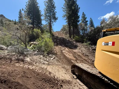
AI Analysis
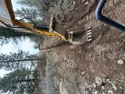
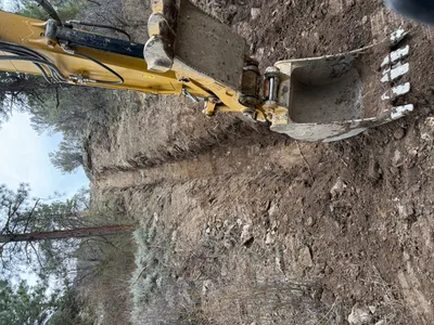
The image shows a yellow bulldozer at the lower right corner, partially out of frame, on a dirt slope primarily composed of soil and rock. Trees and bushes flank the dirt path, suggesting it's located in a forested area. The sky is clear and sunny, providing good lighting conditions. Tracks from the bulldozer are visible in the soil, indicating recent activity.
site-grading
dirt slope with visible tire tracks clear sky with good sunlight pathway accessible with potential for equipment entry
No specific safety features are visible in frame.
Analyzed Apr 21, 2026
Nearby Photos
0m
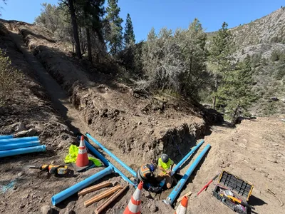
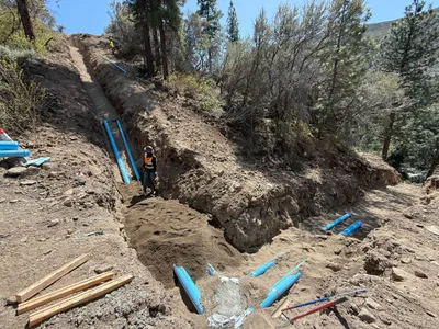
trenching
pipeline-trenchingpipe-installation
shovel
1m
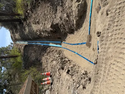
pipeline installation
pipeline-installationtrenching
soil
1m
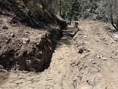
trenching
trenchingexcavation
soil
1m
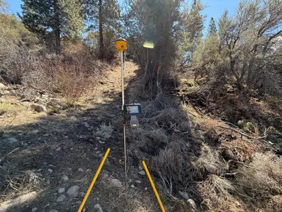
survey layout
surveyinglayout
gps-receiver
2m
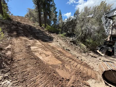
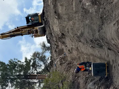
site grading
site-gradingsoil-disturbance
excavator
2m
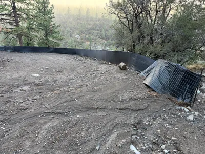
swppp erosion control
erosion-controlsilt-fence-installation
silt-fence-material
2m
trenching
trenchingexcavation
excavator
2m
trenching
trenchingexcavation-work
excavator
2m
trenching
trenchingpipe-staging
blue piping
2m
trenching
trenchingearthmoving
excavator