
No caption
IMG_6830.JPG
Details
Tuesday, March 25, 2025 · 7:35 AM
39.39469, -120.02071· 1664m
Location Context
1 / 5
USGS Topo
No elevation data
FEMA Flood
No flood data
OSM Infra
No address data
USDA Soil
No soil data
USGS Hydro
No hydro data
Apple iPhone 16 Pro
iPhone 16 Pro back triple camera 2.22mm f/2.2
2.220000028611935mmf/2.21/99sISO 320
Flash did not fire, compulsory flash mode
Show all EXIF (43 fields)
ApertureValue2.2750
BrightnessValue2.7411
ColorSpace65535
CompositeImageGeneral Composite Image
ExifImageHeight3024
ExifVersion2.3.2
ExposureCompensation0
ExposureModeAuto
ExposureProgramNormal program
FlashpixVersion1.0
FocalLengthIn35mmFormat14
GPSDateStamp2025:03:25
GPSDestBearing189.2348
GPSDestBearingRefTrue North
GPSHPositioningError8.3481
GPSImgDirection189.2348
GPSImgDirectionRefT
GPSSpeed0.5164
GPSSpeedRefK
GPSTimeStamp14:35:35
HostComputeriPhone 16 Pro
latitude39.3947
LensInfo2.2200, 15.6600, 1.7800, 2.8000
LensMakeApple
longitude-120.0207
MeteringModePattern
ModifyDate2025-03-25T07:35:37.000Z
OffsetTime-07:00
OffsetTimeDigitized-07:00
OffsetTimeOriginal-07:00
ResolutionUnitinches
SceneCaptureTypeStandard
SceneTypeDirectly photographed
SensingMethodOne-chip color area sensor
ShutterSpeedValue6.6325
Software18.4
SubjectArea{"0":2000,"1":1511,"2":2217,"3":1330}
SubSecTimeDigitized096
SubSecTimeOriginal096
WhiteBalanceAuto
XResolution72
YCbCrPositioning1
YResolution72
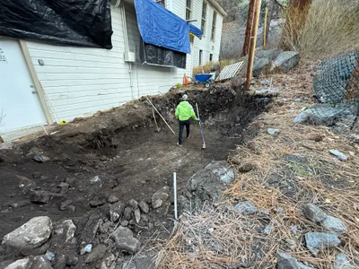
AI Analysis
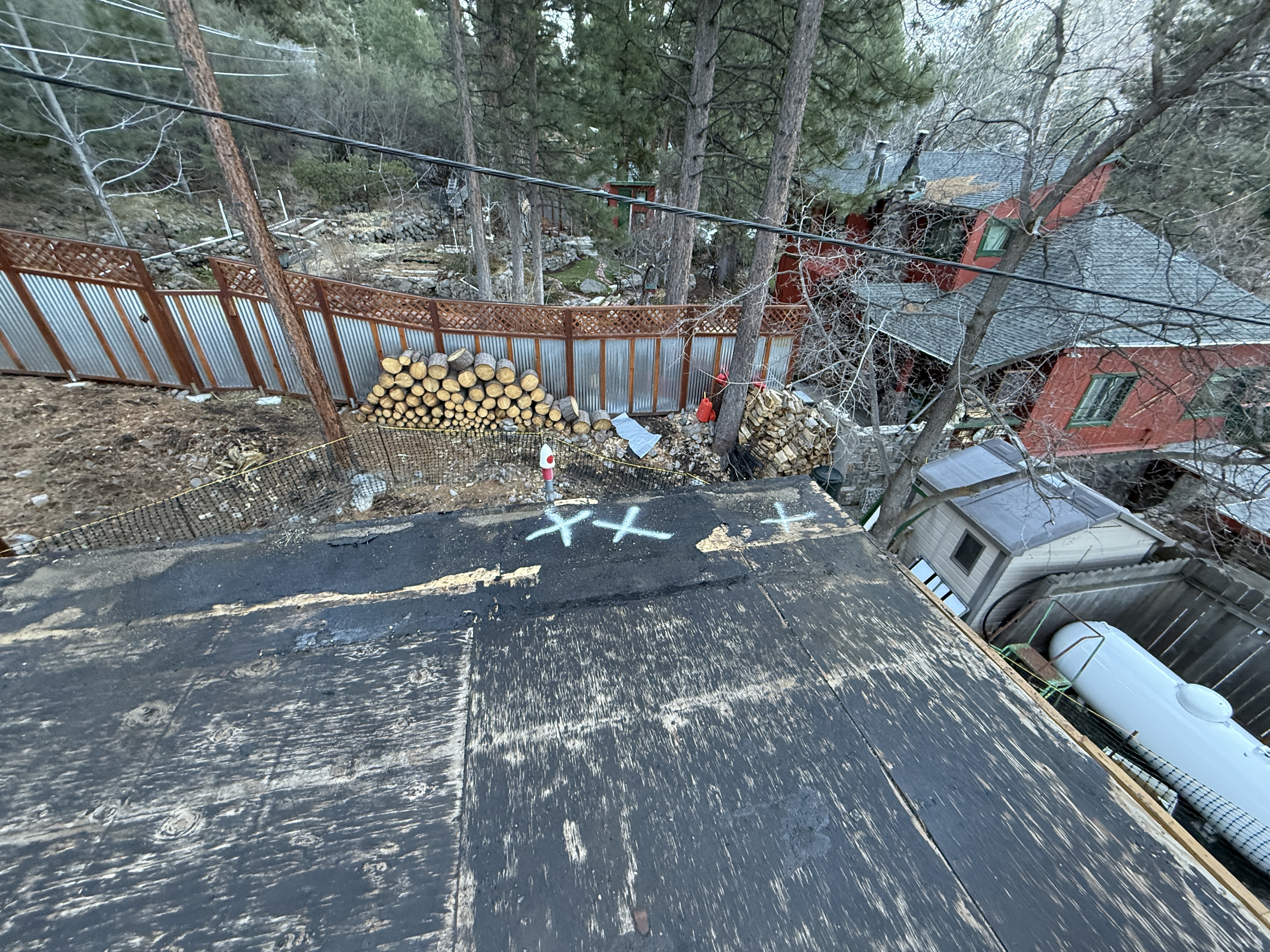
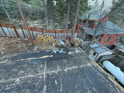
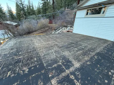
The image is taken from an elevated position, showing a rooftop with worn wooden boards and marked with 'X's. Below appears to be a yard with stacked firewood against a metal fence. A red building with green-framed windows is visible in the background, along with a propane tank on the ground to the right. The site is surrounded by trees and power lines are visible above.
paving-surface-restoration
worn wood on rooftop overcast lighting limited access due to elevation
Safety controls are minimal, only a fence is visible.
Equipment & Materials
Analyzed Apr 21, 2026
Nearby Photos
other
material-stagingmarking
logs
0m
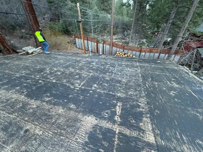
inspection documentation
roof-inspectionvisual-assessment
stacked-firewood

0m
other
roof-inspectionsafety-assessment
1m
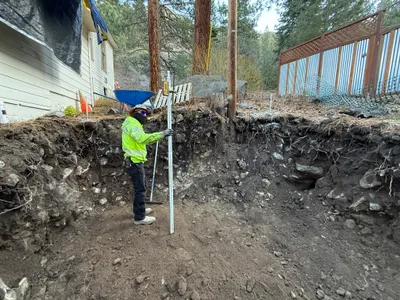
survey layout
surveyinglayout
level rod
2m
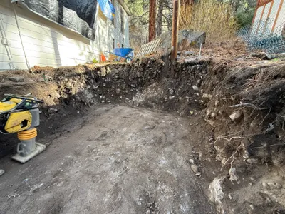
excavation
excavationsite-preparation
compactor

2m
other
roofing-preparationroof-surface-work
plywood
2m
other
roof-inspectioncondition-assessment
3m
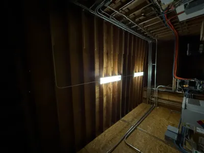
electrical
electrical-installationcable-management
electrical-panels
3m
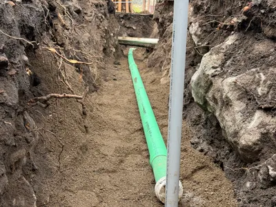
trenching
pipe-installationtrenching
soil
3m
trenching
trenchinginspection
measuring tool