
No caption
IMG_9480.JPG
Details
Friday, August 15, 2025 · 8:16 AM
39.39186, -120.02157· 1657m
Location Context
1 / 5
USGS Topo
No elevation data
FEMA Flood
No flood data
OSM Infra
No address data
USDA Soil
No soil data
USGS Hydro
No hydro data
Apple iPhone 16 Pro
iPhone 16 Pro back triple camera 2.22mm f/2.2
2.220000028611935mmf/2.21/99sISO 64
Flash did not fire, compulsory flash mode
Show all EXIF (43 fields)
ApertureValue2.2750
BrightnessValue5.3049
ColorSpace65535
CompositeImageGeneral Composite Image
ExifImageHeight3024
ExifVersion2.3.2
ExposureCompensation0
ExposureModeAuto
ExposureProgramNormal program
FlashpixVersion1.0
FocalLengthIn35mmFormat14
GPSDateStamp2025:08:15
GPSDestBearing181.6775
GPSDestBearingRefTrue North
GPSHPositioningError36.7309
GPSImgDirection181.6775
GPSImgDirectionRefT
GPSSpeed0
GPSSpeedRefK
GPSTimeStamp15:16:46
HostComputeriPhone 16 Pro
latitude39.3919
LensInfo2.2200, 15.6600, 1.7800, 2.8000
LensMakeApple
longitude-120.0216
MeteringModePattern
ModifyDate2025-08-15T08:16:47.000Z
OffsetTime-07:00
OffsetTimeDigitized-07:00
OffsetTimeOriginal-07:00
ResolutionUnitinches
SceneCaptureTypeStandard
SceneTypeDirectly photographed
SensingMethodOne-chip color area sensor
ShutterSpeedValue6.6325
Software18.6
SubjectArea{"0":2000,"1":1511,"2":2217,"3":1330}
SubSecTimeDigitized112
SubSecTimeOriginal112
WhiteBalanceAuto
XResolution72
YCbCrPositioning1
YResolution72
AI Analysis
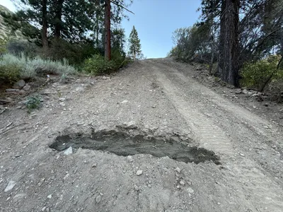
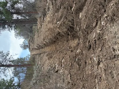
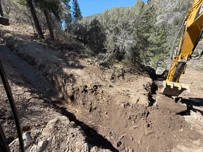
The image shows a section of a dirt road that appears to have a washed-out or eroded area. This depression is located in the center of a sloped road surrounded by trees and vegetation on both sides. The soil appears dry with visible rocks and gravel scattered across the surface.
swppp-erosion-control
dirt road with loose gravel and soil daylight with clear weather clear access with potential erosion hazards
No specific safety features are visible in frame.
AI Tags
Analyzed Apr 21, 2026
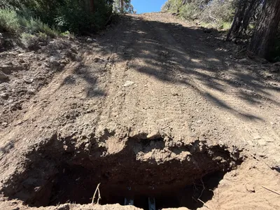
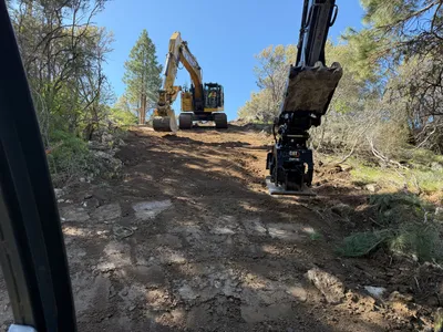
Nearby Photos
3m
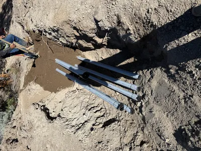
excavation
excavationtrench
3m
excavation
excavationearthwork
excavator
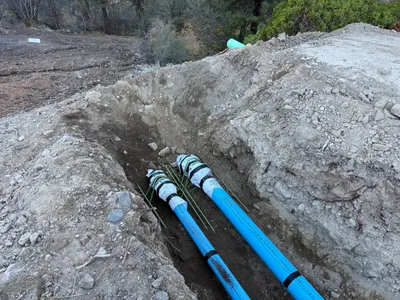
3m
trenching
trenchingpipe-laying
excavated-soil
5m
trenching
trenchingconduit-laying
shovel

6m
trenching
trenchingexcavation
excavator
8m
trenching
trenchingtrench
8m
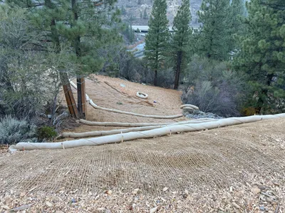
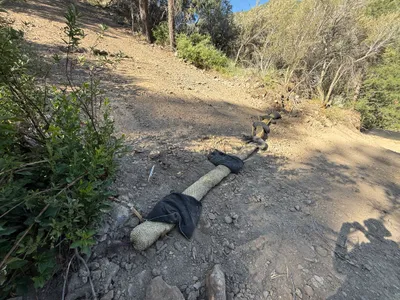
swppp erosion control
slope-stabilizationerosion-control
erosion-control-blanlets
8m
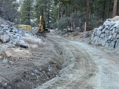
site grading
gradingaccess-road-construction
excavator
8m
trenching
trenchingtrench
excavator
9m
swppp erosion control
erosion-controlswppp-compliance
erosion control blanket