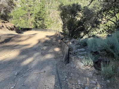
No caption
IMG_7343.JPG
Details
Thursday, April 24, 2025 · 3:06 PM
39.39204, -120.02163· 1659m
Location Context
1 / 5
USGS Topo
No elevation data
FEMA Flood
No flood data
OSM Infra
No address data
USDA Soil
No soil data
USGS Hydro
No hydro data
Apple iPhone 16 Pro
iPhone 16 Pro back triple camera 6.765mm f/1.78
6.764999865652793mmf/1.7799999713880651/3953sISO 80
Flash did not fire, compulsory flash mode
Show all EXIF (43 fields)
ApertureValue1.6638
BrightnessValue9.6949
ColorSpace65535
CompositeImageGeneral Composite Image
ExifImageHeight4284
ExifVersion2.3.2
ExposureCompensation0
ExposureModeAuto
ExposureProgramNormal program
FlashpixVersion1.0
FocalLengthIn35mmFormat24
GPSDateStamp2025:04:24
GPSDestBearing91.2690
GPSDestBearingRefTrue North
GPSHPositioningError53.4819
GPSImgDirection91.2690
GPSImgDirectionRefT
GPSSpeed0
GPSSpeedRefK
GPSTimeStamp22:6:45
HostComputeriPhone 16 Pro
latitude39.3920
LensInfo2.2200, 15.6600, 1.7800, 2.8000
LensMakeApple
longitude-120.0216
MeteringModePattern
ModifyDate2025-04-24T15:06:48.000Z
OffsetTime-07:00
OffsetTimeDigitized-07:00
OffsetTimeOriginal-07:00
ResolutionUnitinches
SceneCaptureTypeStandard
SceneTypeDirectly photographed
SensingMethodOne-chip color area sensor
ShutterSpeedValue11.9486
Software18.5
SubjectArea{"0":2851,"1":2137,"2":3141,"3":1884}
SubSecTimeDigitized231
SubSecTimeOriginal231
WhiteBalanceAuto
XResolution72
YCbCrPositioning1
YResolution72
AI Analysis
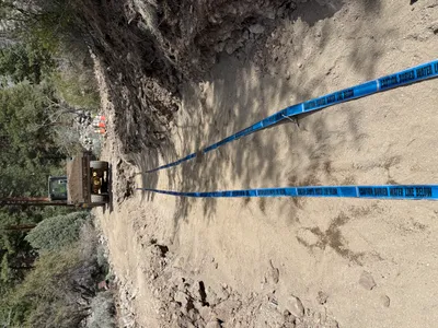
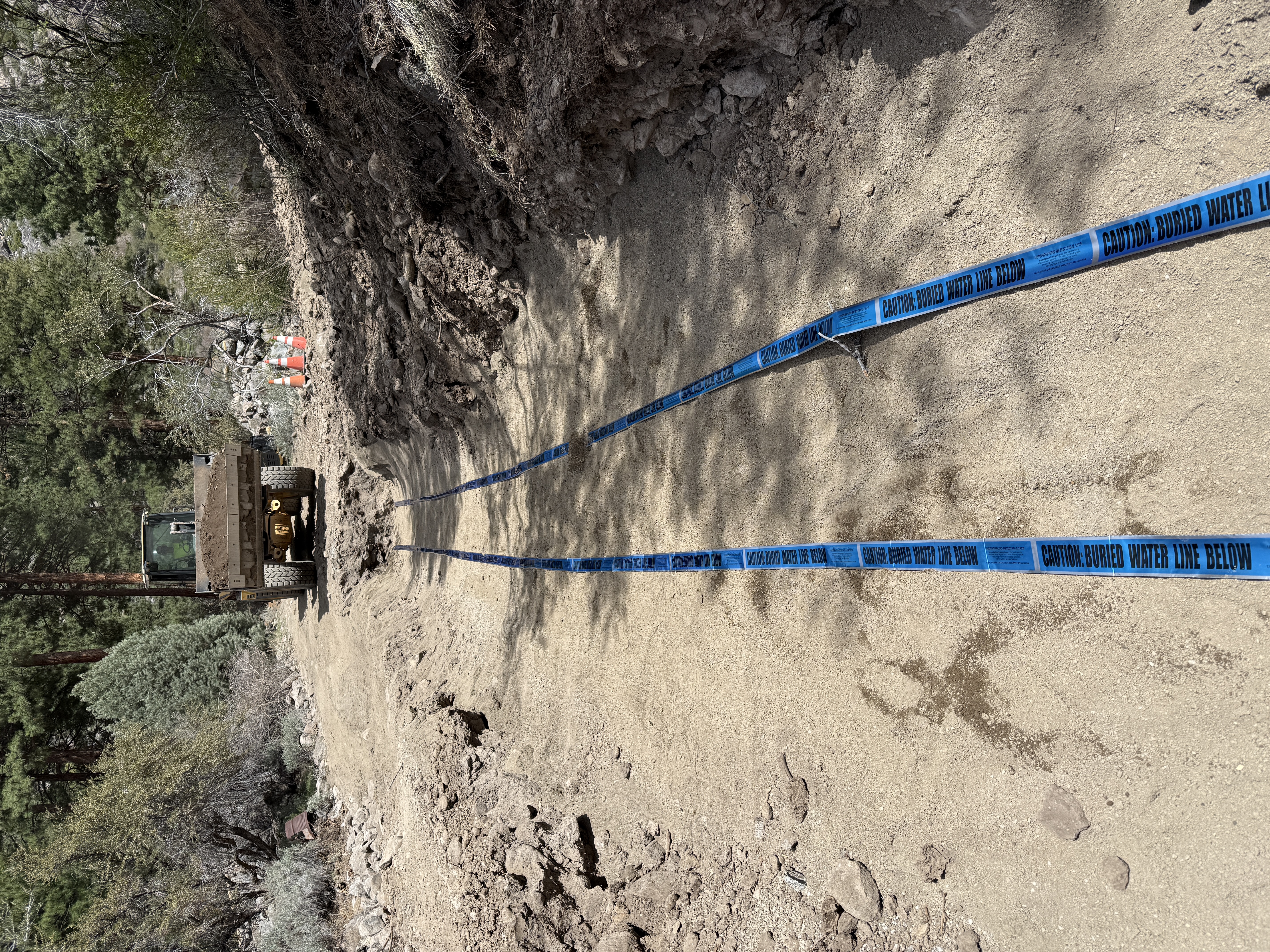
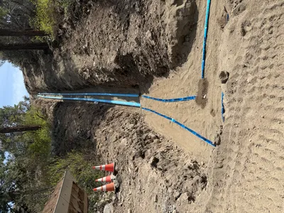
The image shows a trench partially backfilled with a dirt path and blue caution tape laid in parallel. Two cones can be seen in the background along with a piece of heavy machinery, suggesting ongoing trenching or underground utility work. The area appears to be forested with minimal visible congestion.
trenching
dirt and rocky trench sunny and daylight open access with surrounding trees
Caution tape and cones are present, but no personal protective equipment is visible in frame.
Equipment & Materials
AI Tags
Analyzed Apr 21, 2026
Nearby Photos
2m
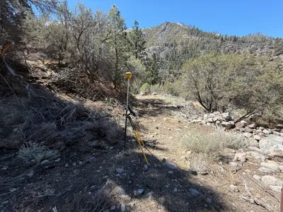
survey layout
survey-setupsite-survey
survey-instrument
2m
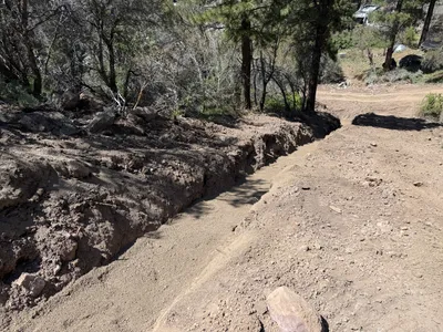
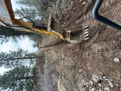
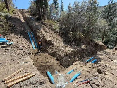
trenching
trenchingexcavation
4m
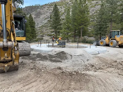
concrete work
foundation-preparationsite-grading
excavator
4m
trenching
trenchingexcavation
excavator
4m
pipeline installation
pipeline-installationtrenching
soil
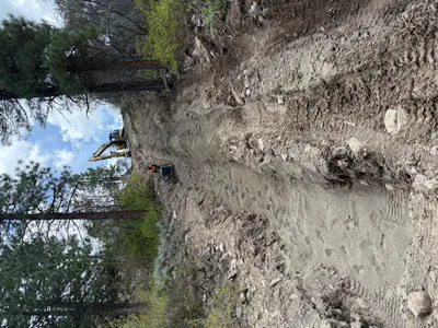
5m
excavation
excavationsloped-excavation
excavator
5m
swppp erosion control
erosion-controlsilt-fence-installation
shovel
5m
trenching
trenchingpipe-staging
blue piping
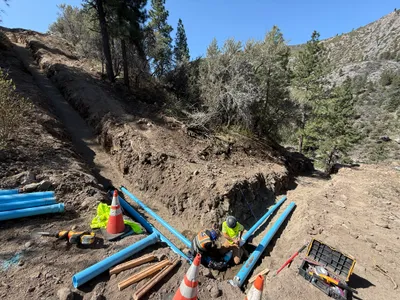
5m
trenching
pipeline-trenchingpipe-installation
shovel
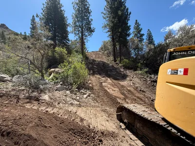
6m
site grading
gradingslope-clearing
bulldozer