No caption
IMG_6866.JPG
Tags
Details
Tuesday, March 25, 2025 · 4:15 PM
39.39655, -120.02052· 1664m
Location Context
1 / 5
USGS Topo
No elevation data
FEMA Flood
No flood data
OSM Infra
No address data
USDA Soil
No soil data
USGS Hydro
No hydro data
Apple iPhone 16 Pro
iPhone 16 Pro back triple camera 6.765mm f/1.78
6.764999865652793mmf/1.7799999713880651/2232sISO 80
Flash did not fire, compulsory flash mode
Show all EXIF (43 fields)
ApertureValue1.6638
BrightnessValue8.6756
ColorSpace65535
CompositeImageGeneral Composite Image
ExifImageHeight4284
ExifVersion2.3.2
ExposureCompensation0
ExposureModeAuto
ExposureProgramNormal program
FlashpixVersion1.0
FocalLengthIn35mmFormat24
GPSDateStamp2025:03:25
GPSDestBearing240.4517
GPSDestBearingRefTrue North
GPSHPositioningError42.4145
GPSImgDirection240.4517
GPSImgDirectionRefT
GPSSpeed0
GPSSpeedRefK
GPSTimeStamp23:15:17
HostComputeriPhone 16 Pro
latitude39.3965
LensInfo2.2200, 15.6600, 1.7800, 2.8000
LensMakeApple
longitude-120.0205
MeteringModePattern
ModifyDate2025-03-25T16:15:18.000Z
OffsetTime-07:00
OffsetTimeDigitized-07:00
OffsetTimeOriginal-07:00
ResolutionUnitinches
SceneCaptureTypeStandard
SceneTypeDirectly photographed
SensingMethodOne-chip color area sensor
ShutterSpeedValue11.1242
Software18.4
SubjectArea{"0":2851,"1":2137,"2":3141,"3":1884}
SubSecTimeDigitized975
SubSecTimeOriginal975
WhiteBalanceAuto
XResolution72
YCbCrPositioning1
YResolution72
AI Analysis
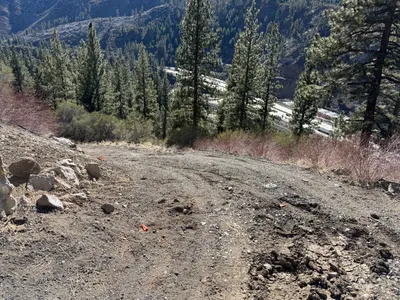
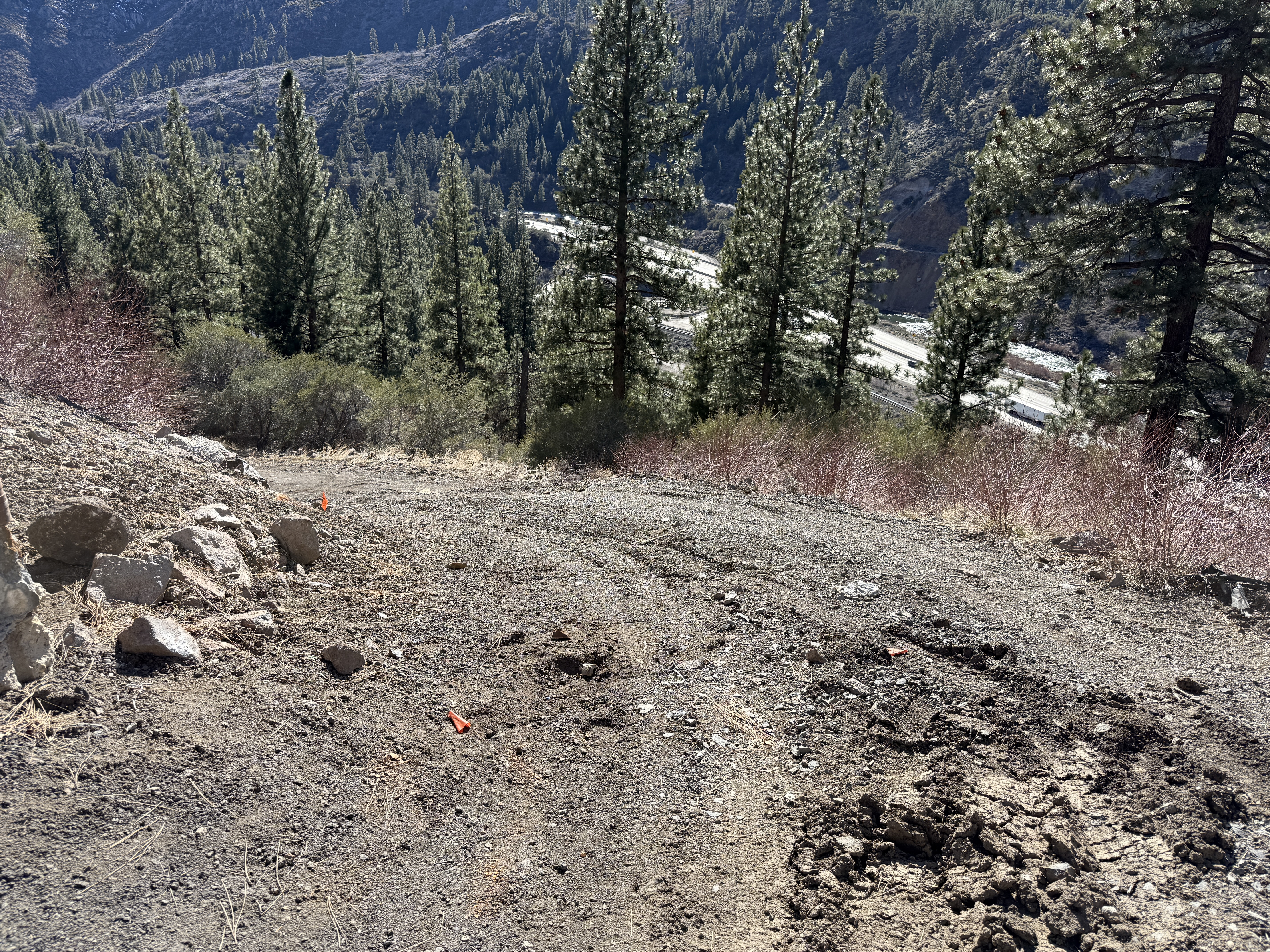
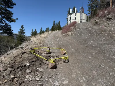
The image captures a dirt road with visible tire tracks and loose soil leading downhill. The road is surrounded by natural vegetation, including trees and bushes, with a view of a distant highway. Small markers or cones are visible on the ground, suggesting a preconstruction assessment or marking location.
site-grading
loose soil with visible tracks clear daylight roadway access with surrounding vegetation
Safety features such as cones are visible on the ground.
AI Tags
Analyzed Apr 21, 2026
Nearby Photos
13m
other
access-road-constructionantennas
antennas
13m
other
dirt-roadpine-trees
14m
site grading
caution-areasite-marking
soil
14m
trenching
trenchingpipe-placement
excavator
15m
excavation
excavationdigging
shovel
16m
excavation
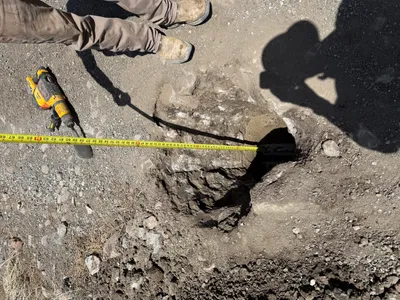
measurementhole-measurement
tape-measure
16m
excavation
hole-excavationdepth-measurement
measuring-tape
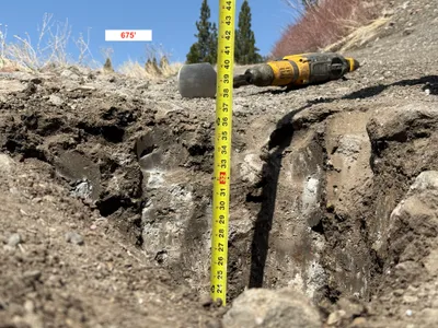
18m
excavation
trenchingdepth-measurement
power-drill
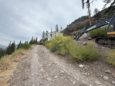
22m
excavation
excavationroad-access
excavator
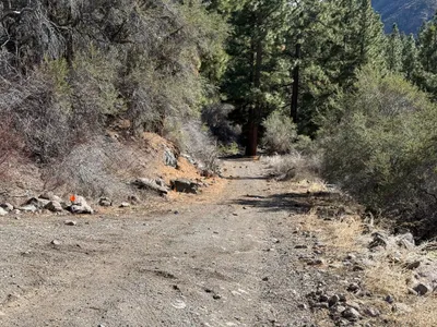
25m
other
preconstructionsite-access