No caption
IMG_2786.JPG
Details
Friday, January 30, 2026 · 3:11 PM
39.39263, -120.02264· 1633m
Location Context
1 / 5
USGS Topo
No elevation data
FEMA Flood
No flood data
OSM Infra
No address data
USDA Soil
No soil data
USGS Hydro
No hydro data
Apple iPhone 16 Pro
iPhone 16 Pro back triple camera 6.765mm f/1.78
6.764999865652793mmf/1.7799999713880651/1855sISO 80
Flash did not fire, compulsory flash mode
Show all EXIF (43 fields)
ApertureValue1.6638
BrightnessValue8.4005
ColorSpace65535
CompositeImageGeneral Composite Image
ExifImageHeight4284
ExifVersion2.3.2
ExposureCompensation0
ExposureModeAuto
ExposureProgramNormal program
FlashpixVersion1.0
FocalLengthIn35mmFormat24
GPSDateStamp2026:01:30
GPSDestBearing302.3754
GPSDestBearingRefTrue North
GPSHPositioningError11.9058
GPSImgDirection302.3754
GPSImgDirectionRefT
GPSSpeed1.9641
GPSSpeedRefK
GPSTimeStamp23:11:42
HostComputeriPhone 16 Pro
latitude39.3926
LensInfo2.2200, 15.6600, 1.7800, 2.8000
LensMakeApple
longitude-120.0226
MeteringModePattern
ModifyDate2026-01-30T15:11:42.000Z
OffsetTime-08:00
OffsetTimeDigitized-08:00
OffsetTimeOriginal-08:00
ResolutionUnitinches
SceneCaptureTypeStandard
SceneTypeDirectly photographed
SensingMethodOne-chip color area sensor
ShutterSpeedValue10.8574
Software26.2.1
SubjectArea{"0":2853,"1":2140,"2":3142,"3":1881}
SubSecTimeDigitized542
SubSecTimeOriginal542
WhiteBalanceAuto
XResolution72
YCbCrPositioning1
YResolution72
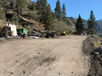
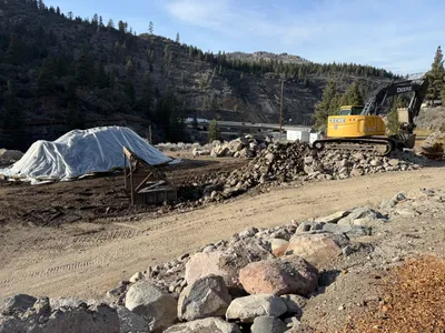
AI Analysis
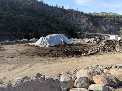
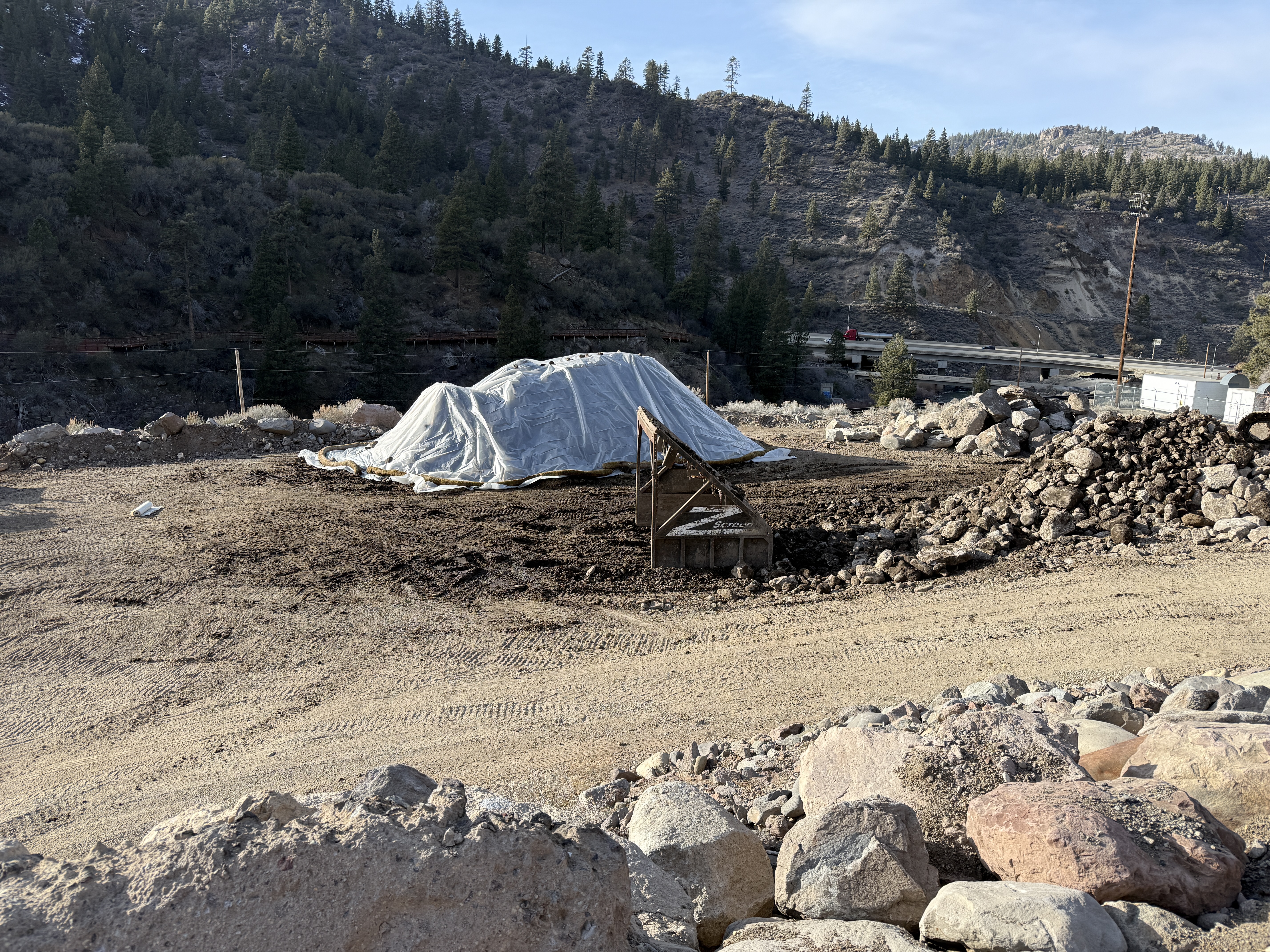
A construction site in a mountainous area shows an earth mound covered with a tarp in the center. To its right, there is a structure that looks like a screening or sifting setup. Rocks and earth are spread around the cleared land area, which is surrounded by larger rocks and a slight slope in the background.
swppp-erosion-control
dirt and rocks clear weather with daylight open access with cleared areas
No explicit safety features are visible in frame.
Analyzed Apr 21, 2026
Nearby Photos
2m
excavation
excavationearth-moving
deere excavator
3m
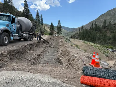
concrete work
concrete-pouringtrench-work
excavator
3m
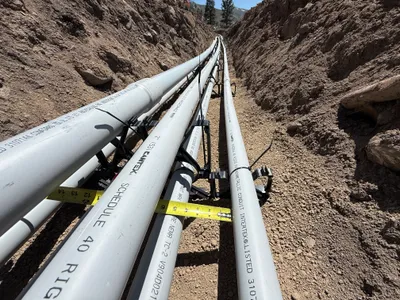
pipeline installation
duct-bank-installationconduit-laying
pvc
3m
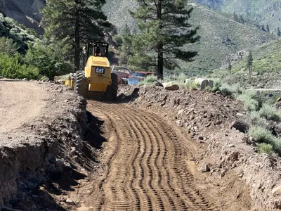
site grading
site-gradingroller
roller
3m
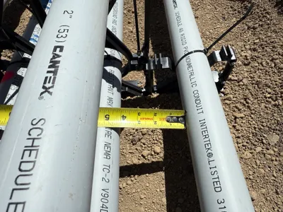
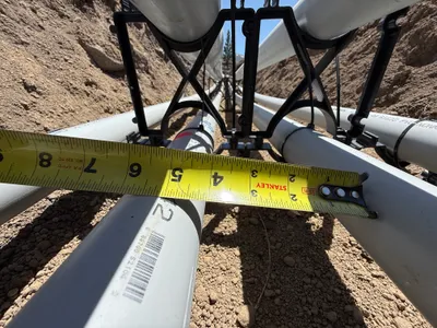
electrical
conduit-measurementconduit-installation
measuring tape
4m
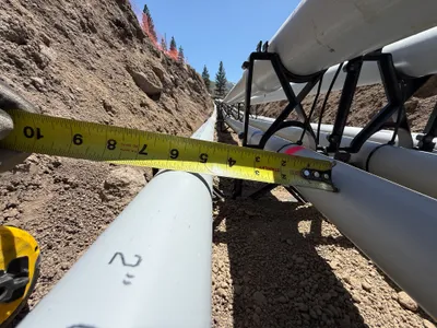
pipeline installation
conduit-alignmentmeasurement-check
tape-measure
4m
concrete work
concrete-pouringtrench-filling
cement truck
4m
site grading
gradingsite-grading
compactor
4m
pipeline installation
conduit-measurementpipeline-installation
tape-measure
4m
excavation
excavationrocks
excavator