
No caption
IMG_7907.JPG
Details
Tuesday, May 20, 2025 · 1:48 PM
39.39266, -120.02262· 1631m
Location Context
1 / 5
USGS Topo
No elevation data
FEMA Flood
No flood data
OSM Infra
No address data
USDA Soil
No soil data
USGS Hydro
No hydro data
Apple iPhone 16 Pro
iPhone 16 Pro back triple camera 2.22mm f/2.2
2.220000028611935mmf/2.21/2092sISO 50
Flash did not fire, compulsory flash mode
Show all EXIF (43 fields)
ApertureValue2.2750
BrightnessValue9.3265
ColorSpace65535
CompositeImageGeneral Composite Image
ExifImageHeight3024
ExifVersion2.3.2
ExposureCompensation0
ExposureModeAuto
ExposureProgramNormal program
FlashpixVersion1.0
FocalLengthIn35mmFormat14
GPSDateStamp2025:05:20
GPSDestBearing161.6320
GPSDestBearingRefTrue North
GPSHPositioningError4.7487
GPSImgDirection161.6320
GPSImgDirectionRefT
GPSSpeed0
GPSSpeedRefK
GPSTimeStamp20:48:34
HostComputeriPhone 16 Pro
latitude39.3927
LensInfo2.2200, 15.6600, 1.7800, 2.8000
LensMakeApple
longitude-120.0226
MeteringModePattern
ModifyDate2025-05-20T13:48:34.000Z
OffsetTime-07:00
OffsetTimeDigitized-07:00
OffsetTimeOriginal-07:00
ResolutionUnitinches
SceneCaptureTypeStandard
SceneTypeDirectly photographed
SensingMethodOne-chip color area sensor
ShutterSpeedValue11.0307
Software18.5
SubjectArea{"0":2000,"1":1511,"2":2217,"3":1330}
SubSecTimeDigitized809
SubSecTimeOriginal809
WhiteBalanceAuto
XResolution72
YCbCrPositioning1
YResolution72
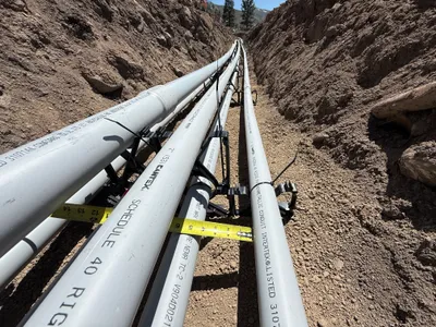
AI Analysis
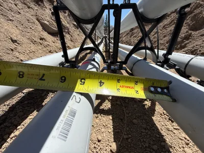
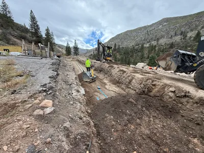
The image shows a close-up view of a measurement being taken of several PVC conduits with a yellow tape measure. The conduits are supported by plastic racks and positioned within a trench dug into the soil. The conduits are laid parallel to each other, and the tape measure indicates the distance between certain points along the conduits.
pipeline-installation
soil trench bright sunlight access appears clear within trench
Safety features are not visible in frame
Equipment & Materials
AI Tags
Analyzed Apr 21, 2026
Nearby Photos
0m
pipeline installation
conduit-alignmentmeasurement-check
tape-measure
1m
electrical
conduit-measurementconduit-installation
measuring tape
1m
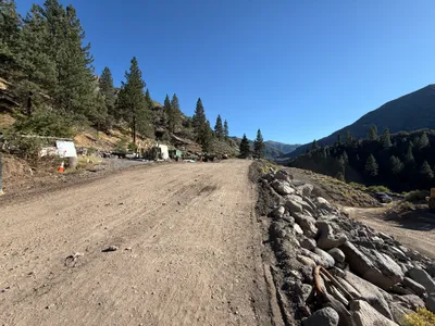
trenching
duct-bank-installationtrenching
gravel
2m
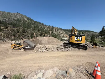
excavation
excavationearth-moving
excavator
2m
pipeline installation
duct-bank-installationconduit-laying
pvc
2m
other
site-preparationequipment-staging
construction-vehicle
3m
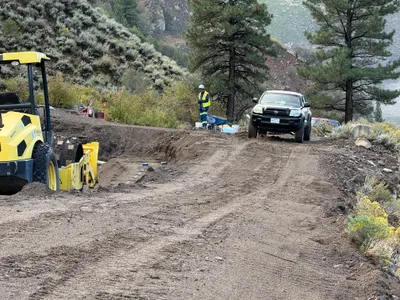
trenching
trenchingearthwork
yellow compactor
3m
site grading
soil-compactioncompactor
compactor
4m
swppp erosion control
rock-movingdebris-clearance
excavator
4m
trenching
trenchingcompacting
excavator