
No caption
IMG_0762.JPG
Details
Tuesday, October 7, 2025 · 3:20 PM
39.39258, -120.02259· 1631m
Location Context
1 / 5
USGS Topo
No elevation data
FEMA Flood
No flood data
OSM Infra
No address data
USDA Soil
No soil data
USGS Hydro
No hydro data
Apple iPhone 16 Pro
iPhone 16 Pro back triple camera 6.765mm f/1.78
6.764999865652793mmf/1.7799999713880651/4405sISO 80
Flash did not fire, compulsory flash mode
Show all EXIF (44 fields)
ApertureValue1.6638
BrightnessValue9.6340
ColorSpace65535
CompositeImageGeneral Composite Image
DigitalZoomRatio1.0014
ExifImageHeight4284
ExifVersion2.3.2
ExposureCompensation0
ExposureModeAuto
ExposureProgramNormal program
FlashpixVersion1.0
FocalLengthIn35mmFormat24
GPSDateStamp2025:10:07
GPSDestBearing163.8212
GPSDestBearingRefTrue North
GPSHPositioningError10.5211
GPSImgDirection163.8212
GPSImgDirectionRefT
GPSSpeed0.4246
GPSSpeedRefK
GPSTimeStamp22:20:42
HostComputeriPhone 16 Pro
latitude39.3926
LensInfo2.2200, 15.6600, 1.7800, 2.8000
LensMakeApple
longitude-120.0226
MeteringModePattern
ModifyDate2025-10-07T15:20:43.000Z
OffsetTime-07:00
OffsetTimeDigitized-07:00
OffsetTimeOriginal-07:00
ResolutionUnitinches
SceneCaptureTypeStandard
SceneTypeDirectly photographed
SensingMethodOne-chip color area sensor
ShutterSpeedValue12.1050
Software26.0.1
SubjectArea{"0":2853,"1":2138,"2":3146,"3":1883}
SubSecTimeDigitized291
SubSecTimeOriginal291
WhiteBalanceAuto
XResolution72
YCbCrPositioning1
YResolution72
AI Analysis
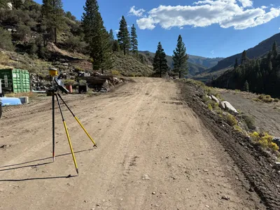
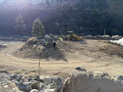
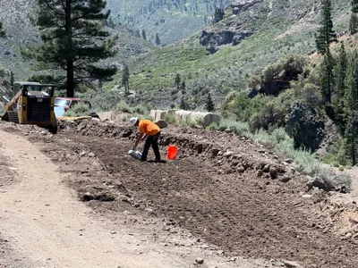
The image shows a construction site with a tripod-mounted surveying instrument placed on a dirt road. Surrounding the area are hills covered with trees and scrub. Containers and construction materials are visible on the left side. The road appears elevated with rocky sides.
survey-layout
dirt road with rocky edges sunny with clear skies and some clouds accessible on a wide dirt path
No visible safety features in frame other than natural terrain conditions with uneven ground.
Equipment & Materials
AI Tags
Analyzed Apr 21, 2026
Nearby Photos
1m
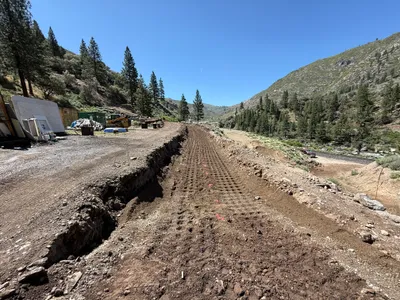
site grading
site-gradingpathway-preparation
excavator
1m
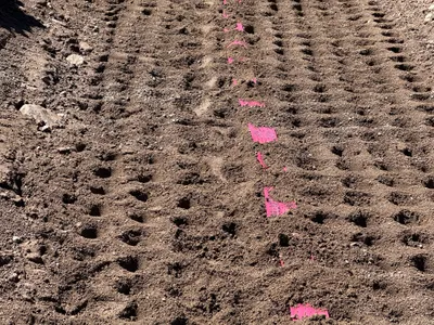
site grading
site-preparationmarker-placement
soil
1m
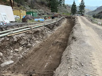
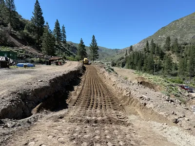
trenching
trenchingexcavation
pipes
2m
swppp erosion control
erosion-controlgrading
backhoe
2m
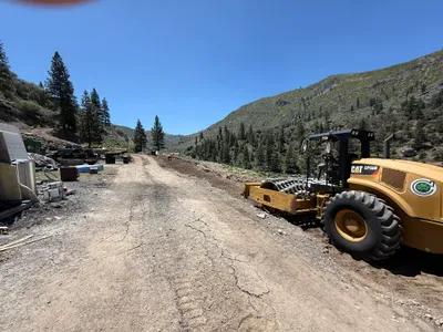
site grading
road-gradingcompaction
soil-compactor
2m
excavation
excavationearthwork
excavator
2m
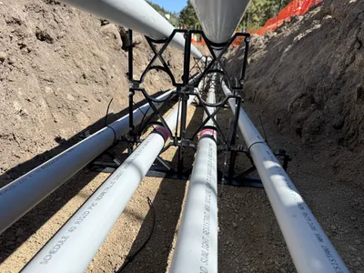
pipeline installation
duct-bank-installationtrenching
PVC conduits
2m
pipeline installation
conduit-installationduct-bank-installation
pvc pipes
2m
site grading
site-gradingrocks
excavator
3m
site grading
soil-preparationmaterial-handling
skid steer loader