No caption
IMG_6606.JPG
Details
Friday, March 14, 2025 · 6:31 PM
39.39470, -120.02109· 1656m
Location Context
1 / 5
USGS Topo
No elevation data
FEMA Flood
No flood data
OSM Infra
No address data
USDA Soil
No soil data
USGS Hydro
No hydro data
Apple iPhone 16 Pro
iPhone 16 Pro back triple camera 6.765mm f/1.78
6.764999865652793mmf/1.7799999713880651/559sISO 80
Flash did not fire, compulsory flash mode
Show all EXIF (43 fields)
ApertureValue1.6638
BrightnessValue6.7645
ColorSpace65535
CompositeImageGeneral Composite Image
ExifImageHeight4284
ExifVersion2.3.2
ExposureCompensation0
ExposureModeAuto
ExposureProgramNormal program
FlashpixVersion1.0
FocalLengthIn35mmFormat24
GPSDateStamp2025:03:15
GPSDestBearing270.0730
GPSDestBearingRefTrue North
GPSHPositioningError6.4376
GPSImgDirection270.0730
GPSImgDirectionRefT
GPSSpeed1.0593
GPSSpeedRefK
GPSTimeStamp1:31:50
HostComputeriPhone 16 Pro
latitude39.3947
LensInfo2.2200, 15.6600, 1.7800, 2.8000
LensMakeApple
longitude-120.0211
MeteringModePattern
ModifyDate2025-03-14T18:31:50.000Z
OffsetTime-07:00
OffsetTimeDigitized-07:00
OffsetTimeOriginal-07:00
ResolutionUnitinches
SceneCaptureTypeStandard
SceneTypeDirectly photographed
SensingMethodOne-chip color area sensor
ShutterSpeedValue9.1258
Software18.4
SubjectArea{"0":2849,"1":2137,"2":3291,"3":1884}
SubSecTimeDigitized757
SubSecTimeOriginal757
WhiteBalanceAuto
XResolution72
YCbCrPositioning1
YResolution72
AI Analysis
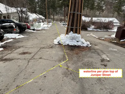
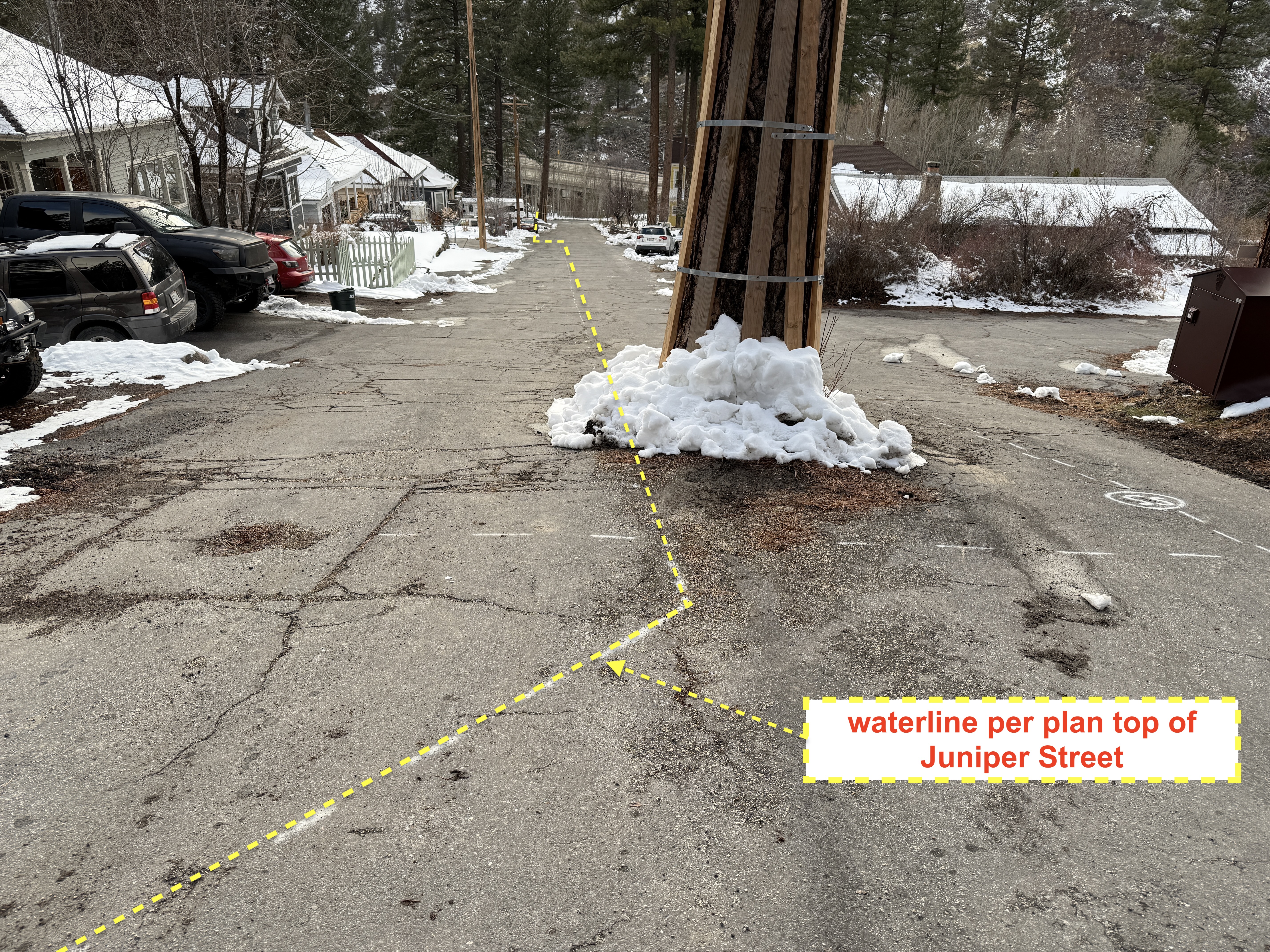
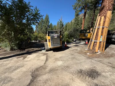
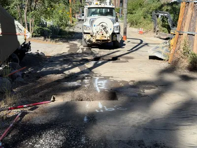
The image shows yellow dashed lines on an asphalt surface, which are indicative of planned waterline alignment on Juniper Street. A utility pole is located near the center, with snow piled around its base. Several vehicles are parked along the left side of the street. The street surface appears cracked and slightly uneven.
survey-layout
cracked asphalt overcast lighting street is clear but has parked vehicles
No active safety features visible in frame.
Equipment & Materials
Analyzed Apr 21, 2026
Nearby Photos
1m
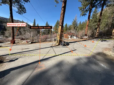
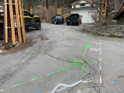
survey layout
utility-markingsurvey-layout
fiber bundle markings
1m
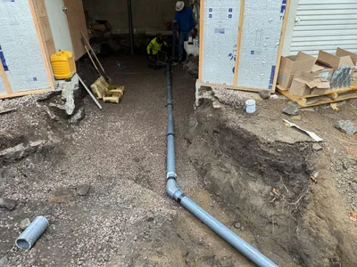
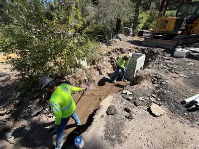
pipeline installation
pipeline-installationindoor-construction
gravel
2m
paving surface restoration
surface-preparationequipment-staging
excavator
2m
other
treesvehicle
two parked vehicles
2m
paving surface restoration
road-markingsurface-assessment
cars
2m
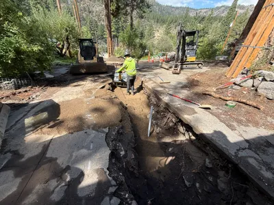
trenching
trenchingexcavation
hydraulic excavator
2m
excavation
pothole-utility-locatingpavement
excavator
2m
trenching
trenchingcompaction
excavator
2m
survey layout
utility-markingpavement-assessment
black-pickup-truck
3m
trenching
trenchingsoil-leveling
tracked excavator