
No caption
IMG_6996.JPG
Tags
Details
Monday, April 7, 2025 · 12:23 PM
39.39468, -120.02107· 1654m
Location Context
1 / 5
USGS Topo
No elevation data
FEMA Flood
No flood data
OSM Infra
No address data
USDA Soil
No soil data
USGS Hydro
No hydro data
Apple iPhone 16 Pro
iPhone 16 Pro back triple camera 6.765mm f/1.78
6.764999865652793mmf/1.7799999713880651/1192sISO 80
Flash did not fire, compulsory flash mode
Show all EXIF (43 fields)
ApertureValue1.6638
BrightnessValue8.0666
ColorSpace65535
CompositeImageGeneral Composite Image
ExifImageHeight4284
ExifVersion2.3.2
ExposureCompensation0
ExposureModeAuto
ExposureProgramNormal program
FlashpixVersion1.0
FocalLengthIn35mmFormat24
GPSDateStamp2025:04:07
GPSDestBearing78.2171
GPSDestBearingRefTrue North
GPSHPositioningError10.7693
GPSImgDirection78.2171
GPSImgDirectionRefT
GPSSpeed1.2076
GPSSpeedRefK
GPSTimeStamp19:23:55
HostComputeriPhone 16 Pro
latitude39.3947
LensInfo2.2200, 15.6600, 1.7800, 2.8000
LensMakeApple
longitude-120.0211
MeteringModePattern
ModifyDate2025-04-07T12:23:55.000Z
OffsetTime-07:00
OffsetTimeDigitized-07:00
OffsetTimeOriginal-07:00
ResolutionUnitinches
SceneCaptureTypeStandard
SceneTypeDirectly photographed
SensingMethodOne-chip color area sensor
ShutterSpeedValue10.2190
Software18.4
SubjectArea{"0":2851,"1":2137,"2":3141,"3":1884}
SubSecTimeDigitized455
SubSecTimeOriginal455
WhiteBalanceAuto
XResolution72
YCbCrPositioning1
YResolution72
AI Analysis
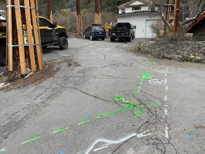
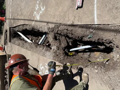
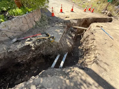
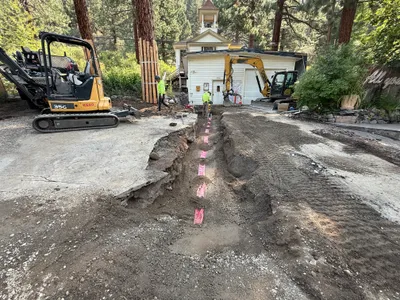
The image captures a section of cracked pavement with colored utility markings. A black and yellow truck is parked to the left, and a couple of other vehicles are ahead. Trees are supported by wooden braces on the left side. The utility markings suggest potential underground utility work or pipeline alignment in the area.
survey-layout
cracked asphalt pavement overcast lighting street access with minor congestion
Safety features are not visible in frame.
Equipment & Materials
AI Tags
Analyzed Apr 21, 2026
Nearby Photos
2m
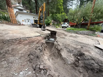
excavation
pothole-utility-locatingpavement
excavator
2m
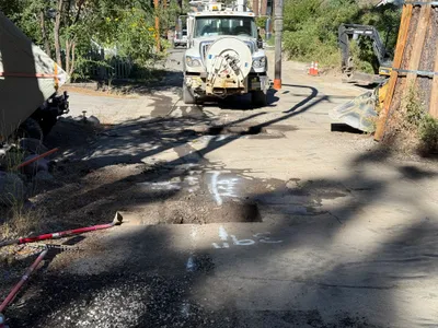
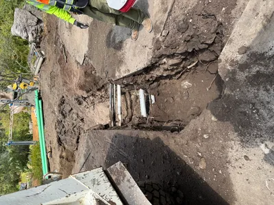
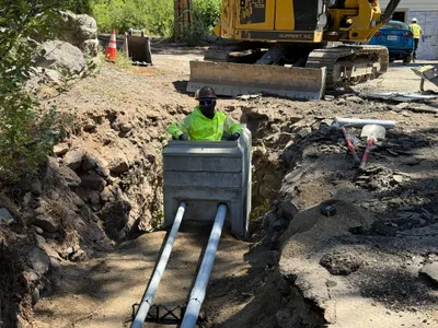
trenching
trenchingexcavation
hydraulic excavator
2m
excavation
excavationtrenching
excavator
2m
trenching
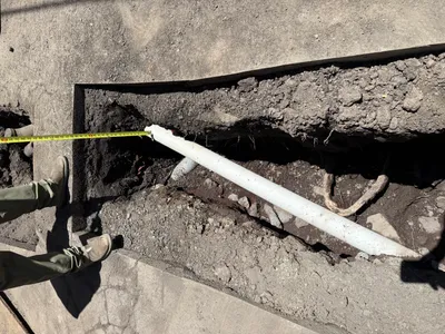
utility-locatingdepth-measurement
measuring-tape
2m
trenching
trenchingexcavation-work
pipes
2m
trenching
utility-locatingdepth-measurement
tape-measure
2m
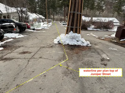
survey layout
line-alignmentutility-pole
parked-cars
2m
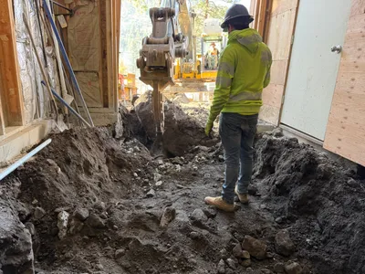
trenching
trenchingpipe-laying
shovel
2m
pipeline installation
duct-bank-installationconduit-placement
excavator
3m
trenching
trenchingexcavation-work
excavators