
No caption
IMG_6546.JPG
Details
Tuesday, March 11, 2025 · 4:58 PM
39.39112, -120.02133· 1679m
Location Context
1 / 5
USGS Topo
No elevation data
FEMA Flood
No flood data
OSM Infra
No address data
USDA Soil
No soil data
USGS Hydro
No hydro data
Apple iPhone 16 Pro
iPhone 16 Pro back triple camera 6.765mm f/1.78
6.764999865652793mmf/1.7799999713880651/5319sISO 80
Flash did not fire, compulsory flash mode
Show all EXIF (44 fields)
ApertureValue1.6638
BrightnessValue10.0138
ColorSpace65535
CompositeImageGeneral Composite Image
DigitalZoomRatio1.0014
ExifImageHeight4284
ExifVersion2.3.2
ExposureCompensation0
ExposureModeAuto
ExposureProgramNormal program
FlashpixVersion1.0
FocalLengthIn35mmFormat24
GPSDateStamp2025:03:11
GPSDestBearing45.7389
GPSDestBearingRefTrue North
GPSHPositioningError2.6528
GPSImgDirection45.7389
GPSImgDirectionRefT
GPSSpeed1.1499
GPSSpeedRefK
GPSTimeStamp23:58:50
HostComputeriPhone 16 Pro
latitude39.3911
LensInfo2.2200, 15.6600, 1.7800, 2.8000
LensMakeApple
longitude-120.0213
MeteringModePattern
ModifyDate2025-03-11T16:58:50.000Z
OffsetTime-07:00
OffsetTimeDigitized-07:00
OffsetTimeOriginal-07:00
ResolutionUnitinches
SceneCaptureTypeStandard
SceneTypeDirectly photographed
SensingMethodOne-chip color area sensor
ShutterSpeedValue12.3770
Software18.4
SubjectArea{"0":2850,"1":2137,"2":3145,"3":1886}
SubSecTimeDigitized538
SubSecTimeOriginal538
WhiteBalanceAuto
XResolution72
YCbCrPositioning1
YResolution72
AI Analysis
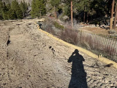
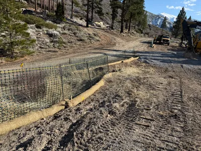
The photo depicts a dirt path bordered by a silt fence and straw wattles, likely for erosion control. The silt fence runs parallel to the edge of the path and is supported by wooden stakes. A person's shadow is visible in the foreground, indicating natural lighting with no machinery or active work visible.
swppp-erosion-control
dirt path with visible soil sunny with clear shadows dirt access path with fencing along one side
Safety controls like fencing are visible; PPE is not visible in frame.
Equipment & Materials
Analyzed Apr 21, 2026
Nearby Photos

swppp erosion control
erosion-controlsite-stabilization
straw-wattles
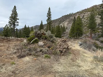
site grading
land-clearingdebris-pile
vegetation

site grading
vegetation-clearingsite-preparation
1m
excavation
excavationsite-preparation
excavator
1m
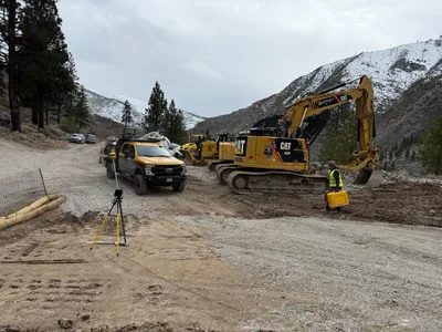
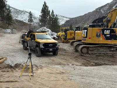
survey layout
survey-setupsurvey-layout
cat excavator
1m
swppp erosion control
ground-preparationsoil-piles
soil
2m
swppp erosion control
erosion-controlsediment-barrier-installation
excavator

2m
swppp erosion control
erosion-control-installationsediment-control-fence
excavator
3m
swppp erosion control
swppperosion-control
roller-compactor
4m
excavation
crane-operationconcrete-foundation
crane