No caption
IMG_7981 2.JPG
Details
Friday, May 23, 2025 · 10:07 AM
39.39468, -120.02144· 1652m
Location Context
1 / 5
USGS Topo
No elevation data
FEMA Flood
No flood data
OSM Infra
No address data
USDA Soil
No soil data
USGS Hydro
No hydro data
Apple iPhone 16 Pro
iPhone 16 Pro back triple camera 2.22mm f/2.2
2.220000028611935mmf/2.21/574sISO 50
Flash did not fire, compulsory flash mode
Show all EXIF (43 fields)
ApertureValue2.2750
BrightnessValue8.4865
ColorSpace65535
CompositeImageGeneral Composite Image
ExifImageHeight3024
ExifVersion2.3.2
ExposureCompensation0
ExposureModeAuto
ExposureProgramNormal program
FlashpixVersion1.0
FocalLengthIn35mmFormat14
GPSDateStamp2025:05:23
GPSDestBearing189.9489
GPSDestBearingRefTrue North
GPSHPositioningError4.9246
GPSImgDirection189.9489
GPSImgDirectionRefT
GPSSpeed0.0894
GPSSpeedRefK
GPSTimeStamp17:7:0
HostComputeriPhone 16 Pro
latitude39.3947
LensInfo2.2200, 15.6600, 1.7800, 2.8000
LensMakeApple
longitude-120.0214
MeteringModePattern
ModifyDate2025-05-23T10:07:01.000Z
OffsetTime-07:00
OffsetTimeDigitized-07:00
OffsetTimeOriginal-07:00
ResolutionUnitinches
SceneCaptureTypeStandard
SceneTypeDirectly photographed
SensingMethodOne-chip color area sensor
ShutterSpeedValue9.1659
Software18.5
SubjectArea{"0":2000,"1":1511,"2":2217,"3":1330}
SubSecTimeDigitized206
SubSecTimeOriginal206
WhiteBalanceAuto
XResolution72
YCbCrPositioning1
YResolution72
AI Analysis
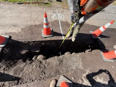
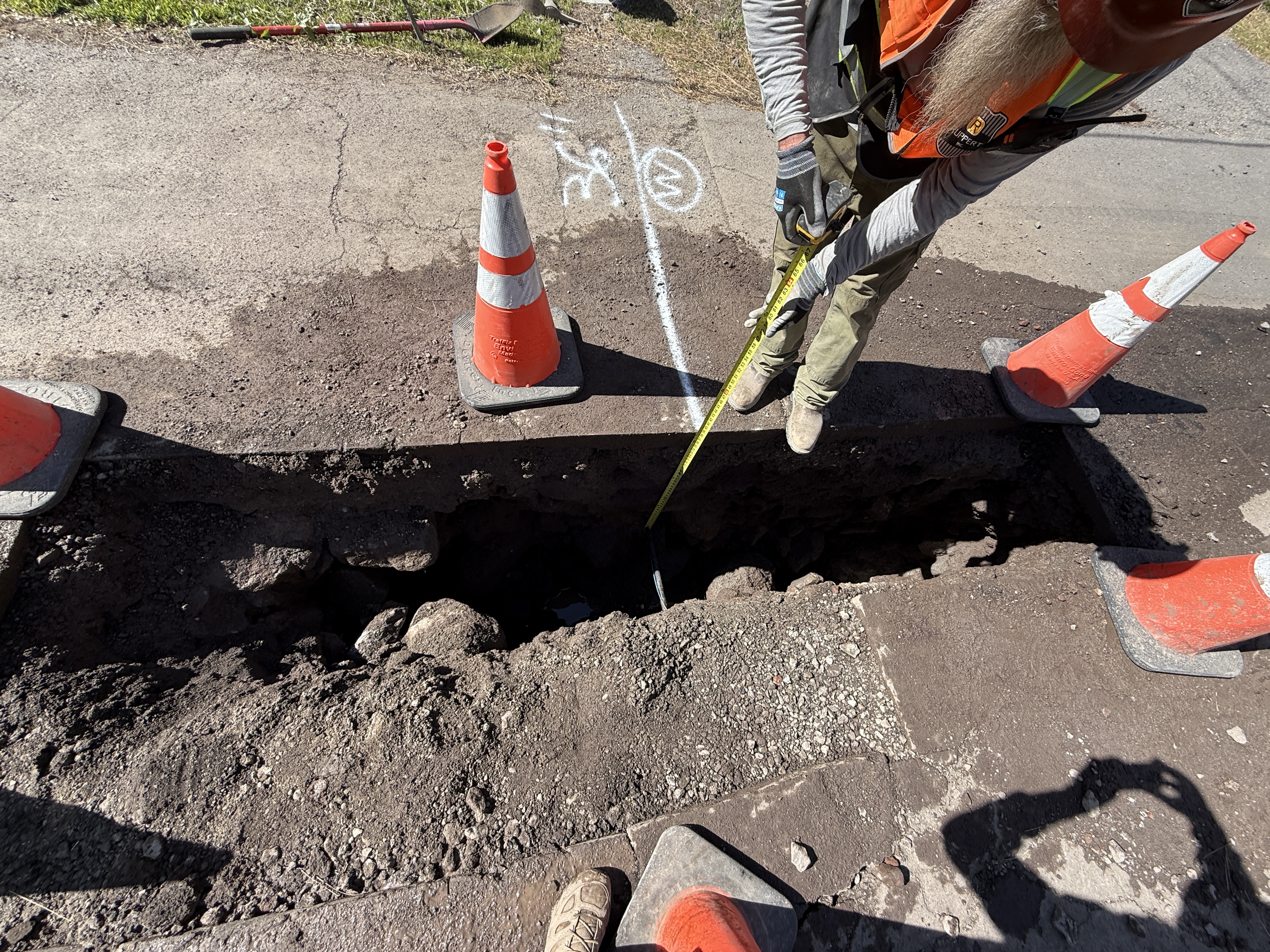
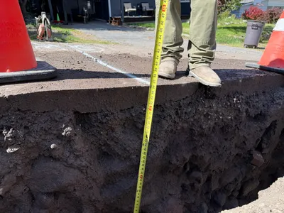
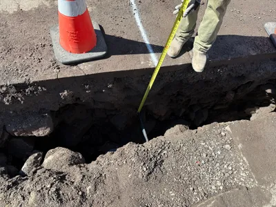
The image shows a worker measuring a pothole with a measuring tape. The area is marked off with safety cones, and the worker is wearing PPE, including a hard hat, hi-vis vest, and work boots. The surface is made of pavement, which has been cut to access the service beneath. No heavy machinery is visible, just the pothole excavation.
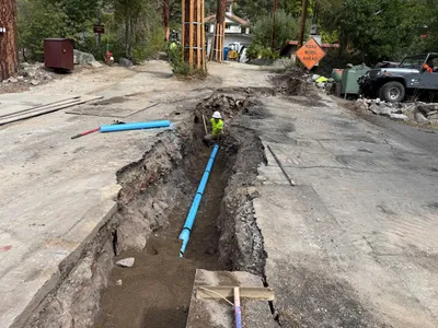
excavation
cut pavement with pothole clear daylight single access point secured with cones
Safety cones are visible providing caution around the open trench.
Equipment & Materials
AI Tags
Analyzed Apr 21, 2026
Nearby Photos
1m
trenching
utility-locatingdepth-measurement
measuring-tape
1m
trenching
trench-depth-measurementutility-locating
measuring-tape
1m
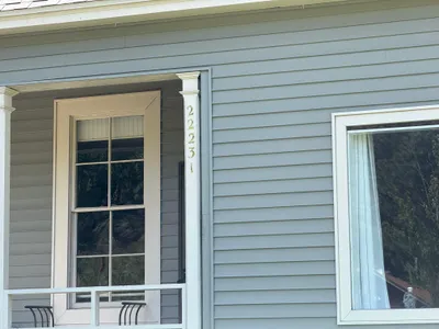
other
sidingwindows
2m
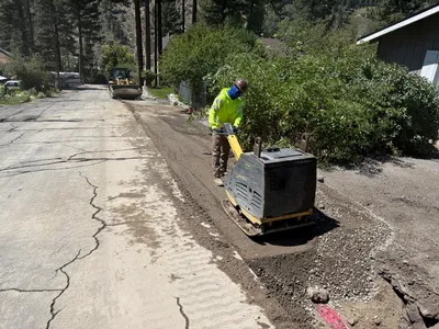
paving surface restoration
compactionroad-repair
plate-compactor
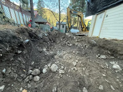
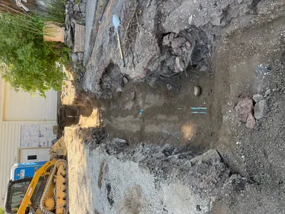
3m
excavation
excavationtrenching
excavator
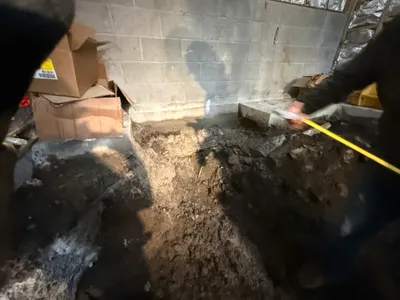
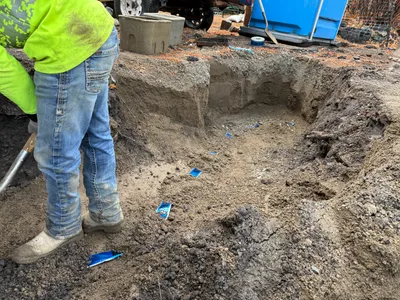
4m
excavation
excavationmeasuring
measuring-tape
4m
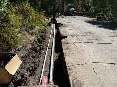
pipeline installation
trenchingpipe-laying
off-road vehicle
4m
trenching
trenchingduct-bank-installation
construction truck
4m
trenching
diggingmanual-excavation
shovel
5m
trenching
trenchingexcavation
compact track loader