No caption
IMG_7980 2.JPG
Details
Friday, May 23, 2025 · 10:06 AM
39.39468, -120.02143· 1653m
Location Context
1 / 5
USGS Topo
No elevation data
FEMA Flood
No flood data
OSM Infra
No address data
USDA Soil
No soil data
USGS Hydro
No hydro data
Apple iPhone 16 Pro
iPhone 16 Pro back triple camera 6.765mm f/1.78
6.764999865652793mmf/1.7799999713880651/1122sISO 80
Flash did not fire, compulsory flash mode
Show all EXIF (43 fields)
ApertureValue1.6638
BrightnessValue7.7438
ColorSpace65535
CompositeImageGeneral Composite Image
ExifImageHeight4284
ExifVersion2.3.2
ExposureCompensation0
ExposureModeAuto
ExposureProgramNormal program
FlashpixVersion1.0
FocalLengthIn35mmFormat24
GPSDateStamp2025:05:23
GPSDestBearing194.7002
GPSDestBearingRefTrue North
GPSHPositioningError5.3386
GPSImgDirection194.7002
GPSImgDirectionRefT
GPSSpeed0
GPSSpeedRefK
GPSTimeStamp17:6:55
HostComputeriPhone 16 Pro
latitude39.3947
LensInfo2.2200, 15.6600, 1.7800, 2.8000
LensMakeApple
longitude-120.0214
MeteringModePattern
ModifyDate2025-05-23T10:06:56.000Z
OffsetTime-07:00
OffsetTimeDigitized-07:00
OffsetTimeOriginal-07:00
ResolutionUnitinches
SceneCaptureTypeStandard
SceneTypeDirectly photographed
SensingMethodOne-chip color area sensor
ShutterSpeedValue10.1323
Software18.5
SubjectArea{"0":2851,"1":2137,"2":3141,"3":1884}
SubSecTimeDigitized314
SubSecTimeOriginal314
WhiteBalanceAuto
XResolution72
YCbCrPositioning1
YResolution72
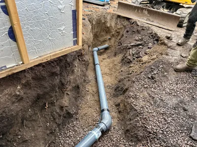
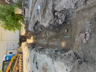
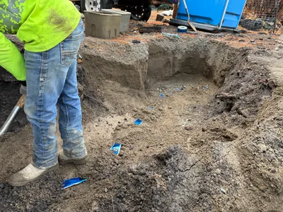
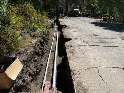
AI Analysis
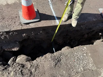
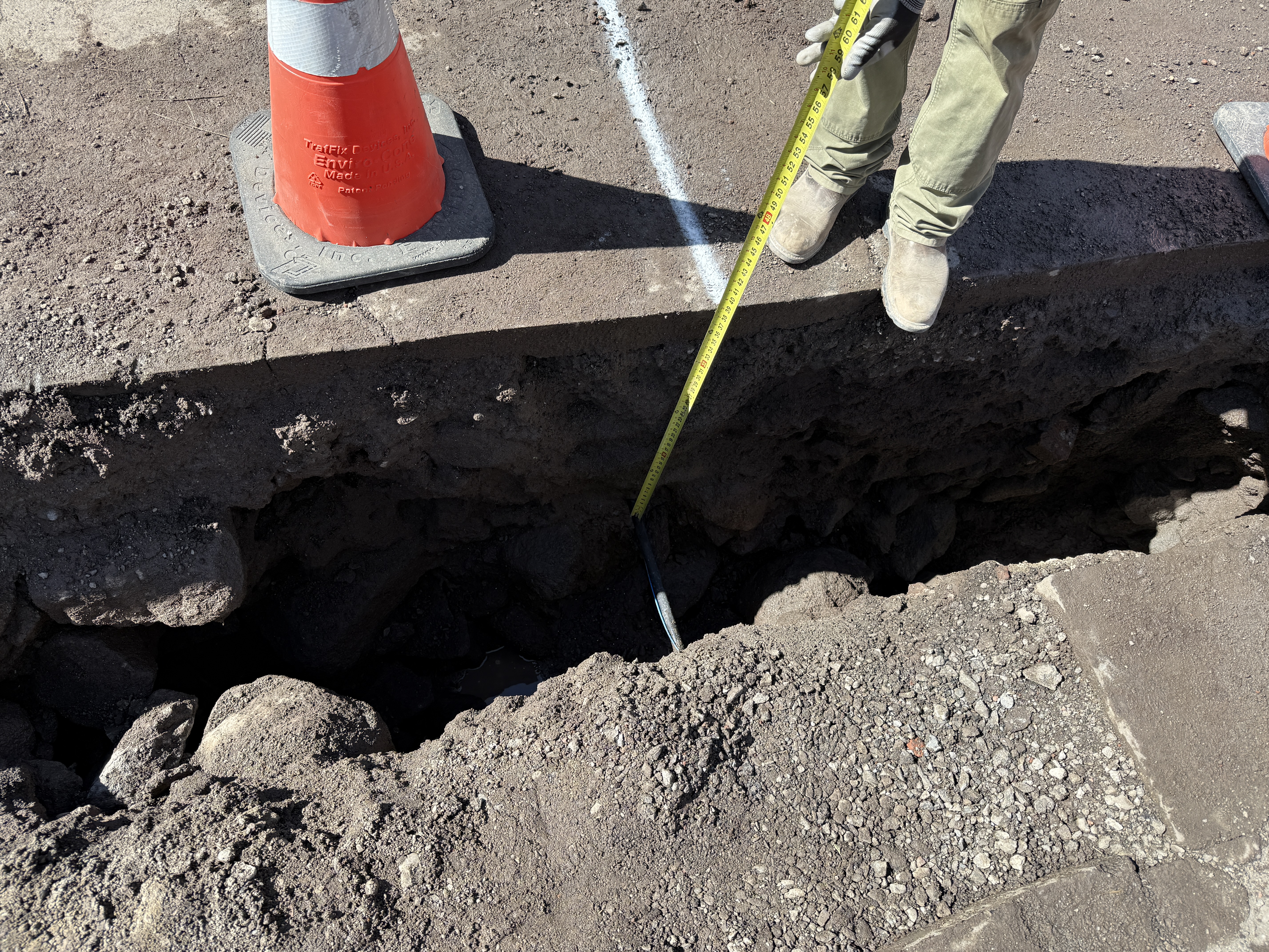
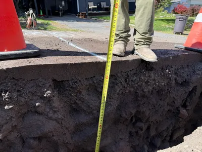
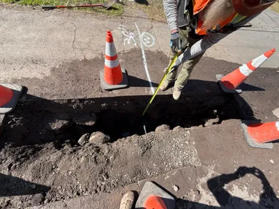
The image shows an individual standing by an open trench using a measuring tape to determine depth. A traffic cone is placed on the edge of the trench. The ground surface consists of dirt and rocks, and there are no installed components or machinery visible. The activity appears to be part of utility locating efforts.
trenching
dirt and rocks bright lighting, likely sunny clear access around trench
A traffic cone is visible for safety. Open trench may pose hazard if not clearly marked.
Equipment & Materials
AI Tags
Analyzed Apr 21, 2026
Nearby Photos
trenching
utility-locatingdepth-measurement
measuring-tape
1m
other
sidingwindows
1m
excavation
pothole-utility-locatingmeasurement-taking
measuring-tape
2m
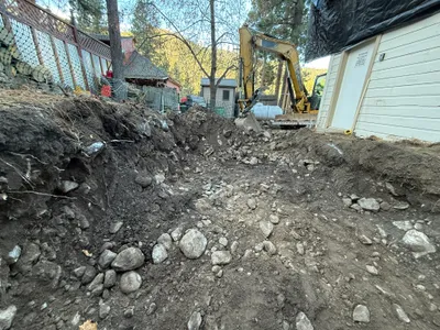
excavation
excavationtrenching
excavator
3m
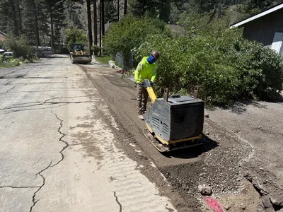
paving surface restoration
compactionroad-repair
plate-compactor
3m
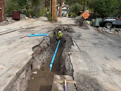
pipeline installation
trenchingpipe-laying
off-road vehicle
4m
pipeline installation
trenchingpipeline-installation
bulldozer
4m
trenching
trenchingexcavation
compact track loader
4m
trenching
diggingmanual-excavation
shovel
4m
trenching
trenchingduct-bank-installation
construction truck