
No caption
IMG_7918.JPG
Details
Tuesday, May 20, 2025 · 3:05 PM
39.39474, -120.02120· 1652m
Location Context
1 / 5
USGS Topo
No elevation data
FEMA Flood
No flood data
OSM Infra
No address data
USDA Soil
No soil data
USGS Hydro
No hydro data
Apple iPhone 16 Pro
iPhone 16 Pro back triple camera 6.765mm f/1.78
6.764999865652793mmf/1.7799999713880651/1522sISO 80
Flash did not fire, compulsory flash mode
Show all EXIF (43 fields)
ApertureValue1.6638
BrightnessValue8.2195
ColorSpace65535
CompositeImageGeneral Composite Image
ExifImageHeight4284
ExifVersion2.3.2
ExposureCompensation0
ExposureModeAuto
ExposureProgramNormal program
FlashpixVersion1.0
FocalLengthIn35mmFormat24
GPSDateStamp2025:05:20
GPSDestBearing77.1784
GPSDestBearingRefTrue North
GPSHPositioningError5.3701
GPSImgDirection77.1784
GPSImgDirectionRefT
GPSSpeed0.2906
GPSSpeedRefK
GPSTimeStamp22:5:35
HostComputeriPhone 16 Pro
latitude39.3947
LensInfo2.2200, 15.6600, 1.7800, 2.8000
LensMakeApple
longitude-120.0212
MeteringModePattern
ModifyDate2025-05-20T15:05:36.000Z
OffsetTime-07:00
OffsetTimeDigitized-07:00
OffsetTimeOriginal-07:00
ResolutionUnitinches
SceneCaptureTypeStandard
SceneTypeDirectly photographed
SensingMethodOne-chip color area sensor
ShutterSpeedValue10.5718
Software18.5
SubjectArea{"0":2851,"1":2137,"2":3141,"3":1884}
SubSecTimeDigitized478
SubSecTimeOriginal478
WhiteBalanceAuto
XResolution72
YCbCrPositioning1
YResolution72
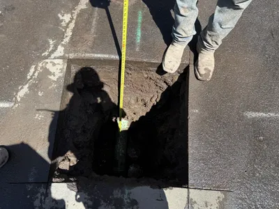
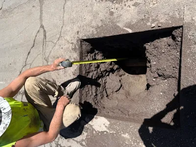
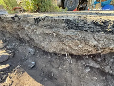
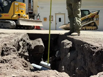
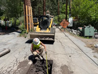
AI Analysis
The image shows a rectangular pothole in pavement with a measuring tape being used to measure its depth. A person in work boots is standing by the edge. A utility component is partially visible within the hole, surrounded by soil. The activity indicates potholing for utility locating. Shadows suggest sunlight exposure.
excavation
pavement with pothole sunlit conditions evident from shadows open access around pothole
Work boots are visible; no other safety controls are visible in frame.
Equipment & Materials
AI Tags
Analyzed Apr 21, 2026
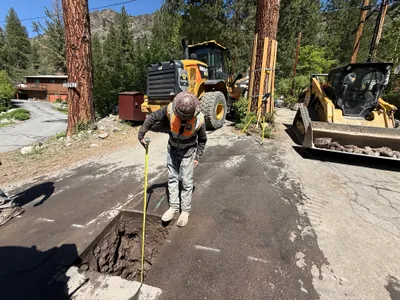
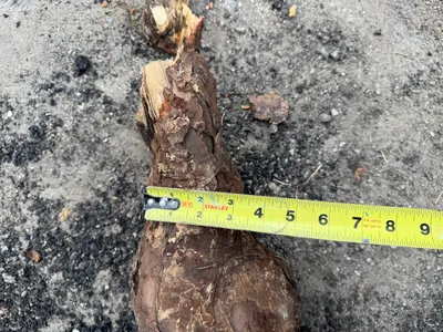
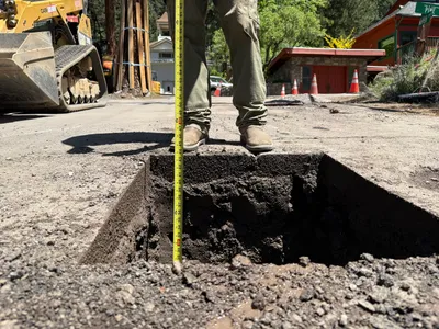
Nearby Photos
excavation
pothole-measurementpothole
backhoe-loader
1m
other
measurementmeasuring-tape
measuring-tape
2m
excavation
pothole-utility-locatingdepth-measurement
tracked machinery
2m
excavation
excavationsite-preparation
concrete-wall
2m
excavation
pothole-measuringutility-locating
tape-measure
2m
trenching
trenchingexcavation
excavator bucket
2m
pipeline installation
conduit-installationtrenching
excavator
3m
trenching
trenchingexcavation
visible vehicle
3m
trenching
trench-creationutility-locating
John Deere excavator
3m
other
pothole-utility-locatingpothole
skid-steer loader