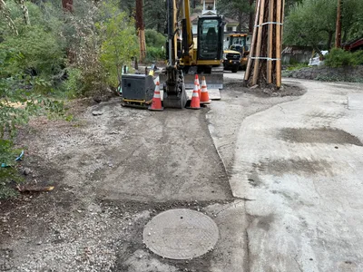
IMG_9424.JPG

No caption

IMG_9424.JPG

Tags

Details

Thursday, August 14, 2025 · 10:23 AM

39.39476, -120.02119· 1655m

Location Context

1 / 5

USGS Topo

No elevation data

FEMA Flood

No flood data

OSM Infra

No address data

USDA Soil

No soil data

USGS Hydro

No hydro data

Apple iPhone 16 Pro
iPhone 16 Pro back triple camera 2.22mm f/2.2
2.220000028611935mmf/2.21/99sISO 160
Flash did not fire, compulsory flash mode
Show all EXIF (43 fields)
ApertureValue2.2750
BrightnessValue4.0675
ColorSpace65535
CompositeImageGeneral Composite Image
ExifImageHeight3024
ExifVersion2.3.2
ExposureCompensation0
ExposureModeAuto
ExposureProgramNormal program
FlashpixVersion1.0
FocalLengthIn35mmFormat14
GPSDateStamp2025:08:14
GPSDestBearing161.0114
GPSDestBearingRefTrue North
GPSHPositioningError5.5839
GPSImgDirection161.0114
GPSImgDirectionRefT
GPSSpeed0.1283
GPSSpeedRefK
GPSTimeStamp17:23:31
HostComputeriPhone 16 Pro
latitude39.3948
LensInfo2.2200, 15.6600, 1.7800, 2.8000
LensMakeApple
longitude-120.0212
MeteringModePattern
ModifyDate2025-08-14T10:23:32.000Z
OffsetTime-07:00
OffsetTimeDigitized-07:00
OffsetTimeOriginal-07:00
ResolutionUnitinches
SceneCaptureTypeStandard
SceneTypeDirectly photographed
SensingMethodOne-chip color area sensor
ShutterSpeedValue6.6325
Software18.6
SubjectArea{"0":2000,"1":1511,"2":2217,"3":1330}
SubSecTimeDigitized573
SubSecTimeOriginal573
WhiteBalanceAuto
XResolution72
YCbCrPositioning1
YResolution72

AI Analysis

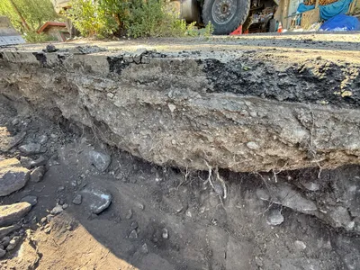
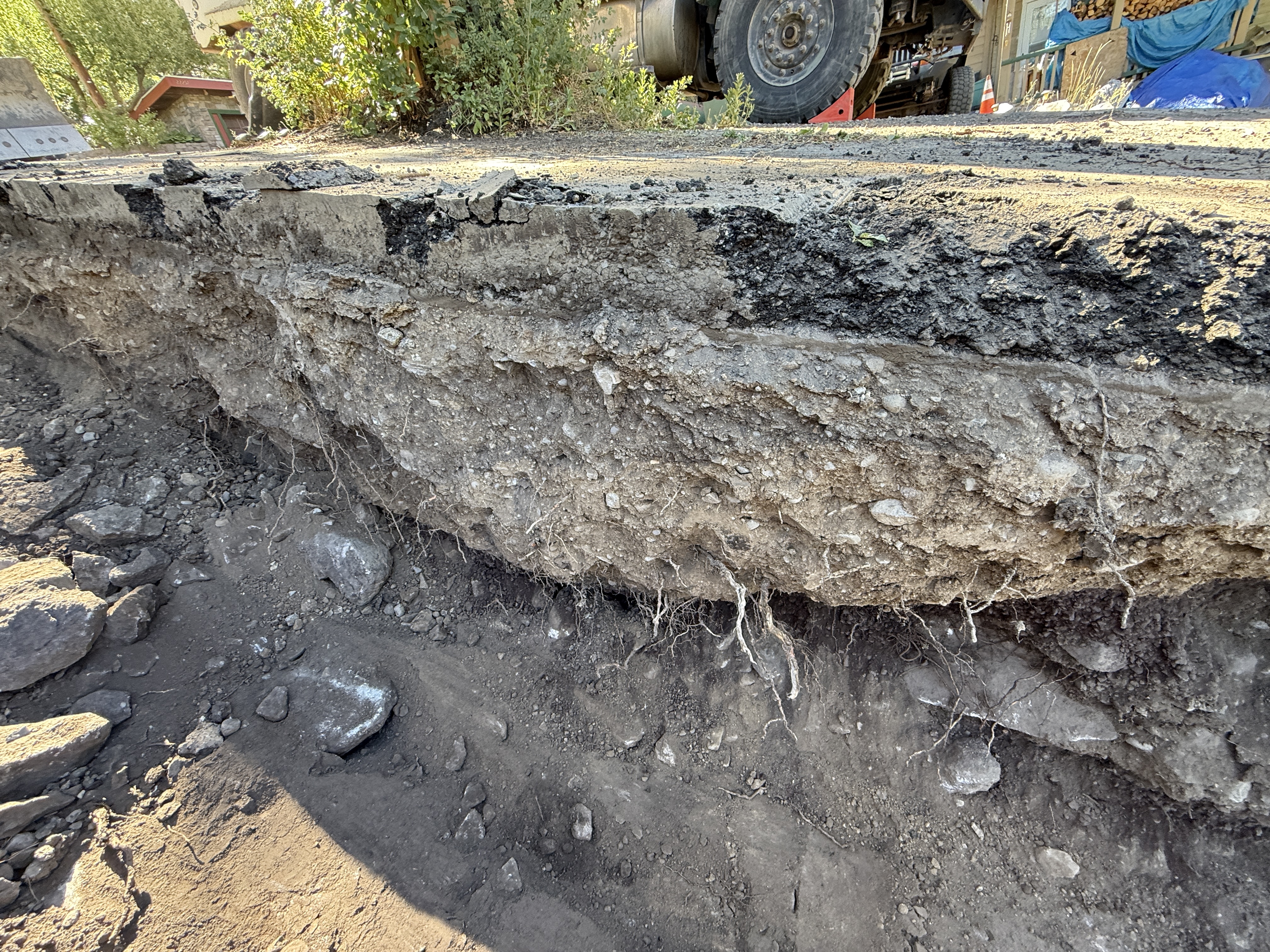
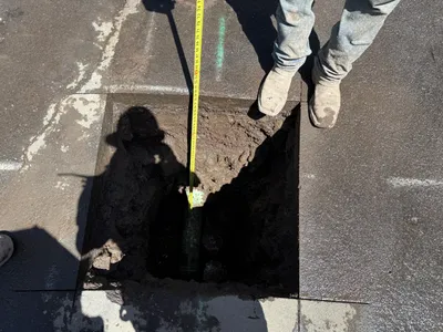
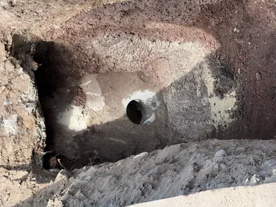
The image captures a trench section with distinct soil layers and an upper asphalt layer. Vegetation and large rocks are visible alongside the trench, suggesting recent excavation work. A vehicle wheel is visible in the background, indicating nearby construction activity. The trench depth exposes different soil compositions, and roots are hanging from the disturbed earth.

trenching
soil layers and asphalt with exposed trench outdoor daylight conditions access appears open around the trench
Safety features are not visible in frame.

Equipment & Materials

Analyzed Apr 21, 2026
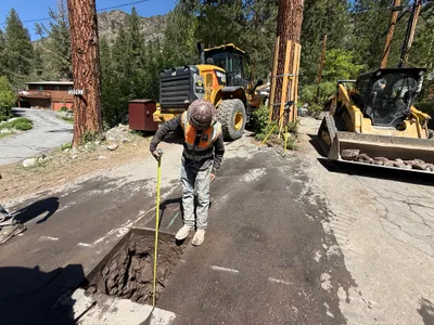
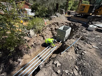