No caption
IMG_7846 2.JPG
Details
Monday, May 19, 2025 · 10:46 AM
39.39464, -120.02100· 1655m
Location Context
1 / 5
USGS Topo
No elevation data
FEMA Flood
No flood data
OSM Infra
No address data
USDA Soil
No soil data
USGS Hydro
No hydro data
Apple iPhone 16 Pro
iPhone 16 Pro back triple camera 6.765mm f/1.78
6.764999865652793mmf/1.7799999713880651/137sISO 125
Flash did not fire, compulsory flash mode
Show all EXIF (43 fields)
ApertureValue1.6638
BrightnessValue4.1686
ColorSpace65535
CompositeImageGeneral Composite Image
ExifImageHeight4284
ExifVersion2.3.2
ExposureCompensation0
ExposureModeAuto
ExposureProgramNormal program
FlashpixVersion1.0
FocalLengthIn35mmFormat24
GPSDateStamp2025:05:19
GPSDestBearing255.3757
GPSDestBearingRefTrue North
GPSHPositioningError7.8119
GPSImgDirection255.3757
GPSImgDirectionRefT
GPSSpeed2.3453
GPSSpeedRefK
GPSTimeStamp17:46:29
HostComputeriPhone 16 Pro
latitude39.3946
LensInfo2.2200, 15.6600, 1.7800, 2.8000
LensMakeApple
longitude-120.0210
MeteringModePattern
ModifyDate2025-05-19T10:46:31.000Z
OffsetTime-07:00
OffsetTimeDigitized-07:00
OffsetTimeOriginal-07:00
ResolutionUnitinches
SceneCaptureTypeStandard
SceneTypeDirectly photographed
SensingMethodOne-chip color area sensor
ShutterSpeedValue7.1005
Software18.5
SubjectArea{"0":2851,"1":2137,"2":3141,"3":1884}
SubSecTimeDigitized081
SubSecTimeOriginal081
WhiteBalanceAuto
XResolution72
YCbCrPositioning1
YResolution72
AI Analysis
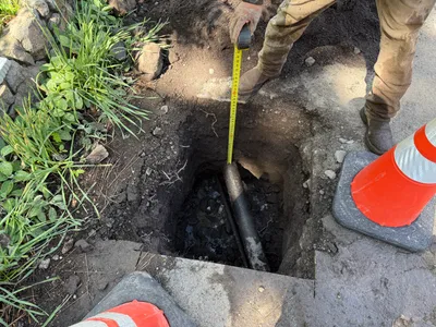
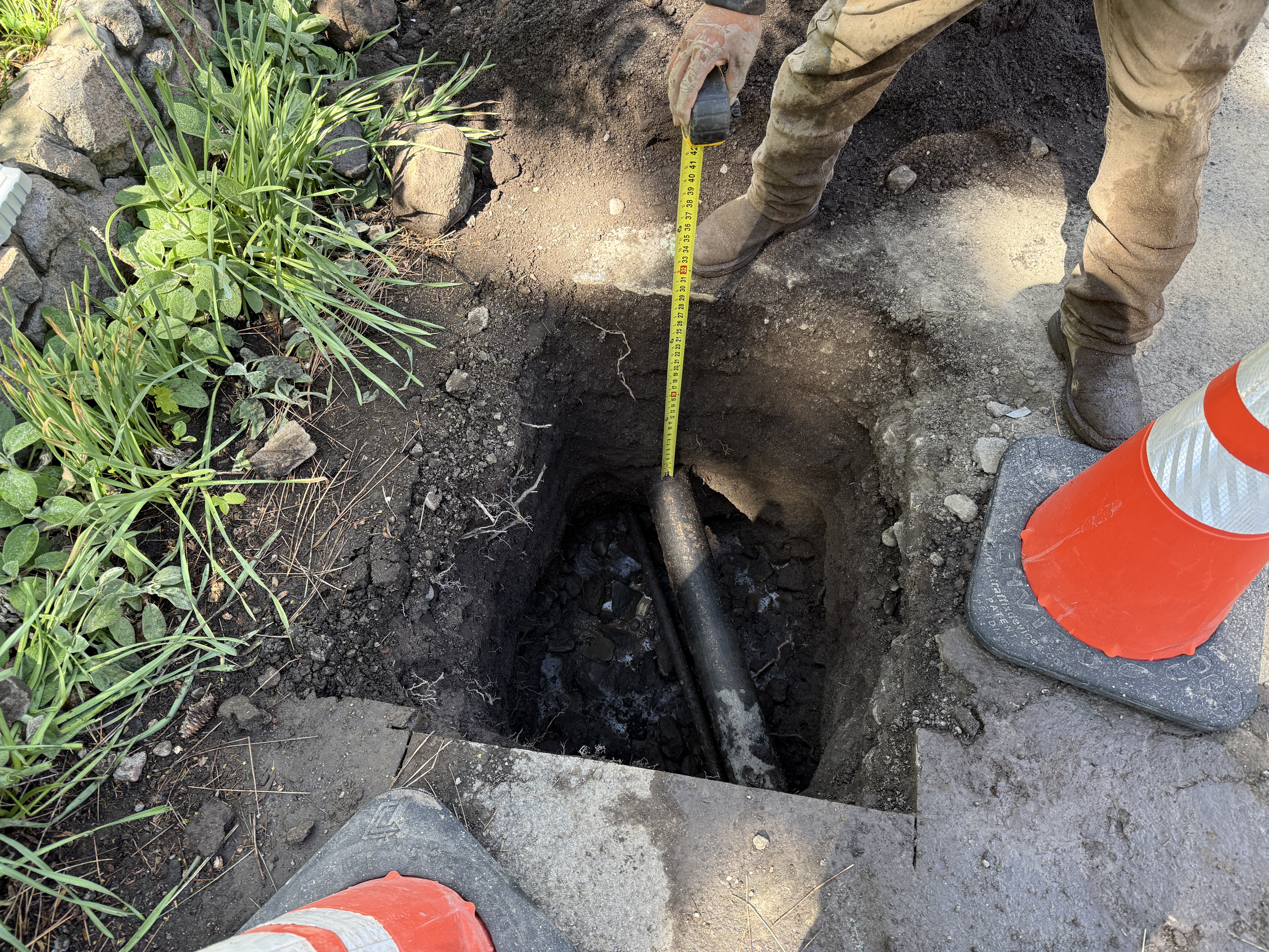
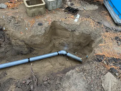
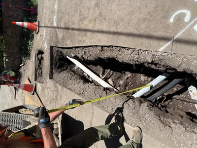
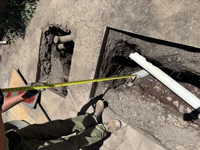
The image shows a person measuring the depth of a hole with a tape measure. A pipe is partially exposed inside the hole. Two safety cones are positioned at the corners of the area, indicating an ongoing pothole utility locating activity. The surrounding ground is composed of soil and some vegetation close to the hole.
excavation
soil and adjacent vegetation clear daylight conditions limited access around excavation area due to cones
Safety cones are positioned as a control measure, and an open trench presents a hazard.
Equipment & Materials
AI Tags
Analyzed Apr 21, 2026
Nearby Photos
1m
trenching
trenchingutility-locating
skid-steer
2m
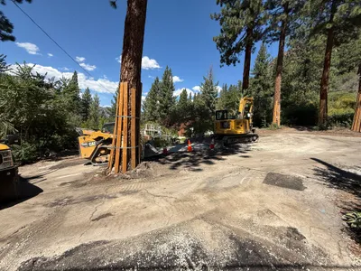
excavation
excavationconcrete-removal
excavator
2m
trenching
pipeline-installationtrenching
pvc-pipe
2m
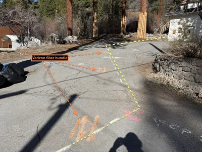
survey layout
survey-markingutility-alignment
3m
trenching
pothole-utility-locatingmeasurement
tape-measure
3m
excavation
excavationsite-work
mini excavator
3m
pothole utility locating
pothole-utility-locatingdepth-measurement
tape-measure
3m
trenching
trenchingpipe-exposure
excavator
3m
survey layout
utility-markingsurvey-marking
water-valve
3m
trenching
trenchingexposed-pipes
pipes