No caption
IMG_6729.JPG
Details
Thursday, March 20, 2025 · 4:03 PM
39.39465, -120.02102· 1657m
Location Context
1 / 5
USGS Topo
No elevation data
FEMA Flood
No flood data
OSM Infra
No address data
USDA Soil
No soil data
USGS Hydro
No hydro data
Apple iPhone 16 Pro
iPhone 16 Pro back triple camera 6.765mm f/1.78
6.764999865652793mmf/1.7799999713880651/4975sISO 80
Flash did not fire, compulsory flash mode
Show all EXIF (43 fields)
ApertureValue1.6638
BrightnessValue9.9928
ColorSpace65535
CompositeImageGeneral Composite Image
ExifImageHeight4284
ExifVersion2.3.2
ExposureCompensation0
ExposureModeAuto
ExposureProgramNormal program
FlashpixVersion1.0
FocalLengthIn35mmFormat24
GPSDateStamp2025:03:20
GPSDestBearing47.0006
GPSDestBearingRefTrue North
GPSHPositioningError4.0492
GPSImgDirection47.0006
GPSImgDirectionRefT
GPSSpeed0.3407
GPSSpeedRefK
GPSTimeStamp23:2:59
HostComputeriPhone 16 Pro
latitude39.3947
LensInfo2.2200, 15.6600, 1.7800, 2.8000
LensMakeApple
longitude-120.0210
MeteringModePattern
ModifyDate2025-03-20T16:03:00.000Z
OffsetTime-07:00
OffsetTimeDigitized-07:00
OffsetTimeOriginal-07:00
ResolutionUnitinches
SceneCaptureTypeStandard
SceneTypeDirectly photographed
SensingMethodOne-chip color area sensor
ShutterSpeedValue12.2805
Software18.4
SubjectArea{"0":2851,"1":2137,"2":3141,"3":1884}
SubSecTimeDigitized997
SubSecTimeOriginal997
WhiteBalanceAuto
XResolution72
YCbCrPositioning1
YResolution72
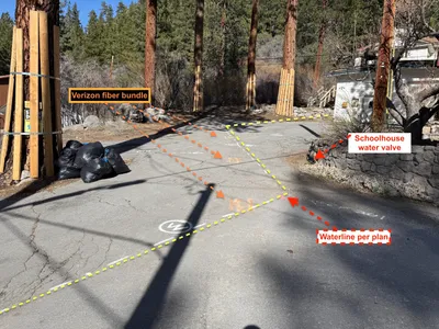
AI Analysis
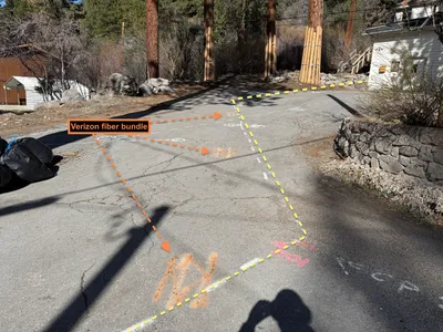
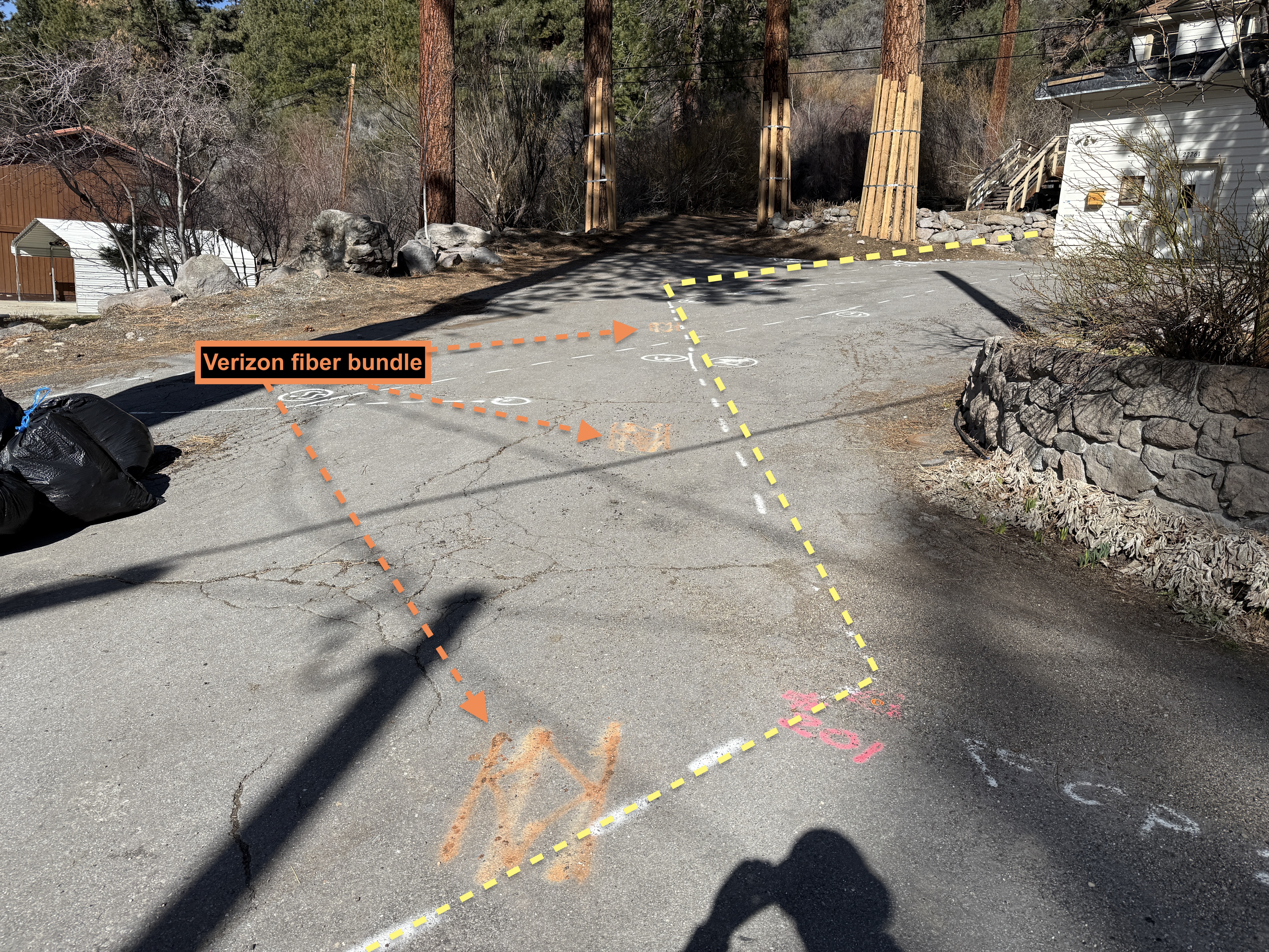
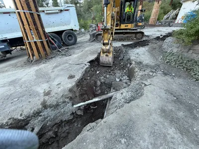
The image shows a paved surface with colored markings indicating alignment paths. Orange spray paint notes a 'Verizon fiber bundle', while other markings suggest waterline alignments. A shadow is visible on the pavement, and a stone wall runs along the right side.
survey-layout
paved sunny, clear shadow visible access appears open, no visible congestion
Safety features are not visible in frame.
AI Tags
Analyzed Apr 21, 2026
Nearby Photos
1m
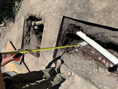
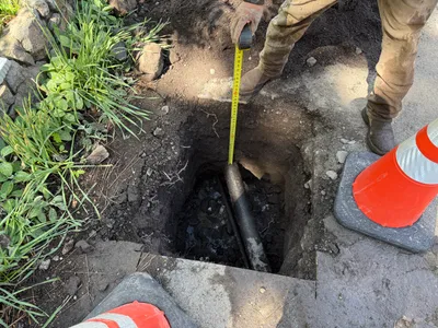
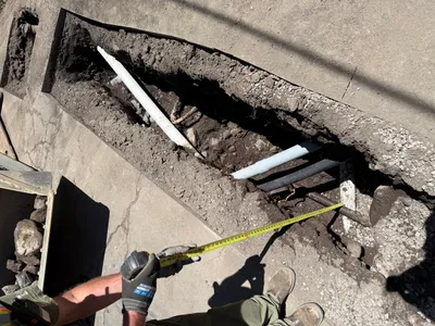
pothole utility locating
pothole-utility-locatingdepth-measurement
tape-measure
1m
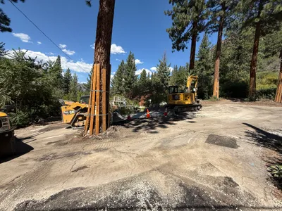
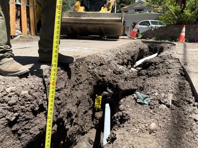
excavation
excavationsite-work
mini excavator
2m
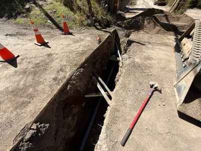
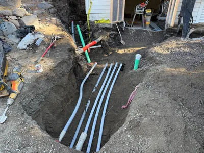
trenching
trenchingexcavation-work
excavator
2m
excavation
trenchingexcavation-safety
shovel
2m
excavation
utility-locatingpotholing
tape-measure
2m
trenching
trenchingpipeline-installation
excavator
2m
trenching
measuring-depthpothole-utility-locating
measuring-tape
2m
trenching
trenchingdepth-measurement
excavator
2m
trenching
trenchingduct-bank-installation
drill
2m
survey layout
utility-markingsurvey-marking
water-valve