No caption
IMG_8729.JPG
Details
Thursday, July 10, 2025 · 11:17 AM
39.39188, -120.02215· 1646m
Location Context
1 / 5
USGS Topo
No elevation data
FEMA Flood
No flood data
OSM Infra
No address data
USDA Soil
No soil data
USGS Hydro
No hydro data
Apple iPhone 16 Pro
iPhone 16 Pro back triple camera 2.22mm f/2.2
2.220000028611935mmf/2.21/1534sISO 50
Flash did not fire, compulsory flash mode
Show all EXIF (43 fields)
ApertureValue2.2750
BrightnessValue9.1334
ColorSpace65535
CompositeImageGeneral Composite Image
ExifImageHeight3024
ExifVersion2.3.2
ExposureCompensation0
ExposureModeAuto
ExposureProgramNormal program
FlashpixVersion1.0
FocalLengthIn35mmFormat14
GPSDateStamp2025:07:10
GPSDestBearing325.8044
GPSDestBearingRefTrue North
GPSHPositioningError3.0222
GPSImgDirection325.8044
GPSImgDirectionRefT
GPSSpeed0
GPSSpeedRefK
GPSTimeStamp18:17:47
HostComputeriPhone 16 Pro
latitude39.3919
LensInfo2.2200, 15.6600, 1.7800, 2.8000
LensMakeApple
longitude-120.0221
MeteringModePattern
ModifyDate2025-07-10T11:17:47.000Z
OffsetTime-07:00
OffsetTimeDigitized-07:00
OffsetTimeOriginal-07:00
ResolutionUnitinches
SceneCaptureTypeStandard
SceneTypeDirectly photographed
SensingMethodOne-chip color area sensor
ShutterSpeedValue10.5828
Software18.5
SubjectArea{"0":2000,"1":1511,"2":2217,"3":1330}
SubSecTimeDigitized875
SubSecTimeOriginal875
WhiteBalanceAuto
XResolution72
YCbCrPositioning1
YResolution72
AI Analysis
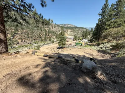
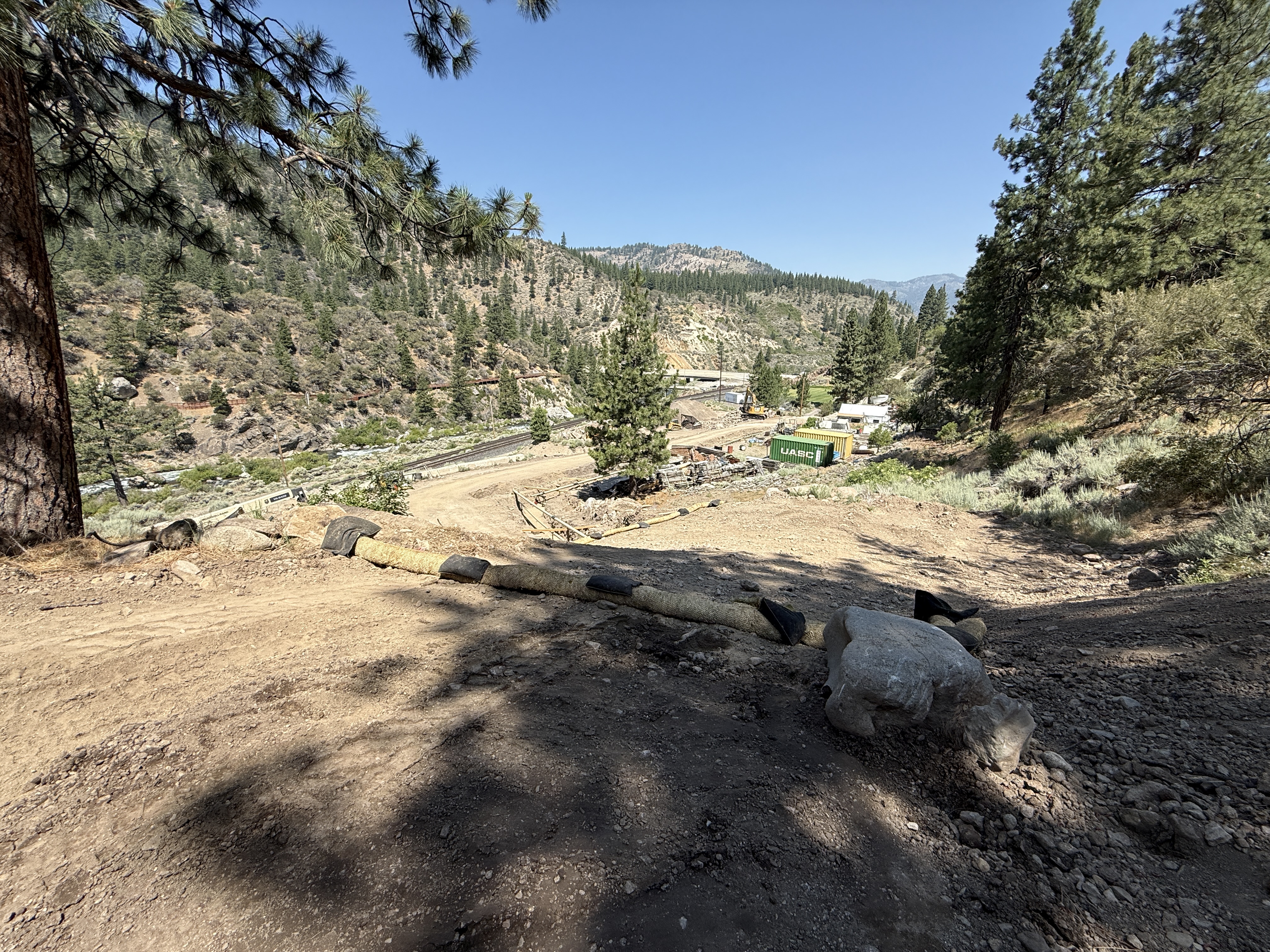
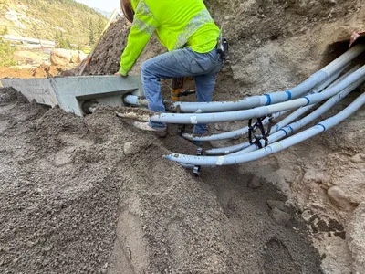
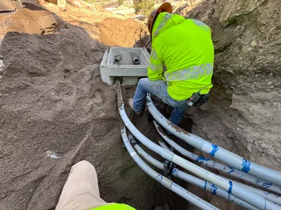
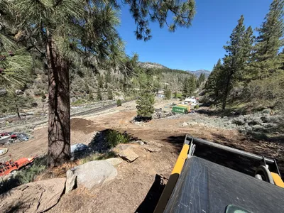
The photograph shows an area with erosion control measures in place, including straw wattles and silt fencing along a dirt path or slope. Several trees and vegetation surround the site, providing a natural backdrop. In the background, a container and structures are visible at the edge of the work area.
swppp-erosion-control
dirt slope with erosion control measures clear sunny day with shadows open access along the dirt path
No specific safety features are visible in frame.
Equipment & Materials
Analyzed Apr 21, 2026
Nearby Photos
1m
excavation
excavationsoil-removal
power tool
1m
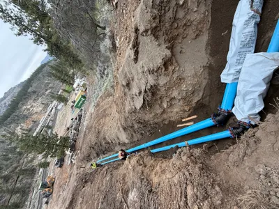
pipeline installation
duct-bank-installationconcrete-form-handling
excavator
1m
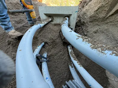
pipeline installation
conduit-installationduct-bank-work
hand tool
1m
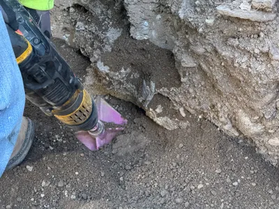
trenching
conduit-installationtrenching
power-drill
2m
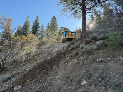
excavation
excavationsoil
excavator
3m
pipeline installation
conduit-installationjunction-box-connection
soil
3m
site grading
site-clearingslope-preparation
construction equipment with visible roof
3m
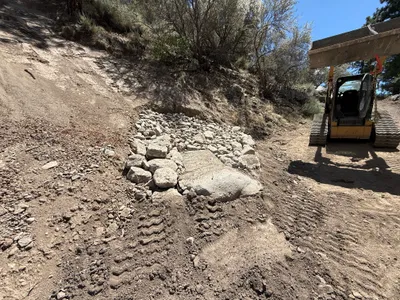
swppp erosion control
erosion-controlrock-placement
track-based construction machinery
3m
pipeline installation
pipe-layingtrenching-work
front-loader
3m
other
drillingsurface-excavation
drill