
No caption
IMG_0618.JPG
Details
Thursday, October 2, 2025 · 8:44 AM
39.39694, -120.02012· 1691m
Location Context
1 / 5
USGS Topo
No elevation data
FEMA Flood
No flood data
OSM Infra
No address data
USDA Soil
No soil data
USGS Hydro
No hydro data
Apple iPhone 16 Pro
iPhone 16 Pro back triple camera 2.22mm f/2.2
2.220000028611935mmf/2.21/165sISO 50
Flash did not fire, compulsory flash mode
Show all EXIF (43 fields)
ApertureValue2.2750
BrightnessValue6.3154
ColorSpace65535
CompositeImageGeneral Composite Image
ExifImageHeight3024
ExifVersion2.3.2
ExposureCompensation0
ExposureModeAuto
ExposureProgramNormal program
FlashpixVersion1.0
FocalLengthIn35mmFormat14
GPSDateStamp2025:10:02
GPSDestBearing29.3302
GPSDestBearingRefTrue North
GPSHPositioningError8.1274
GPSImgDirection29.3302
GPSImgDirectionRefT
GPSSpeed0.2032
GPSSpeedRefK
GPSTimeStamp15:44:31
HostComputeriPhone 16 Pro
latitude39.3969
LensInfo2.2200, 15.6600, 1.7800, 2.8000
LensMakeApple
longitude-120.0201
MeteringModePattern
ModifyDate2025-10-02T08:44:32.000Z
OffsetTime-07:00
OffsetTimeDigitized-07:00
OffsetTimeOriginal-07:00
ResolutionUnitinches
SceneCaptureTypeStandard
SceneTypeDirectly photographed
SensingMethodOne-chip color area sensor
ShutterSpeedValue7.3646
Software26.0
SubjectArea{"0":2002,"1":1511,"2":2218,"3":1328}
SubSecTimeDigitized074
SubSecTimeOriginal074
WhiteBalanceAuto
XResolution72
YCbCrPositioning1
YResolution72
AI Analysis
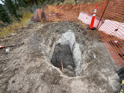
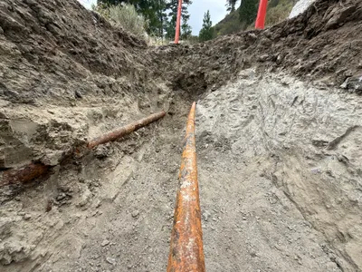
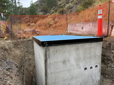
The image shows an excavation for a raw water tank area, with a trench and visible pipes. An orange safety fence surrounds the trench, and a traffic cone is positioned nearby. Gravel is visible at the bottom of the trench, suggesting preparation for further work. The surrounding area is uneven with dirt, indicating ongoing excavation work.
excavation
soil and dirt with trench clear outdoor conditions limited access due to fencing
Safety features include an orange fence and a traffic cone around the open trench.
AI Tags
Analyzed Apr 21, 2026
Nearby Photos
1m
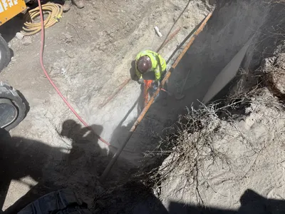
trenching
trenchingjackhammer-operation
jackhammer
1m
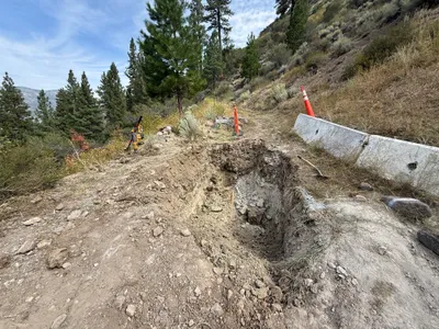
excavation
excavationtrenching
compactor
1m
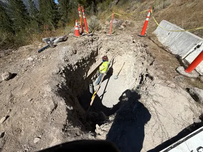
trenching
pipe-installationtrenching
shovel
1m
trenching
trenchingexcavation
soil

2m
trenching
trenchingpipe-exposure
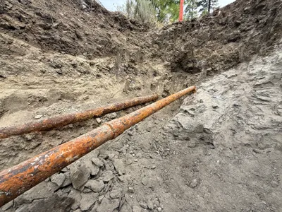
rusted pipes
2m
excavation
excavationsite-prep
shovel
4m
swppp erosion control
gradingembankment-stabilization
compact-track-loader
4m
trenching
trenchingexcavation
concrete
4m
other
excavationstructure-placement
concrete-structure
4m
excavation
trenchingpipe-exposure
rusty metal pipes