
No caption
IMG_0283.JPG
Details
Thursday, September 18, 2025 · 3:33 PM
39.39695, -120.02012· 1691m
Location Context
1 / 5
USGS Topo
No elevation data
FEMA Flood
No flood data
OSM Infra
No address data
USDA Soil
No soil data
USGS Hydro
No hydro data
Apple iPhone 16 Pro
iPhone 16 Pro back triple camera 2.22mm f/2.2
2.220000028611935mmf/2.21/368sISO 50
Flash did not fire, compulsory flash mode
Show all EXIF (43 fields)
ApertureValue2.2750
BrightnessValue7.3849
ColorSpace65535
CompositeImageGeneral Composite Image
ExifImageHeight3024
ExifVersion2.3.2
ExposureCompensation0
ExposureModeAuto
ExposureProgramNormal program
FlashpixVersion1.0
FocalLengthIn35mmFormat14
GPSDateStamp2025:09:18
GPSDestBearing14.7921
GPSDestBearingRefTrue North
GPSHPositioningError5.3031
GPSImgDirection14.7921
GPSImgDirectionRefT
GPSSpeed0.5634
GPSSpeedRefK
GPSTimeStamp22:33:47
HostComputeriPhone 16 Pro
latitude39.3969
LensInfo2.2200, 15.6600, 1.7800, 2.8000
LensMakeApple
longitude-120.0201
MeteringModePattern
ModifyDate2025-09-18T15:33:47.000Z
OffsetTime-07:00
OffsetTimeDigitized-07:00
OffsetTimeOriginal-07:00
ResolutionUnitinches
SceneCaptureTypeStandard
SceneTypeDirectly photographed
SensingMethodOne-chip color area sensor
ShutterSpeedValue8.5222
Software26.0
SubjectArea{"0":2002,"1":1508,"2":2218,"3":1328}
SubSecTimeDigitized718
SubSecTimeOriginal718
WhiteBalanceAuto
XResolution72
YCbCrPositioning1
YResolution72
AI Analysis
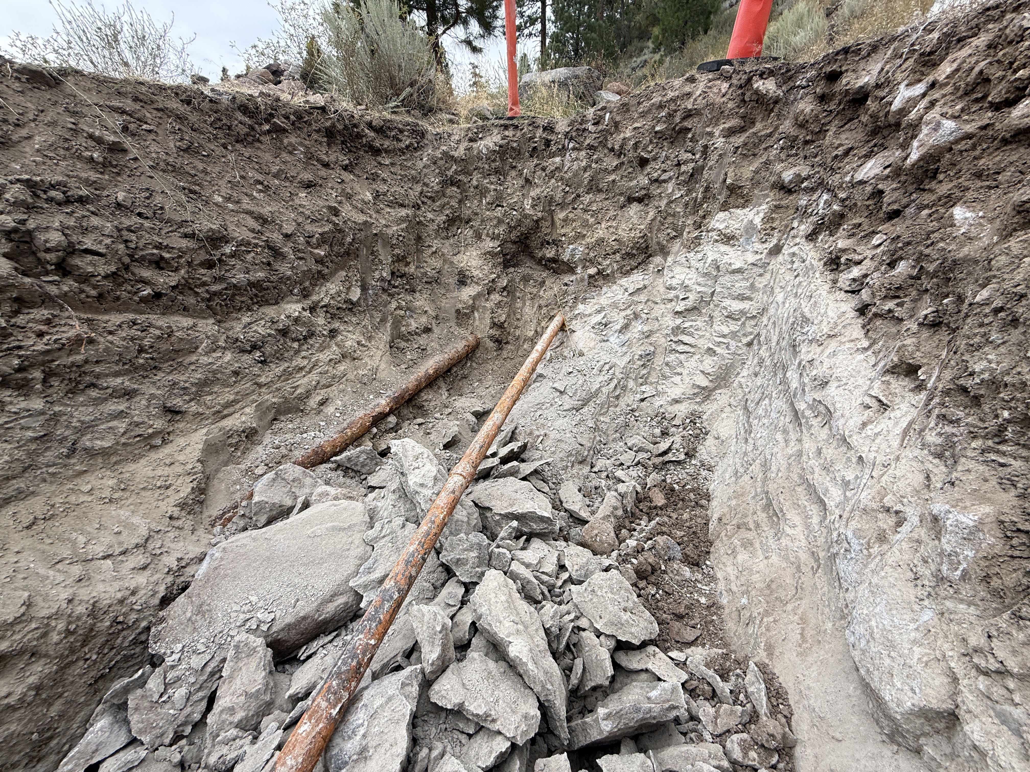
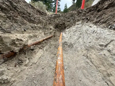
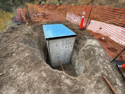
The image shows a trench with two rusted pipes laid diagonally across the floor, surrounded by disturbed soil and rock debris. The sidewalls of the trench display stratified layers of earth. Orange markers or caps are visible at the top of the trench edge, possibly indicating caution. No heavy equipment or active work is seen in this frame.
trenching
rock and soil trench overcast sky clear open trench access
Safety markers are visible, but no PPE or additional safety controls are seen in frame.
Equipment & Materials
AI Tags
Analyzed Apr 21, 2026
Nearby Photos
1m
trenching
pipe-installationtrenching
shovel
1m
excavation
excavationsite-prep
shovel
1m
trenching
trenchingjackhammer-operation
jackhammer
1m
trenching
trenchingexcavation
soil
2m
excavation
trenchingexcavation
gravel
2m
excavation
excavationtrenching
compactor
2m
other
excavationstructure-placement
concrete-structure
2m
trenching
trenchingexcavation
concrete
2m
excavation
excavationtrenching
excavator

3m
trenching
trenchingexcavation
excavator