No caption
IMG_0289.JPG
Details
Thursday, September 18, 2025 · 4:38 PM
39.39465, -120.02076· 1659m
Location Context
1 / 5
USGS Topo
No elevation data
FEMA Flood
No flood data
OSM Infra
No address data
USDA Soil
No soil data
USGS Hydro
No hydro data
Apple iPhone 16 Pro
iPhone 16 Pro back triple camera 6.765mm f/1.78
6.764999865652793mmf/1.7799999713880651/121sISO 64
Flash did not fire, compulsory flash mode
Show all EXIF (43 fields)
ApertureValue1.6638
BrightnessValue4.9428
ColorSpace65535
CompositeImageGeneral Composite Image
ExifImageHeight4284
ExifVersion2.3.2
ExposureCompensation0
ExposureModeAuto
ExposureProgramNormal program
FlashpixVersion1.0
FocalLengthIn35mmFormat24
GPSDateStamp2025:09:18
GPSDestBearing106.7838
GPSDestBearingRefTrue North
GPSHPositioningError7.7009
GPSImgDirection106.7838
GPSImgDirectionRefT
GPSSpeed0.2339
GPSSpeedRefK
GPSTimeStamp23:38:32
HostComputeriPhone 16 Pro
latitude39.3946
LensInfo2.2200, 15.6600, 1.7800, 2.8000
LensMakeApple
longitude-120.0208
MeteringModePattern
ModifyDate2025-09-18T16:38:32.000Z
OffsetTime-07:00
OffsetTimeDigitized-07:00
OffsetTimeOriginal-07:00
ResolutionUnitinches
SceneCaptureTypeStandard
SceneTypeDirectly photographed
SensingMethodOne-chip color area sensor
ShutterSpeedValue6.9235
Software26.0
SubjectArea{"0":2853,"1":2140,"2":3142,"3":1881}
SubSecTimeDigitized900
SubSecTimeOriginal900
WhiteBalanceAuto
XResolution72
YCbCrPositioning1
YResolution72
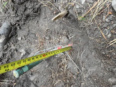
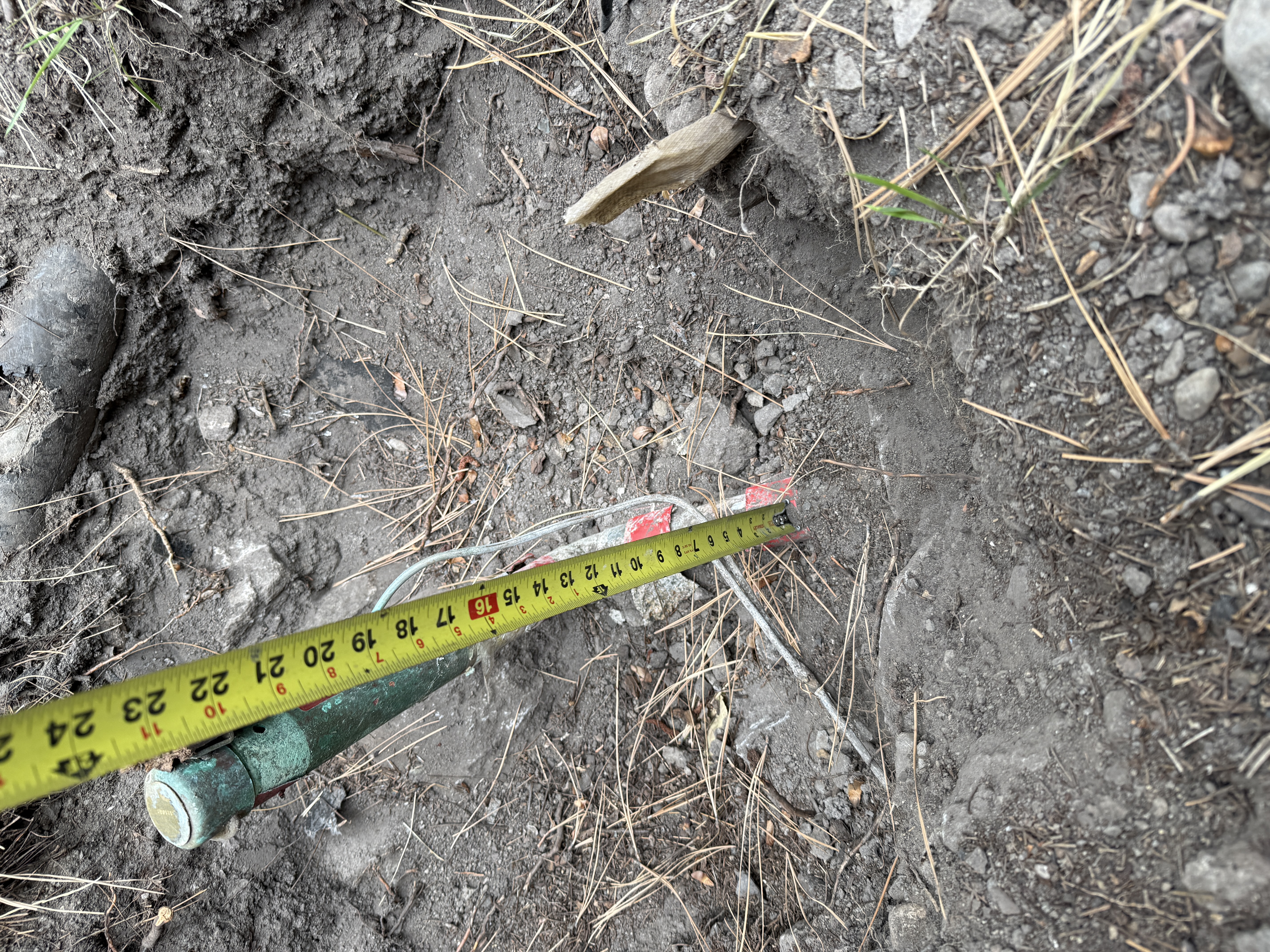
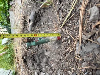
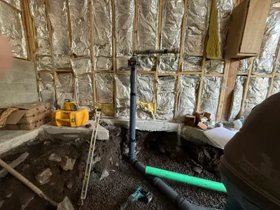
AI Analysis
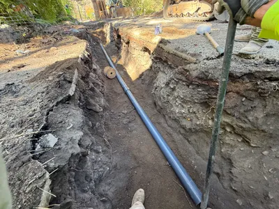
The image shows a measuring tape being used to measure a vertical distance in an area of exposed soil. A green metal pipe is partially embedded in the ground, with some wires visible nearby. The soil appears disturbed, suggesting recent excavation work. The vegetation around indicates an outdoor, possibly rural, setting.
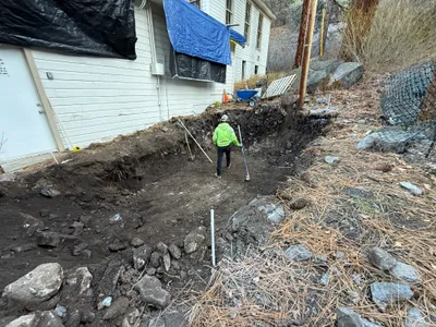
excavation
exposed soil and gravel daylight open access
Safety controls and PPE are not visible in frame.
Equipment & Materials
AI Tags
Analyzed Apr 21, 2026
Nearby Photos
1m
excavation
excavation-measurementdepth-check
measuring-tape
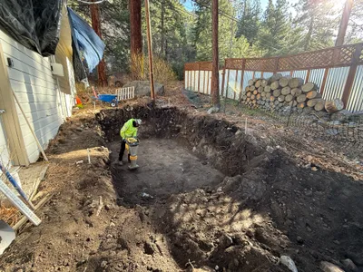
2m
trenching
trenchinginspection
measuring tool
3m
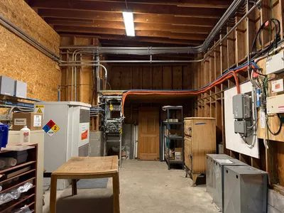
electrical
electrical-installationutility-room-setup
electrical-panel
4m
trenching
trenchingpipe-laying
earth-moving-equipment
5m
site grading
compactionsite-preparation
compaction-tool
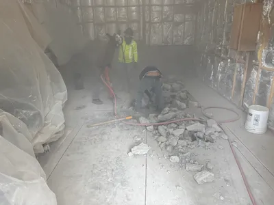
5m
demolition
floor-demolitionconcrete-breaking
jackhammer
5m
pipeline installation
pipeline-installationpipe-fitting
level
5m
trenching
trenchingexcavation
excavator
5m
site grading
soil-compactionpit-preparation
compactor
6m
other
material-stagingmarking
logs