No caption
IMG_1165.JPG
Details
Monday, October 27, 2025 · 4:55 PM
39.39331, -120.02260· 1630m
Location Context
1 / 5
USGS Topo
No elevation data
FEMA Flood
No flood data
OSM Infra
No address data
USDA Soil
No soil data
USGS Hydro
No hydro data
Apple iPhone 16 Pro
iPhone 16 Pro back triple camera 6.765mm f/1.78
6.764999865652793mmf/1.7799999713880651/141sISO 50
Flash did not fire, compulsory flash mode
Show all EXIF (43 fields)
ApertureValue1.6638
BrightnessValue5.2025
ColorSpace65535
CompositeImageGeneral Composite Image
ExifImageHeight4284
ExifVersion2.3.2
ExposureCompensation0
ExposureModeAuto
ExposureProgramNormal program
FlashpixVersion1.0
FocalLengthIn35mmFormat24
GPSDateStamp2025:10:27
GPSDestBearing177.1949
GPSDestBearingRefTrue North
GPSHPositioningError8.0261
GPSImgDirection177.1949
GPSImgDirectionRefT
GPSSpeed1.1234
GPSSpeedRefK
GPSTimeStamp23:55:47
HostComputeriPhone 16 Pro
latitude39.3933
LensInfo2.2200, 15.6600, 1.7800, 2.8000
LensMakeApple
longitude-120.0226
MeteringModePattern
ModifyDate2025-10-27T16:55:47.000Z
OffsetTime-07:00
OffsetTimeDigitized-07:00
OffsetTimeOriginal-07:00
ResolutionUnitinches
SceneCaptureTypeStandard
SceneTypeDirectly photographed
SensingMethodOne-chip color area sensor
ShutterSpeedValue7.1396
Software26.0.1
SubjectArea{"0":2853,"1":2140,"2":3142,"3":1881}
SubSecTimeDigitized680
SubSecTimeOriginal680
WhiteBalanceAuto
XResolution72
YCbCrPositioning1
YResolution72
AI Analysis
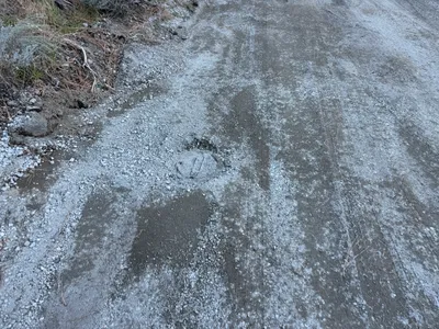
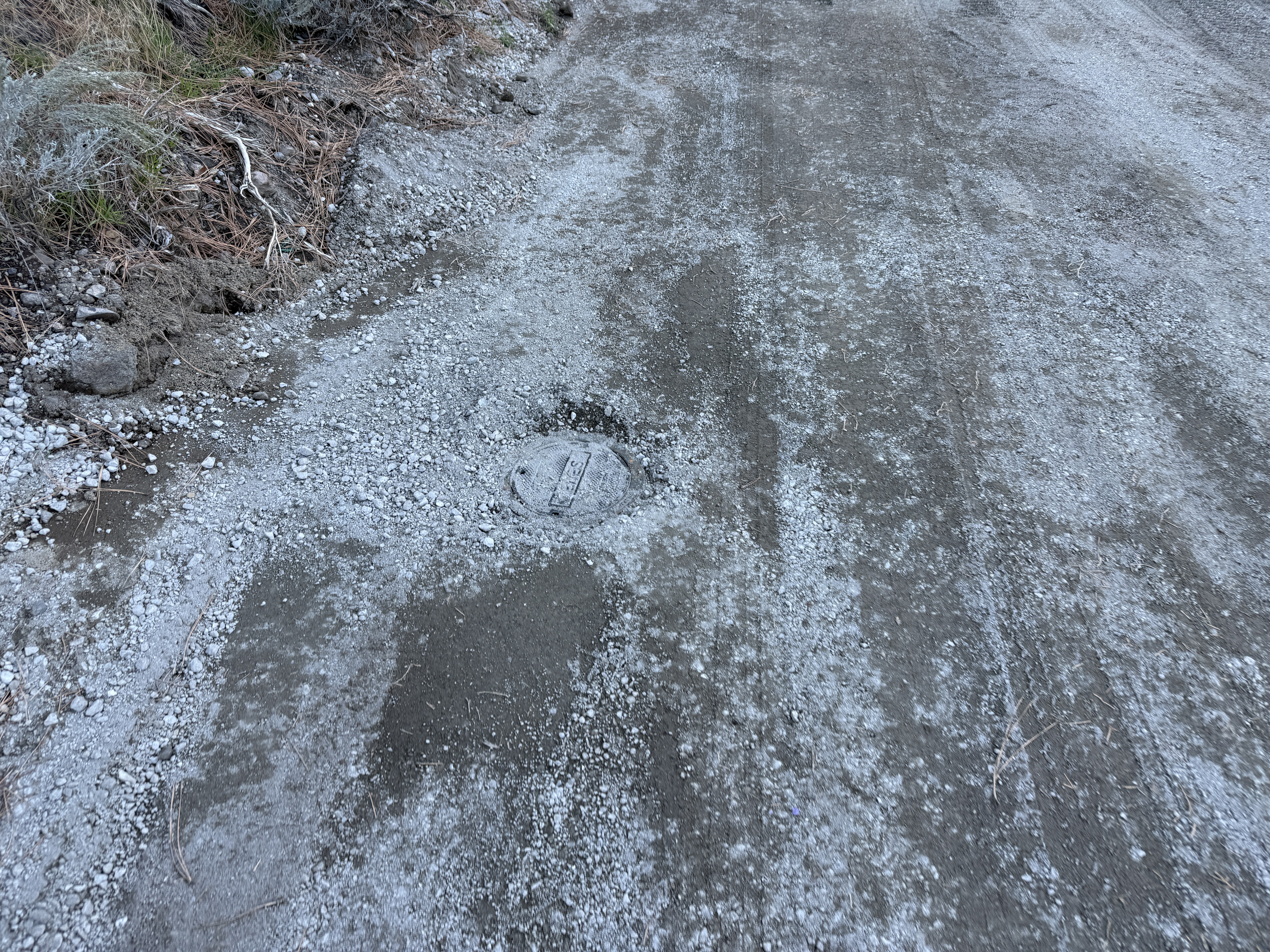
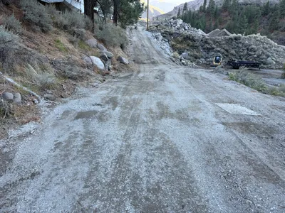
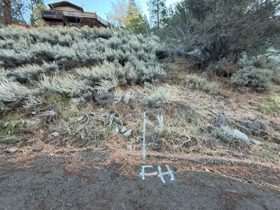
The image displays a dirt road with scattered gravel and a circular utility access cover embedded in the ground. The access cover is positioned towards the left side of the road. There is no visible construction equipment, active work, or personnel. The area appears to be part of a fire hydrant work zone as indicated by the work area tag.
site-grading
gravel and dirt road natural lighting unobstructed dirt road
No safety features are visible in frame.
Equipment & Materials
Analyzed Apr 21, 2026
Nearby Photos
1m
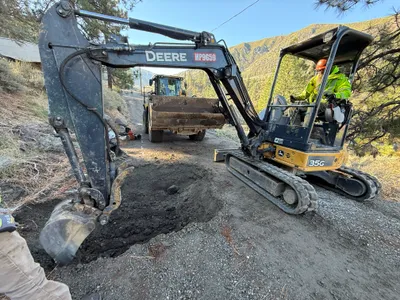
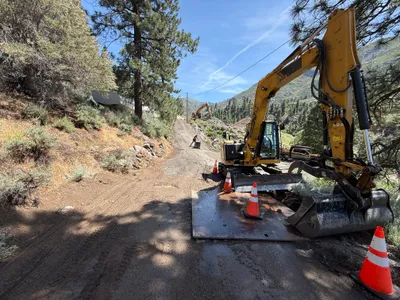
excavation
excavationtrenching
excavator
2m
site grading
site-gradingearth-moving
front loader
3m
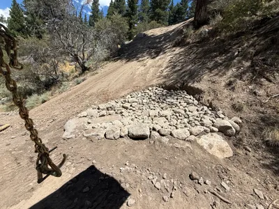
swppp erosion control
riprap-installationerosion-control
rocks
3m
excavation
excavationearthmoving
mini-excavator
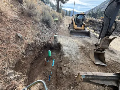
4m
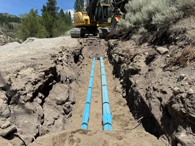
trenching
trenchingpipes
excavator
4m
site grading
site-gradingearth-moving
compact excavator
5m
survey layout
location-markingsurvey-layout
5m
excavation
excavationroadwork
excavator
6m
other
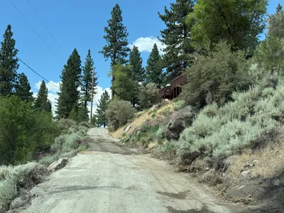
gravel-roadvegetation
6m
trenching
trenchingpipe-laying
excavator