
No caption
IMG_9095.JPG
Details
Friday, August 1, 2025 · 1:20 PM
39.39420, -120.02277· 1640m
Location Context
1 / 5
USGS Topo
No elevation data
FEMA Flood
No flood data
OSM Infra
No address data
USDA Soil
No soil data
USGS Hydro
No hydro data
Apple iPhone 16 Pro
iPhone 16 Pro back triple camera 6.765mm f/1.78
6.764999865652793mmf/1.7799999713880651/607sISO 100
Flash did not fire, compulsory flash mode
Show all EXIF (44 fields)
ApertureValue1.6638
BrightnessValue6.2228
ColorSpace65535
CompositeImageGeneral Composite Image
DigitalZoomRatio1.0014
ExifImageHeight4284
ExifVersion2.3.2
ExposureCompensation0
ExposureModeAuto
ExposureProgramNormal program
FlashpixVersion1.0
FocalLengthIn35mmFormat24
GPSDateStamp2025:08:01
GPSDestBearing301.9809
GPSDestBearingRefTrue North
GPSHPositioningError12.3948
GPSImgDirection301.9809
GPSImgDirectionRefT
GPSSpeed1.2714
GPSSpeedRefK
GPSTimeStamp20:20:32
HostComputeriPhone 16 Pro
latitude39.3942
LensInfo2.2200, 15.6600, 1.7800, 2.8000
LensMakeApple
longitude-120.0228
MeteringModePattern
ModifyDate2025-08-01T13:20:32.000Z
OffsetTime-07:00
OffsetTimeDigitized-07:00
OffsetTimeOriginal-07:00
ResolutionUnitinches
SceneCaptureTypeStandard
SceneTypeDirectly photographed
SensingMethodOne-chip color area sensor
ShutterSpeedValue9.2459
Software18.6
SubjectArea{"0":2831,"1":2137,"2":3145,"3":1886}
SubSecTimeDigitized774
SubSecTimeOriginal774
WhiteBalanceAuto
XResolution72
YCbCrPositioning1
YResolution72
AI Analysis
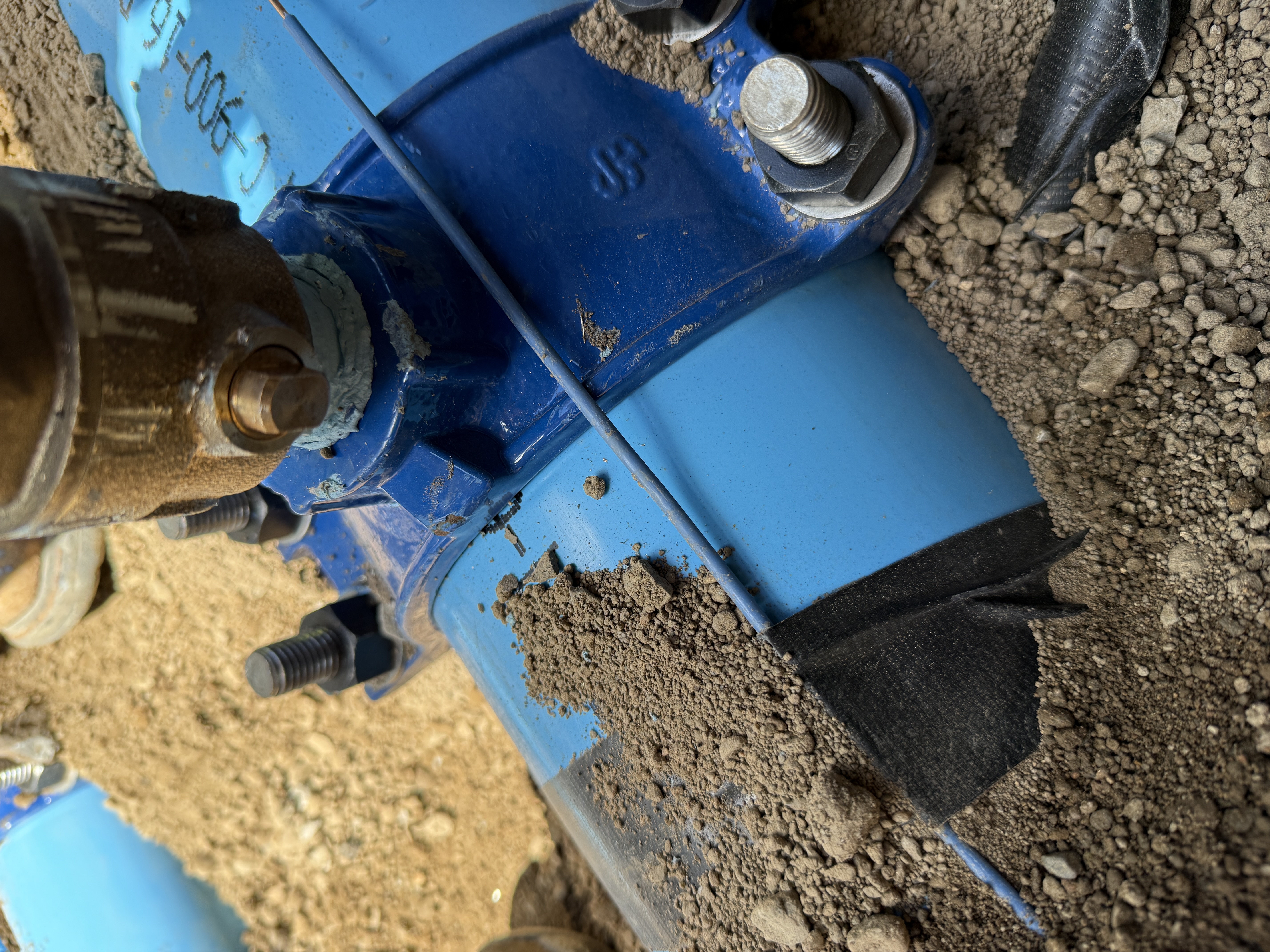
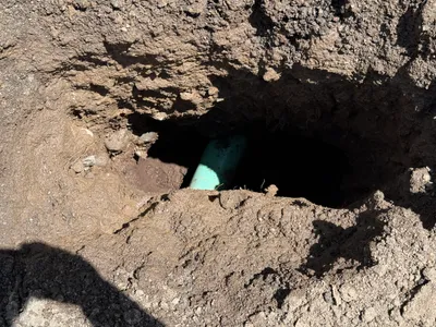
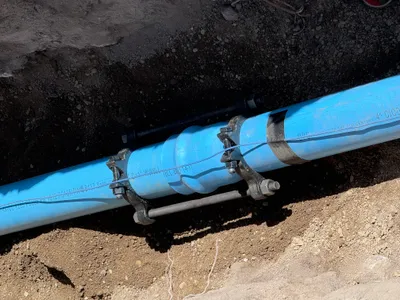
The image shows a close-up view of a blue pipeline with a valve assembly. The connection is secured with bolts and surrounded by soil. Part of the pipeline is covered with black tape, and some dirt is on the surface. The view suggests a recently completed or in-progress installation task.
pipeline-installation
soil with rocks outdoor in daylight access appears open but limited view
No specific safety features visible in frame.
AI Tags
Analyzed Apr 21, 2026
Nearby Photos
4m
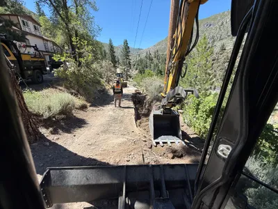
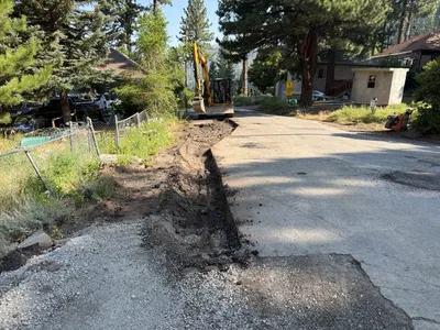
trenching
trenchingexcavation-activity
excavator
4m
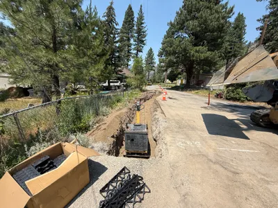
trenching
trenchingroadside-trenching
excavator
4m
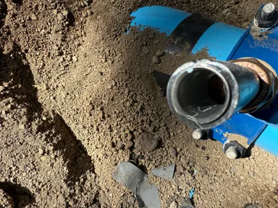
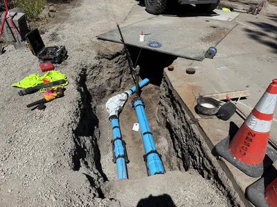
pipeline installation
pipe-installationmechanical-setup
soil
5m
excavation
utility-locatingpotholing
soil
5m
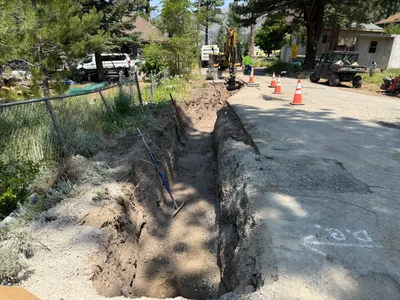
trenching
trenchingpipeline-placement
visible truck tire
5m
excavation
excavationdigging
excavator
5m
trenching
trenchingexcavation
excavator
6m
trenching
trenchingconduit-laying
excavator
6m
trenching
soil-compactiontrenching-activity
tracked excavator
6m
pipeline installation
pipeline-installationpipe-laying
pipe