
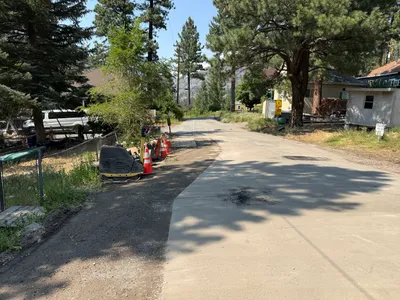
No caption
IMG_9081.JPG
Details
Friday, August 1, 2025 · 11:06 AM
39.39410, -120.02271· 1640m
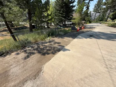
Location Context
1 / 5
USGS Topo
No elevation data
FEMA Flood
No flood data
OSM Infra
No address data
USDA Soil
No soil data
USGS Hydro
No hydro data
Apple iPhone 16 Pro
iPhone 16 Pro back triple camera 2.22mm f/2.2
2.220000028611935mmf/2.21/1125sISO 50
Flash did not fire, compulsory flash mode
Show all EXIF (43 fields)
ApertureValue2.2750
BrightnessValue8.4613
ColorSpace65535
CompositeImageGeneral Composite Image
ExifImageHeight3024
ExifVersion2.3.2
ExposureCompensation0
ExposureModeAuto
ExposureProgramNormal program
FlashpixVersion1.0
FocalLengthIn35mmFormat14
GPSDateStamp2025:08:01
GPSDestBearing357.9236
GPSDestBearingRefTrue North
GPSHPositioningError4.7487
GPSImgDirection357.9236
GPSImgDirectionRefT
GPSSpeed0.0856
GPSSpeedRefK
GPSTimeStamp18:6:15
HostComputeriPhone 16 Pro
latitude39.3941
LensInfo2.2200, 15.6600, 1.7800, 2.8000
LensMakeApple
longitude-120.0227
MeteringModePattern
ModifyDate2025-08-01T11:06:16.000Z
OffsetTime-07:00
OffsetTimeDigitized-07:00
OffsetTimeOriginal-07:00
ResolutionUnitinches
SceneCaptureTypeStandard
SceneTypeDirectly photographed
SensingMethodOne-chip color area sensor
ShutterSpeedValue10.1355
Software18.6
SubjectArea{"0":2000,"1":1511,"2":2217,"3":1330}
SubSecTimeDigitized249
SubSecTimeOriginal249
WhiteBalanceAuto
XResolution72
YCbCrPositioning1
YResolution72
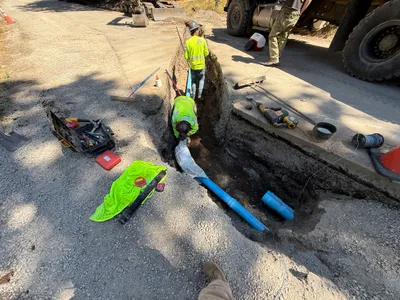
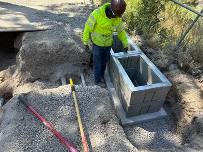
AI Analysis
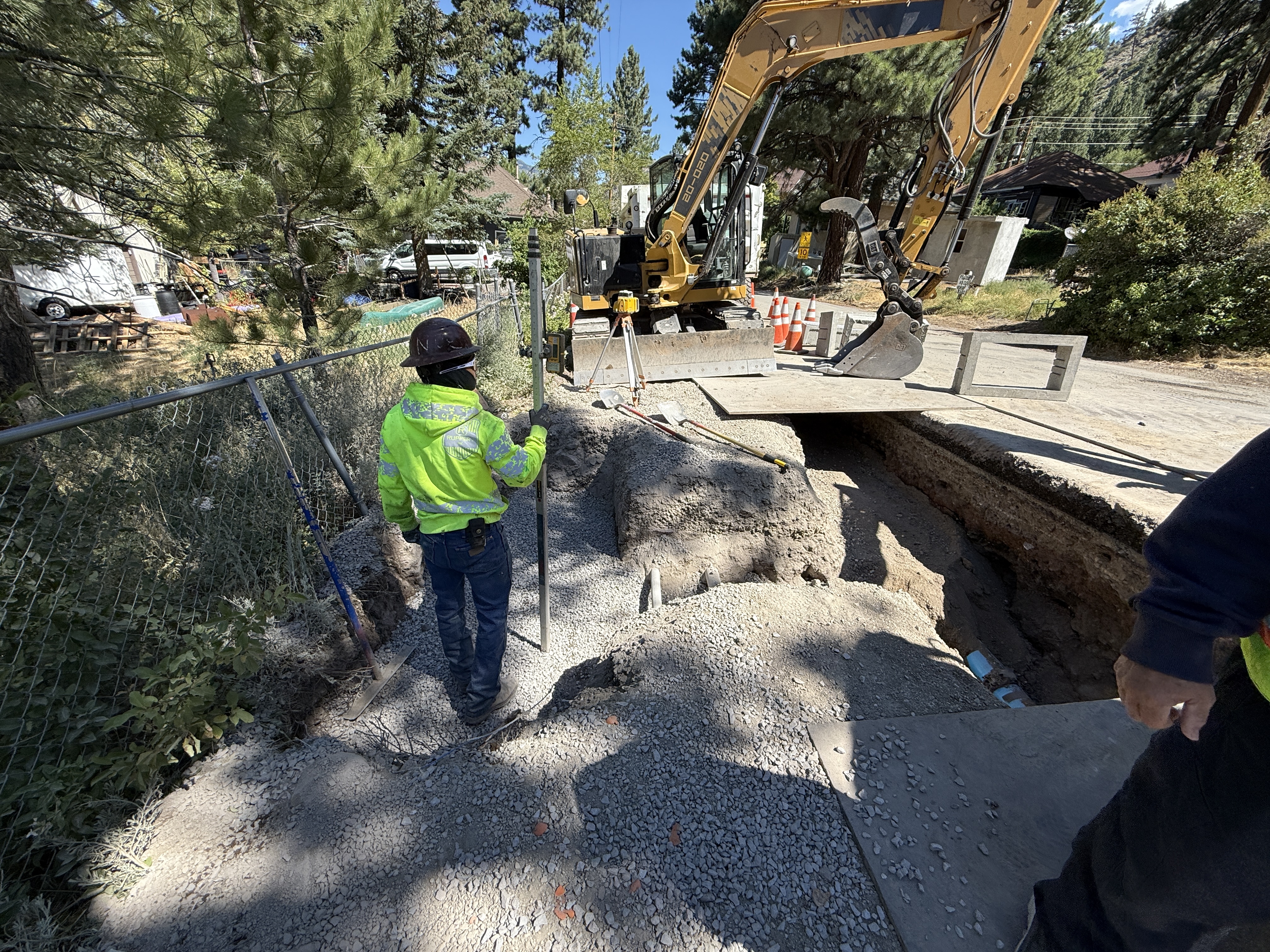
The image shows a worker holding a survey pole next to an open trench, indicating survey layout activities. An excavator is positioned above the trench, and there is loose gravel on the ground. The surrounding area includes cones and fencing for safety. Some pipes are visible within the trench.
survey-layout
gravel and exposed soil clear weather, daylight restricted access with fencing and traffic cones visible
PPE is worn by workers and safety controls like fencing and cones are visible.
Equipment & Materials
Analyzed Apr 21, 2026
Nearby Photos
1m
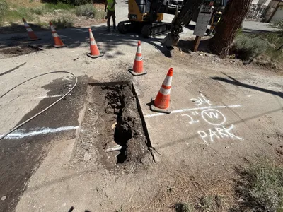
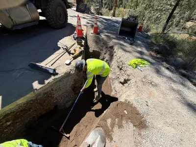
excavation
pothole-utility-locatingtrenching
excavator
2m
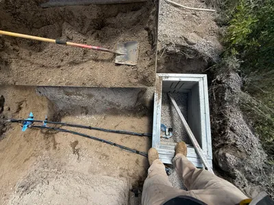
trenching
trenchingvault-access
shovel
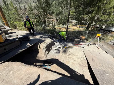
3m
excavation
excavationsite-preparation
excavator
3m
trenching
trenchingpipe-installation
truck
3m
trenching
trenchingsoil-compaction
truck
3m
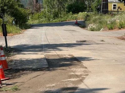
paving surface restoration
pavement-patchingroad-marking
asphalt
3m
excavation
excavationtrenching
mini excavator
4m
paving surface restoration
road-surface-patchingasphalt-patching
compacting-machine
4m
paving surface restoration
pavingtraffic-control
truck
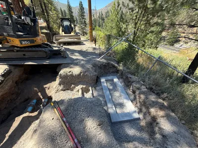
4m
valve vault
vault-inspectionstructure-installation
shovels