
No caption
IMG_8070.JPG
Details
Tuesday, May 27, 2025 · 1:47 PM
39.39411, -120.02271· 1639m
Location Context
1 / 5
USGS Topo
No elevation data
FEMA Flood
No flood data
OSM Infra
No address data
USDA Soil
No soil data
USGS Hydro
No hydro data
Apple iPhone 16 Pro
iPhone 16 Pro back triple camera 2.22mm f/2.2
2.220000028611935mmf/2.21/3460sISO 50
Flash did not fire, compulsory flash mode
Show all EXIF (43 fields)
ApertureValue2.2750
BrightnessValue9.9980
ColorSpace65535
CompositeImageGeneral Composite Image
ExifImageHeight3024
ExifVersion2.3.2
ExposureCompensation0
ExposureModeAuto
ExposureProgramNormal program
FlashpixVersion1.0
FocalLengthIn35mmFormat14
GPSDateStamp2025:05:27
GPSDestBearing113.7804
GPSDestBearingRefTrue North
GPSHPositioningError6.1845
GPSImgDirection113.7804
GPSImgDirectionRefT
GPSSpeed0.5403
GPSSpeedRefK
GPSTimeStamp20:47:23
HostComputeriPhone 16 Pro
latitude39.3941
LensInfo2.2200, 15.6600, 1.7800, 2.8000
LensMakeApple
longitude-120.0227
MeteringModeSpot
ModifyDate2025-05-27T13:47:23.000Z
OffsetTime-07:00
OffsetTimeDigitized-07:00
OffsetTimeOriginal-07:00
ResolutionUnitinches
SceneCaptureTypeStandard
SceneTypeDirectly photographed
SensingMethodOne-chip color area sensor
ShutterSpeedValue11.7566
Software18.5
SubjectArea{"0":2924,"1":1901,"2":422,"3":423}
SubSecTimeDigitized465
SubSecTimeOriginal465
WhiteBalanceAuto
XResolution72
YCbCrPositioning1
YResolution72
AI Analysis
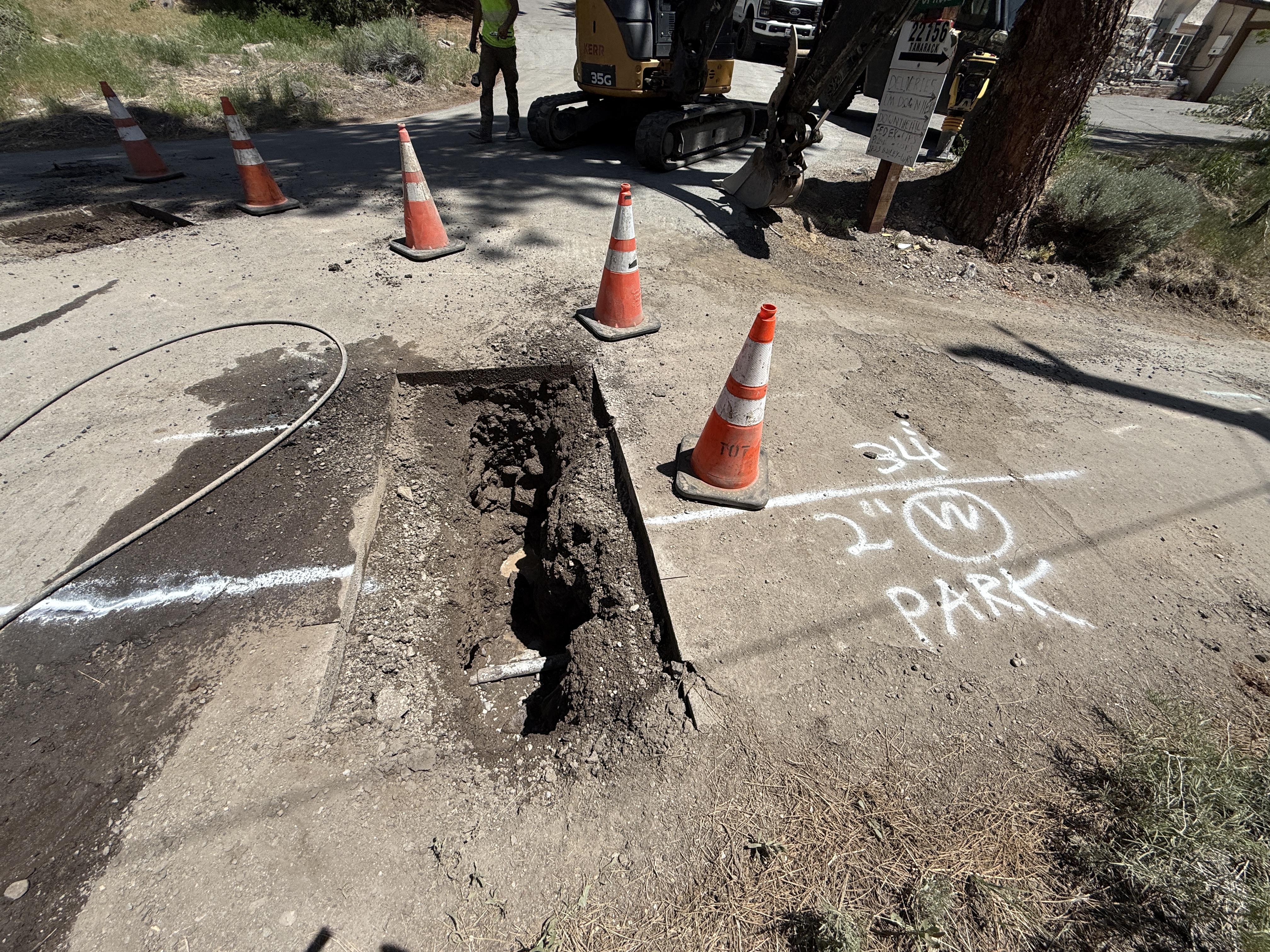
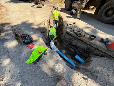
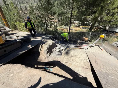
The image shows a trench cut into a paved road surface, possibly for utility locating purposes. Traffic cones are positioned around the perimeter, marking a safety boundary. An excavator is seen in the background, indicating active excavation work. A pipe is partially visible at the bottom of the trench.
excavation
paved road surface with an open trench sunny conditions, well-lit appears slightly congested because of equipment and cones
Safety controls visible include cones around the trench; hi-vis vest on worker.
AI Tags
Analyzed Apr 21, 2026
Nearby Photos
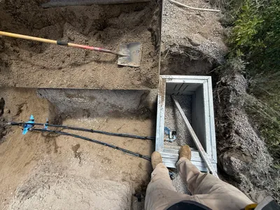
1m
trenching
trenchingvault-access
shovel
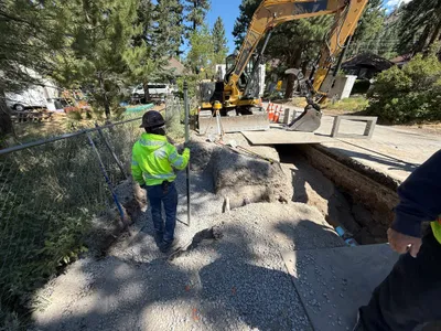
1m
survey layout
survey-layouttrenching
excavator
2m
trenching
trenchingsoil-compaction
truck
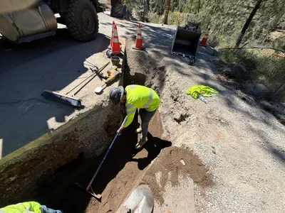
2m
trenching
trenchingpipe-installation
truck
2m
excavation
excavationtrenching
mini excavator
3m
valve vault
vault-inspectionstructure-installation
shovels
3m
paving surface restoration
pavement-patchingroad-marking
asphalt
3m
excavation
excavationsite-preparation
excavator
3m
other
equipment-operationmaterial-transport
front-loader
3m
paving surface restoration
compactingsurface-restoration
loader