No caption
IMG_7012.JPG
Tags
Details
Monday, April 7, 2025 · 2:09 PM
39.39465, -120.02123· 1654m
Location Context
1 / 5
USGS Topo
No elevation data
FEMA Flood
No flood data
OSM Infra
No address data
USDA Soil
No soil data
USGS Hydro
No hydro data
Apple iPhone 16 Pro
iPhone 16 Pro back triple camera 6.765mm f/1.78
6.764999865652793mmf/1.7799999713880651/1060sISO 80
Flash did not fire, compulsory flash mode
Show all EXIF (43 fields)
ApertureValue1.6638
BrightnessValue7.8818
ColorSpace65535
CompositeImageGeneral Composite Image
ExifImageHeight4284
ExifVersion2.3.2
ExposureCompensation0
ExposureModeAuto
ExposureProgramNormal program
FlashpixVersion1.0
FocalLengthIn35mmFormat24
GPSDateStamp2025:04:07
GPSDestBearing86.3965
GPSDestBearingRefTrue North
GPSHPositioningError16.0430
GPSImgDirection86.3965
GPSImgDirectionRefT
GPSSpeed1.6142
GPSSpeedRefK
GPSTimeStamp21:8:59
HostComputeriPhone 16 Pro
latitude39.3947
LensInfo2.2200, 15.6600, 1.7800, 2.8000
LensMakeApple
longitude-120.0212
MeteringModePattern
ModifyDate2025-04-07T14:09:00.000Z
OffsetTime-07:00
OffsetTimeDigitized-07:00
OffsetTimeOriginal-07:00
ResolutionUnitinches
SceneCaptureTypeStandard
SceneTypeDirectly photographed
SensingMethodOne-chip color area sensor
ShutterSpeedValue10.0505
Software18.4
SubjectArea{"0":2851,"1":2137,"2":3141,"3":1884}
SubSecTimeDigitized250
SubSecTimeOriginal250
WhiteBalanceAuto
XResolution72
YCbCrPositioning1
YResolution72
AI Analysis
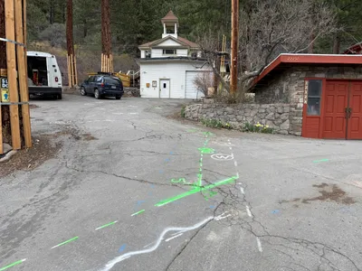
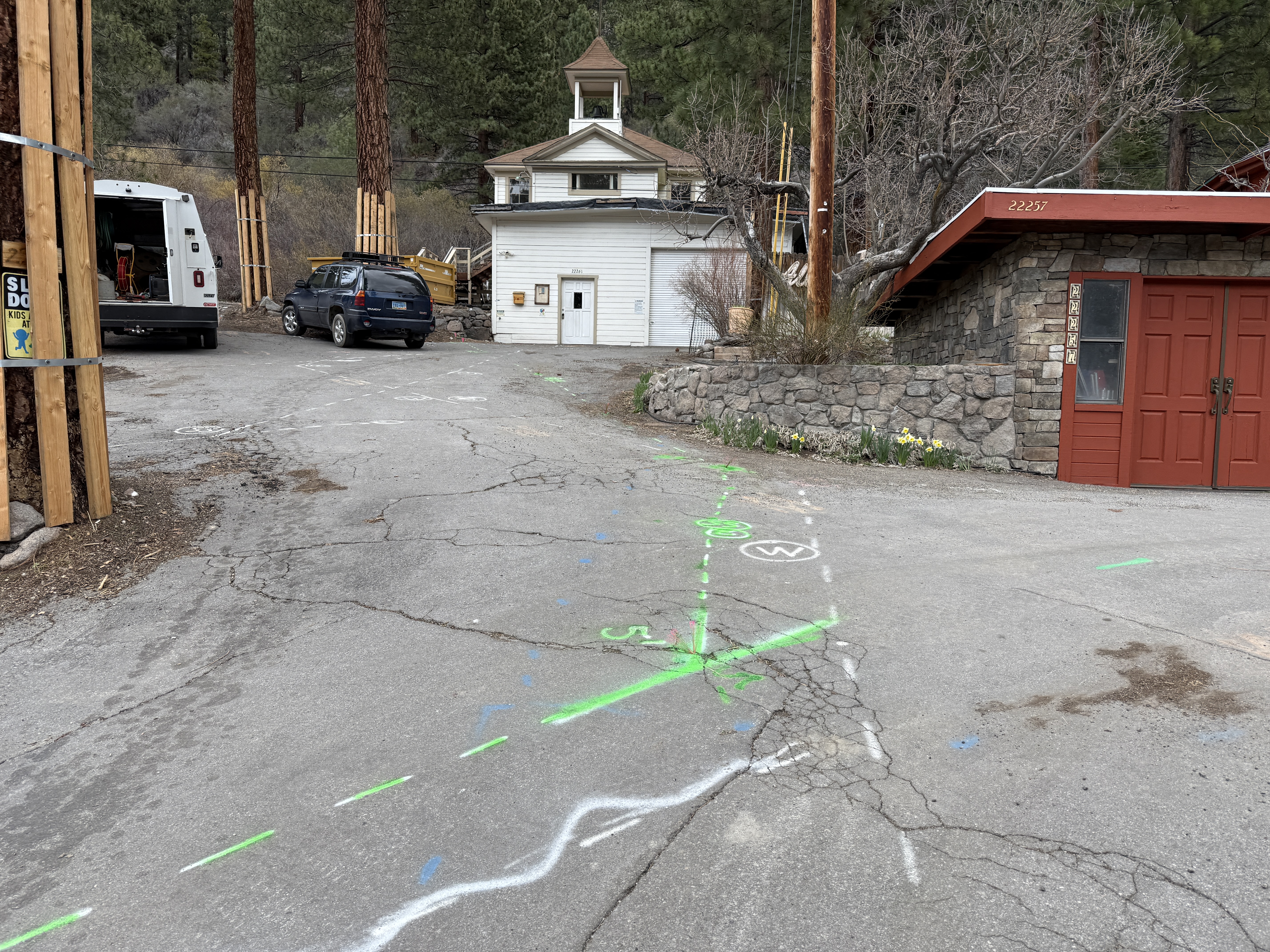
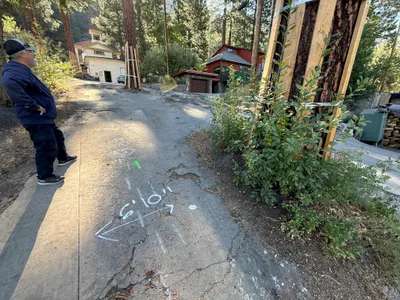
There are green and white utility markings on cracked pavement, indicating potential underground work. A white van and a blue SUV are parked nearby. A small building with a white exterior is visible behind the vehicles. The area is surrounded by trees, and there is a red stone building on the right.
survey-layout
cracked pavement overcast lighting open access with some congestion
No specific safety features are visible in frame.
AI Tags
Analyzed Apr 21, 2026
Nearby Photos
1m
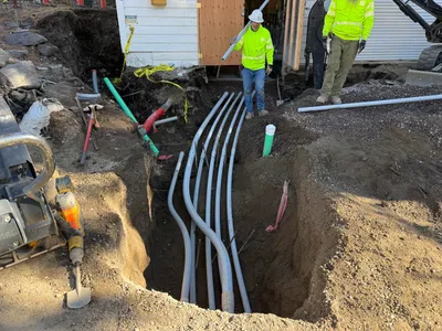
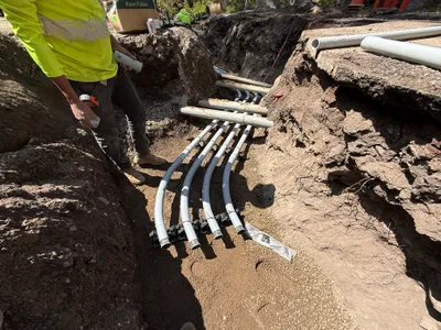
pipeline installation
duct-bank-installationconduit-pipes
small-excavator
1m
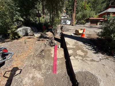
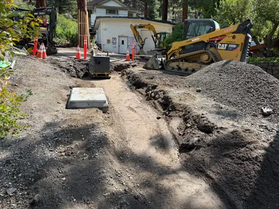
trenching
trenchinghazard-marking
shovel
2m
other
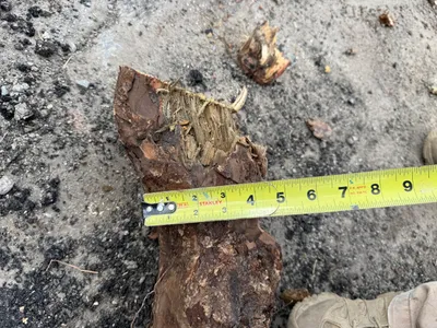
measuringpipe
measuring-tape
2m
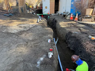
trenching
trenchingsoil excavation
excavator
2m
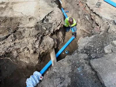
pipeline installation
pipe-installationtrenching-activity
blue-pipes
2m
trenching
trenchingconduit-installation
shovel
3m
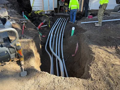
pipeline installation
conduit-installationtrenching
dirt
4m
inspection documentation
inspectionpavement-assessment
wooden braces
4m
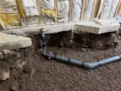
pipeline installation
pipeline-installationtrenching
PVC pipes
4m
pipeline installation
trenchingpipeline-installation
gravel