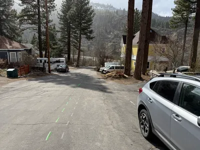
No caption
IMG_6995.JPG
Tags
Details
Monday, April 7, 2025 · 12:23 PM
39.39474, -120.02181· 1652m
Location Context
1 / 5
USGS Topo
No elevation data
FEMA Flood
No flood data
OSM Infra
No address data
USDA Soil
No soil data
USGS Hydro
No hydro data
Apple iPhone 16 Pro
iPhone 16 Pro back triple camera 6.765mm f/1.78
6.764999865652793mmf/1.7799999713880651/1292sISO 80
Flash did not fire, compulsory flash mode
Show all EXIF (43 fields)
ApertureValue1.6638
BrightnessValue8.1885
ColorSpace65535
CompositeImageGeneral Composite Image
ExifImageHeight4284
ExifVersion2.3.2
ExposureCompensation0
ExposureModeAuto
ExposureProgramNormal program
FlashpixVersion1.0
FocalLengthIn35mmFormat24
GPSDateStamp2025:04:07
GPSDestBearing335.8116
GPSDestBearingRefTrue North
GPSHPositioningError43.2614
GPSImgDirection335.8116
GPSImgDirectionRefT
GPSSpeed0
GPSSpeedRefK
GPSTimeStamp19:23:40
HostComputeriPhone 16 Pro
latitude39.3947
LensInfo2.2200, 15.6600, 1.7800, 2.8000
LensMakeApple
longitude-120.0218
MeteringModePattern
ModifyDate2025-04-07T12:23:45.000Z
OffsetTime-07:00
OffsetTimeDigitized-07:00
OffsetTimeOriginal-07:00
ResolutionUnitinches
SceneCaptureTypeStandard
SceneTypeDirectly photographed
SensingMethodOne-chip color area sensor
ShutterSpeedValue10.3354
Software18.4
SubjectArea{"0":2851,"1":2137,"2":3141,"3":1884}
SubSecTimeDigitized700
SubSecTimeOriginal700
WhiteBalanceAuto
XResolution72
YCbCrPositioning1
YResolution72
AI Analysis
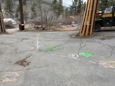
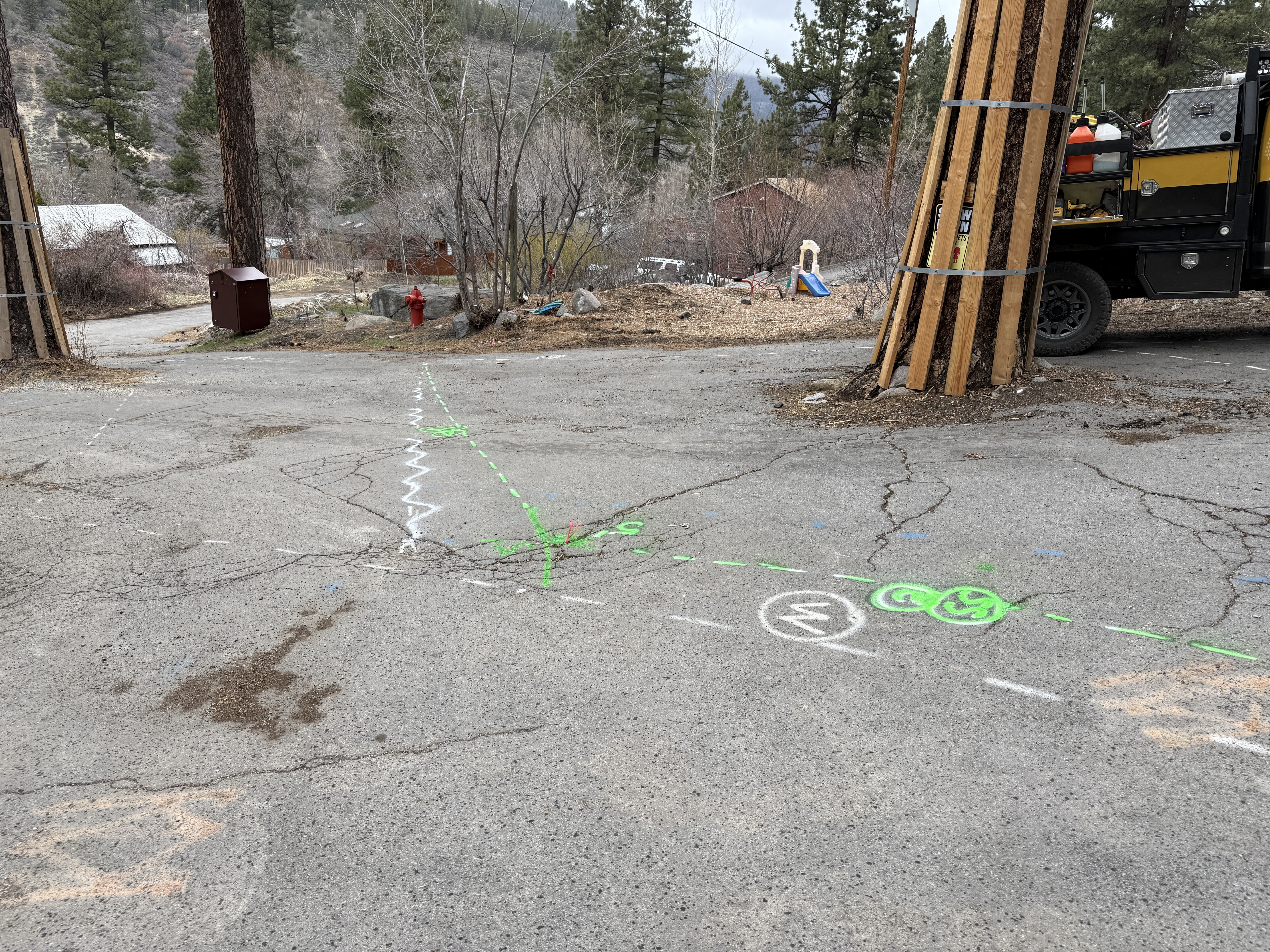
The image shows survey markings in green and white paint on a cracked pavement, likely indicating utility locations or waterline alignment. A large truck is partially visible on the right, and wooden posts surround a tree. Buildings and trees are visible in the background, suggesting rural or semi-rural surroundings. These markings are typical before excavation work.
survey-layout
cracked pavement overcast lighting open area with visible access for vehicles
No specific safety features are visible in frame.
Equipment & Materials
AI Tags
Analyzed Apr 21, 2026
Nearby Photos
3m
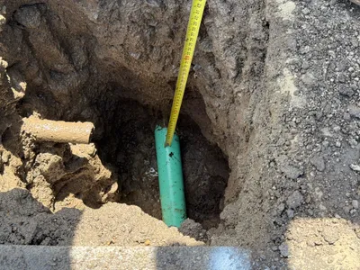
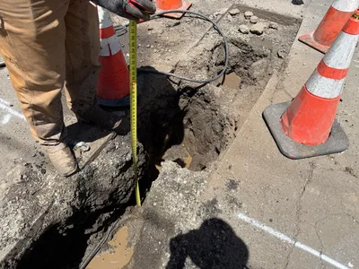
excavation
pothole-utility-locatingexcavation
parked-vehicles
3m
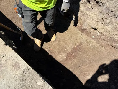
excavation
utility-locatingconcrete-pouring
concrete-truck
4m
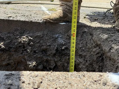
excavation
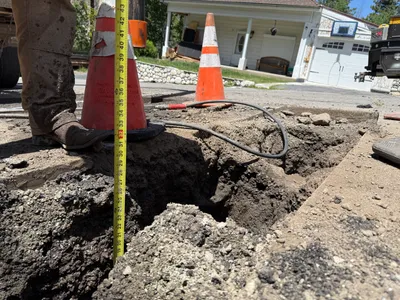
potholingutility-locating
tape-measure
4m
trenching
trenchingexcavation-preparation
shovel
4m
excavation
utility-locatingdepth-measurement
measuring-tape
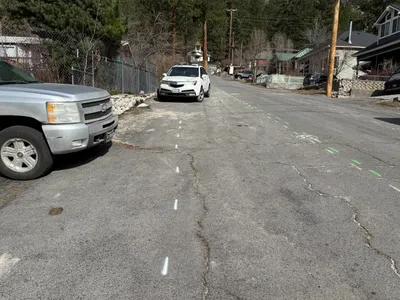
4m
survey layout
pavement-markingsite-preparation
pickup-truck
4m
excavation
utility-locatingdepth-measurement
measuring-tape
4m
trenching
trench-measurementmeasuring-tape
measuring-tape
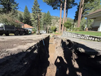
4m
trenching
trenchingsoil-handling
excavator
4m
other
road-markingpre-construction
silver-car