No caption
IMG_8095.JPG
Details
Wednesday, May 28, 2025 · 11:32 AM
39.39409, -120.02261· 1633m
Location Context
1 / 5
USGS Topo
No elevation data
FEMA Flood
No flood data
OSM Infra
No address data
USDA Soil
No soil data
USGS Hydro
No hydro data
Apple iPhone 16 Pro
iPhone 16 Pro back triple camera 6.765mm f/1.78
6.764999865652793mmf/1.7799999713880651/2703sISO 80
Flash did not fire, compulsory flash mode
Show all EXIF (43 fields)
ApertureValue1.6638
BrightnessValue9.2341
ColorSpace65535
CompositeImageGeneral Composite Image
ExifImageHeight4284
ExifVersion2.3.2
ExposureCompensation0
ExposureModeAuto
ExposureProgramNormal program
FlashpixVersion1.0
FocalLengthIn35mmFormat24
GPSDateStamp2025:05:28
GPSDestBearing248.3032
GPSDestBearingRefTrue North
GPSHPositioningError23.7590
GPSImgDirection248.3032
GPSImgDirectionRefT
GPSSpeed0
GPSSpeedRefK
GPSTimeStamp18:32:57
HostComputeriPhone 16 Pro
latitude39.3941
LensInfo2.2200, 15.6600, 1.7800, 2.8000
LensMakeApple
longitude-120.0226
MeteringModePattern
ModifyDate2025-05-28T11:32:57.000Z
OffsetTime-07:00
OffsetTimeDigitized-07:00
OffsetTimeOriginal-07:00
ResolutionUnitinches
SceneCaptureTypeStandard
SceneTypeDirectly photographed
SensingMethodOne-chip color area sensor
ShutterSpeedValue11.4002
Software18.5
SubjectArea{"0":2851,"1":2137,"2":3141,"3":1884}
SubSecTimeDigitized946
SubSecTimeOriginal946
WhiteBalanceAuto
XResolution72
YCbCrPositioning1
YResolution72
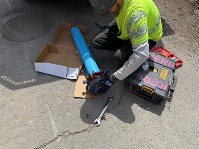
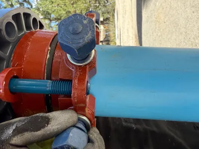
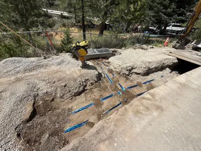
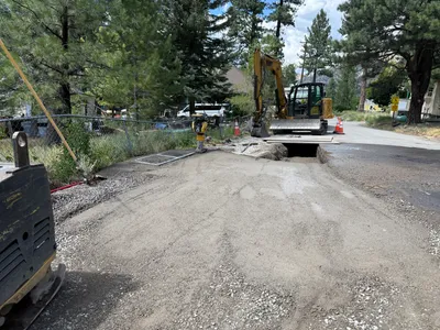
AI Analysis
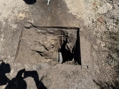
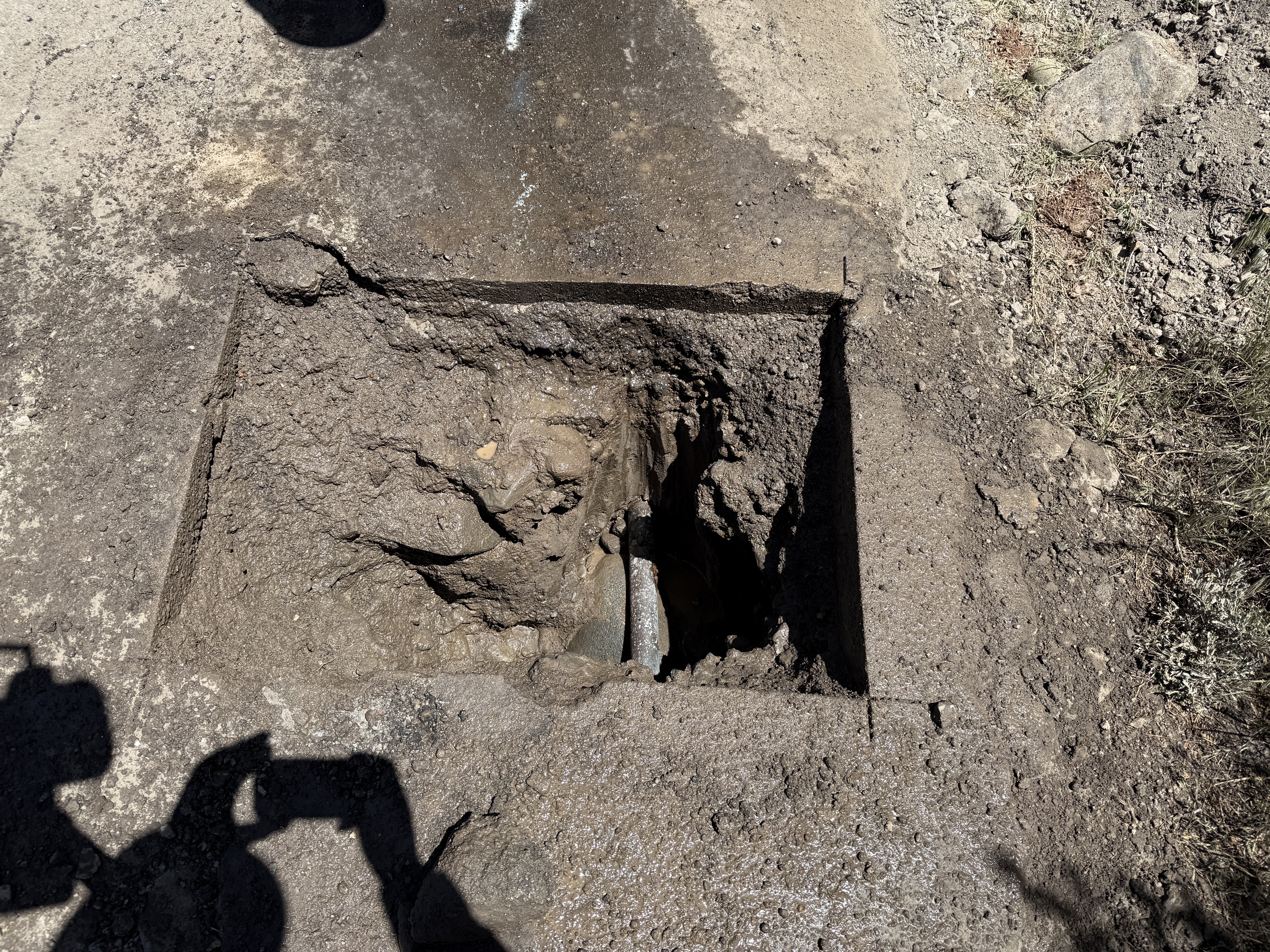
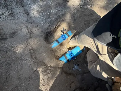
The photo depicts a roughly excavated hole in the ground for the purpose of potholing to locate underground utilities. There is visible dirt piled around the excavation, and part of a pipe is exposed within the pothole. No machinery or tools are visible in the frame, and the surface appears muddy due to recent digging activity.
excavation
muddy excavation site sunny with shadows visible no visible congestion or staging
No visible safety measures or PPE are apparent in the frame.
Equipment & Materials
Analyzed Apr 21, 2026
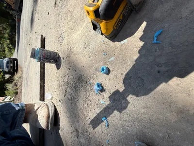
Nearby Photos
1m
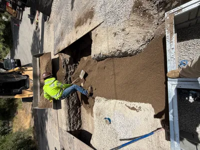
backfill
backfillingtrench-work
shovel
2m
backfill
trench-backfillingpipe-installation
backhoe loader
2m
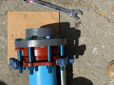
mechanical installation
pipe-assemblytool-use
wrench
2m
mechanical installation
bolt-tighteningflange-connection
wrench
3m
pipeline installation
pipe-installationcomponent-check
soil
3m
backfill
backfillsoil-placement
front-loader
3m
mechanical installation
bolt-assemblypipe-fitting
flange
4m
survey layout
layout-markingutility-marking
unidentified vehicle
4m
trenching
trenchingutility-marking
backhoe
5m
excavation
trenchingutility-excavation
excavator