No caption
IMG_7984 2.JPG
Details
Friday, May 23, 2025 · 10:29 AM
39.39473, -120.02167· 1648m
Location Context
1 / 5
USGS Topo
No elevation data
FEMA Flood
No flood data
OSM Infra
No address data
USDA Soil
No soil data
USGS Hydro
No hydro data
Apple iPhone 16 Pro
iPhone 16 Pro back triple camera 6.765mm f/1.78
6.764999865652793mmf/1.7799999713880651/992sISO 80
Flash did not fire, compulsory flash mode
Show all EXIF (43 fields)
ApertureValue1.6638
BrightnessValue7.4860
ColorSpace65535
CompositeImageGeneral Composite Image
ExifImageHeight4284
ExifVersion2.3.2
ExposureCompensation0
ExposureModeAuto
ExposureProgramNormal program
FlashpixVersion1.0
FocalLengthIn35mmFormat24
GPSDateStamp2025:05:23
GPSDestBearing36.7455
GPSDestBearingRefTrue North
GPSHPositioningError14
GPSImgDirection36.7455
GPSImgDirectionRefT
GPSSpeed1.0831
GPSSpeedRefK
GPSTimeStamp17:29:16
HostComputeriPhone 16 Pro
latitude39.3947
LensInfo2.2200, 15.6600, 1.7800, 2.8000
LensMakeApple
longitude-120.0217
MeteringModePattern
ModifyDate2025-05-23T10:29:16.000Z
OffsetTime-07:00
OffsetTimeDigitized-07:00
OffsetTimeOriginal-07:00
ResolutionUnitinches
SceneCaptureTypeStandard
SceneTypeDirectly photographed
SensingMethodOne-chip color area sensor
ShutterSpeedValue9.9543
Software18.5
SubjectArea{"0":2851,"1":2137,"2":3141,"3":1884}
SubSecTimeDigitized484
SubSecTimeOriginal484
WhiteBalanceAuto
XResolution72
YCbCrPositioning1
YResolution72
AI Analysis
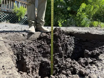
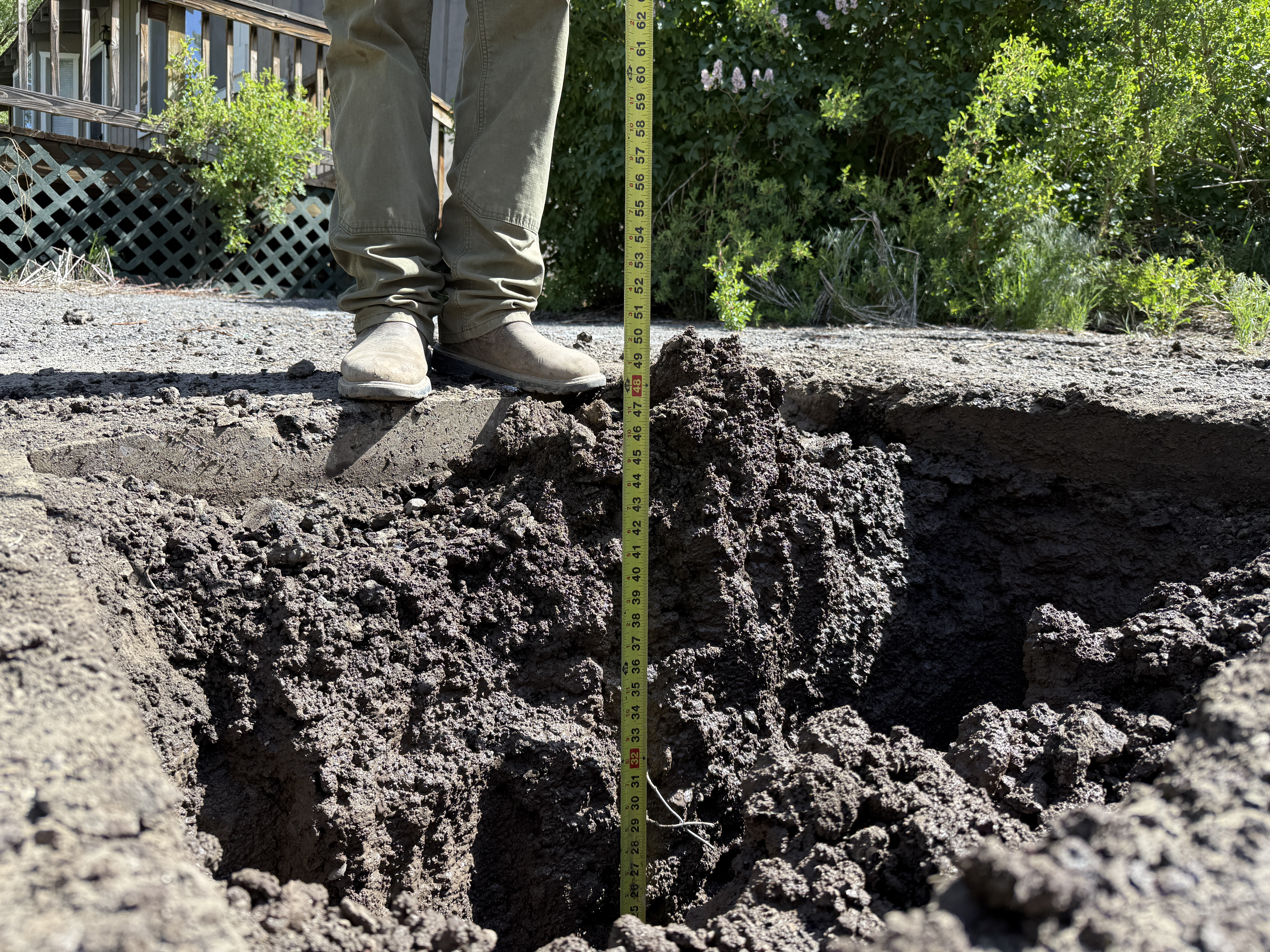
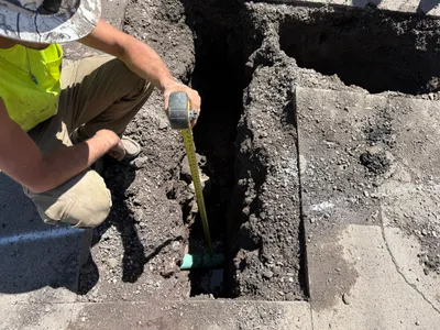
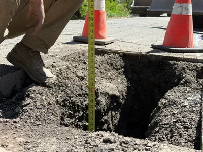
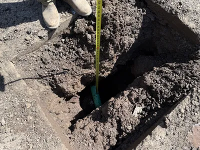
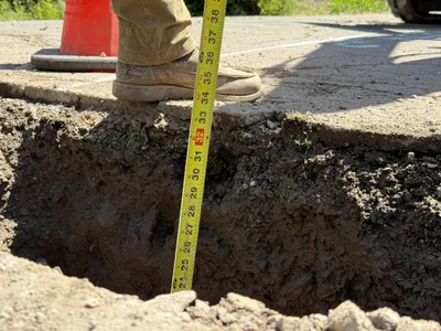
The image shows a deep hole being examined, likely for pothole utility locating on Juniper Street. A person is standing near the edge of the excavation, using a measuring tape to assess the depth. The soil is dark and clumpy, suggesting recent excavation activity. There are no visible utilities or markings in the hole.
excavation
dark, clumpy soil bright sunlight open access around the excavation
Safety features such as barriers or cones are not visible in frame.
Equipment & Materials
Analyzed Apr 21, 2026
Nearby Photos
1m
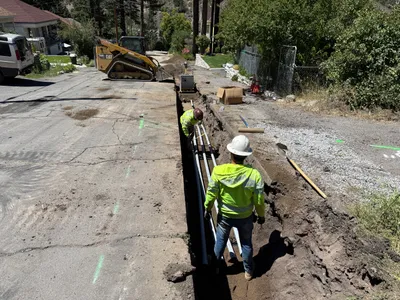
trenching
trench-measurementutility-locating
tape-measure
2m
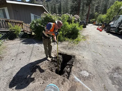
excavation
depth-measurementutility-locating
tape-measure
2m
excavation
pothole-utility-locatingmeasuring-depth
measuring-tape
2m
paving surface restoration
paving-surface-restorationroad-grading
skid-steer-loader
3m
excavation
utility-locatingpotholing
excavator
3m
trenching
trenchingconduit-installation
excavator
3m
pipeline installation
trenchingconduit-installation
compact track loader
4m
excavation
pothole-measuringutility-locating
construction-truck
4m
excavation
depth-measurementutility-locating
tape-measure
5m
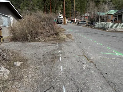
survey layout
survey-layoutmarking