
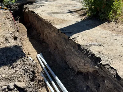
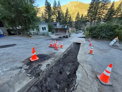
No caption
IMG_7934.JPG
Details
Wednesday, May 21, 2025 · 1:33 PM
39.39479, -120.02131· 1651m
Location Context
1 / 5
USGS Topo
No elevation data
FEMA Flood
No flood data
OSM Infra
No address data
USDA Soil
No soil data
USGS Hydro
No hydro data
Apple iPhone 16 Pro
iPhone 16 Pro back triple camera 2.22mm f/2.2
2.220000028611935mmf/2.21/1464sISO 50
Flash did not fire, compulsory flash mode
Show all EXIF (43 fields)
ApertureValue2.2750
BrightnessValue9.4121
ColorSpace65535
CompositeImageGeneral Composite Image
ExifImageHeight3024
ExifVersion2.3.2
ExposureCompensation0
ExposureModeAuto
ExposureProgramNormal program
FlashpixVersion1.0
FocalLengthIn35mmFormat14
GPSDateStamp2025:05:21
GPSDestBearing275.4365
GPSDestBearingRefTrue North
GPSHPositioningError7.4500
GPSImgDirection275.4365
GPSImgDirectionRefT
GPSSpeed0
GPSSpeedRefK
GPSTimeStamp20:33:47
HostComputeriPhone 16 Pro
latitude39.3948
LensInfo2.2200, 15.6600, 1.7800, 2.8000
LensMakeApple
longitude-120.0213
MeteringModePattern
ModifyDate2025-05-21T13:33:48.000Z
OffsetTime-07:00
OffsetTimeDigitized-07:00
OffsetTimeOriginal-07:00
ResolutionUnitinches
SceneCaptureTypeStandard
SceneTypeDirectly photographed
SensingMethodOne-chip color area sensor
ShutterSpeedValue10.5158
Software18.5
SubjectArea{"0":2000,"1":1511,"2":2217,"3":1330}
SubSecTimeDigitized192
SubSecTimeOriginal192
WhiteBalanceAuto
XResolution72
YCbCrPositioning1
YResolution72
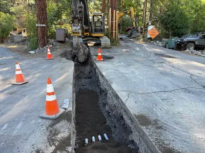
AI Analysis
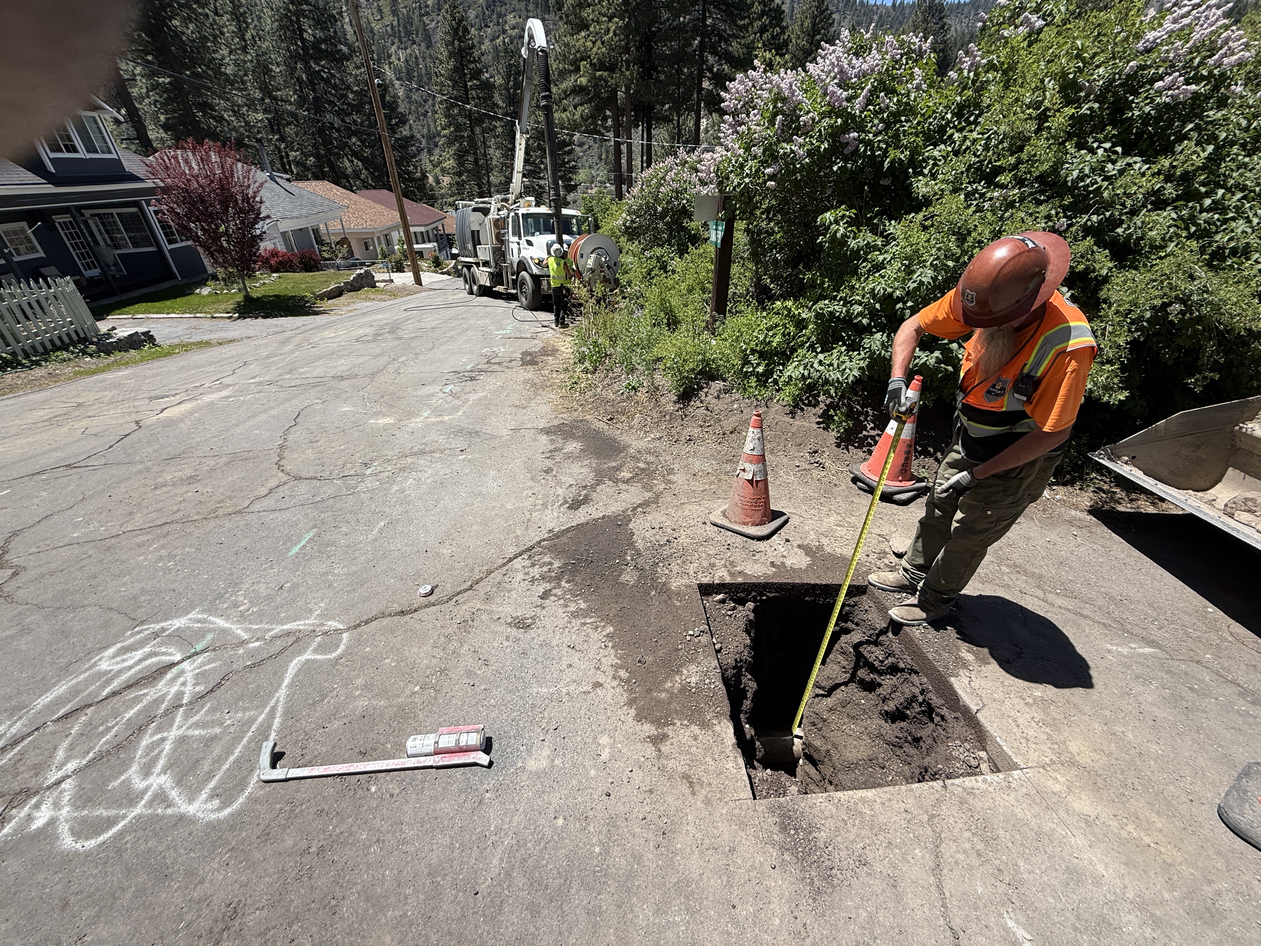
A worker wearing a hard hat and hi-vis vest is measuring the depth of a rectangular pothole on a paved street. The worker uses a measuring tape, and there are safety cones around the work area. A vacuum truck is positioned further down the street, suggesting utility locating activity. Chalk marks and an L-shaped tool are visible on the pavement.
excavation
paved street with pothole sunny and bright open street with moderate access
Safety features like cones and PPE are visible around the open trench.
Equipment & Materials
AI Tags
Analyzed Apr 21, 2026
Nearby Photos
1m
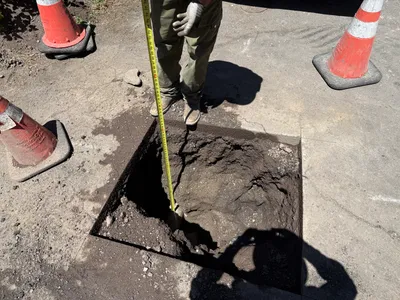
excavation
pothole-utility-locatingdepth-measurement
tape-measure
3m
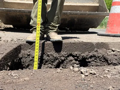
excavation
excavation-depth-measurementutility-locating
measuring-tape
3m
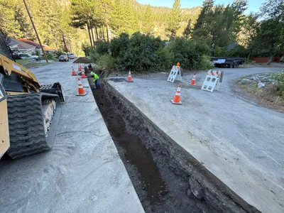
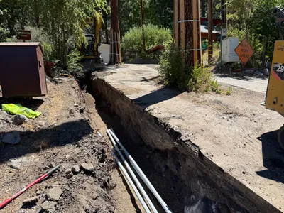
trenching
trenchingtrench
excavator
4m
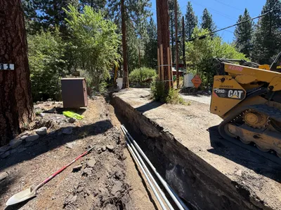
trenching
road-trenchingutility-excavation
excavator
4m
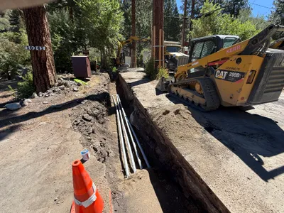
trenching
trenchingpipe-laying
excavator
4m
trenching
trenchingpipe-installation
compact-track-loader
4m
trenching
trenchingconduit-installation
tracked loader
4m
trenching
trenchingduct-bank-installation
shovel
4m
trenching
trenchingutility-work
backhoe loader
4m
excavation
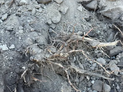
site-excavationtree-roots