IMG_7917.JPG

No caption

IMG_7917.JPG

Tags

Details

Tuesday, May 20, 2025 · 3:05 PM

39.39472, -120.02123· 1651m

Location Context

1 / 5

USGS Topo

No elevation data

FEMA Flood

No flood data

OSM Infra

No address data

USDA Soil

No soil data

USGS Hydro

No hydro data

Apple iPhone 16 Pro
iPhone 16 Pro back triple camera 6.765mm f/1.78
6.764999865652793mmf/1.7799999713880651/1901sISO 80
Flash did not fire, compulsory flash mode
Show all EXIF (43 fields)
ApertureValue1.6638
BrightnessValue8.4819
ColorSpace65535
CompositeImageGeneral Composite Image
ExifImageHeight4284
ExifVersion2.3.2
ExposureCompensation0
ExposureModeAuto
ExposureProgramNormal program
FlashpixVersion1.0
FocalLengthIn35mmFormat24
GPSDateStamp2025:05:20
GPSDestBearing76.1692
GPSDestBearingRefTrue North
GPSHPositioningError7.5361
GPSImgDirection76.1692
GPSImgDirectionRefT
GPSSpeed0.5740
GPSSpeedRefK
GPSTimeStamp22:5:33
HostComputeriPhone 16 Pro
latitude39.3947
LensInfo2.2200, 15.6600, 1.7800, 2.8000
LensMakeApple
longitude-120.0212
MeteringModePattern
ModifyDate2025-05-20T15:05:33.000Z
OffsetTime-07:00
OffsetTimeDigitized-07:00
OffsetTimeOriginal-07:00
ResolutionUnitinches
SceneCaptureTypeStandard
SceneTypeDirectly photographed
SensingMethodOne-chip color area sensor
ShutterSpeedValue10.8926
Software18.5
SubjectArea{"0":2851,"1":2137,"2":3141,"3":1884}
SubSecTimeDigitized865
SubSecTimeOriginal865
WhiteBalanceAuto
XResolution72
YCbCrPositioning1
YResolution72

AI Analysis

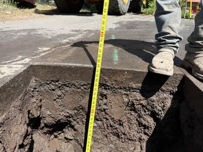
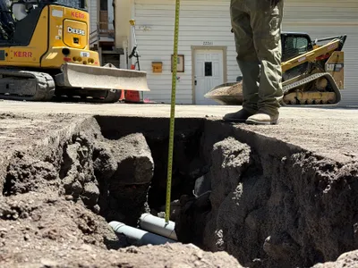
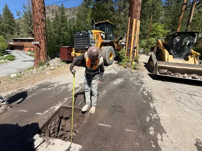
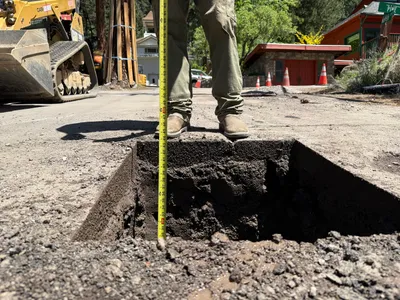
The image shows a pothole with exposed soil at the bottom and a measuring tape positioned vertically for depth measurement. An individual stands near the edge of the pothole, wearing work boots. Pavement borders the edge of the excavation, and construction equipment is partially visible in the background. The main visible activity appears to be the measurement of the excavation depth.

excavation
exposed soil and pavement sunny daylight open access to pothole
No additional safety features are visible in the frame.

Equipment & Materials

Analyzed Apr 21, 2026