
No caption
IMG_7847 2.JPG
Details
Monday, May 19, 2025 · 10:50 AM
39.39471, -120.02092· 1660m
Location Context
1 / 5
USGS Topo
No elevation data
FEMA Flood
No flood data
OSM Infra
No address data
USDA Soil
No soil data
USGS Hydro
No hydro data
Apple iPhone 16 Pro
iPhone 16 Pro back triple camera 6.765mm f/1.78
6.764999865652793mmf/1.7799999713880651/127sISO 80
Flash did not fire, compulsory flash mode
Show all EXIF (43 fields)
ApertureValue1.6638
BrightnessValue4.3845
ColorSpace65535
CompositeImageGeneral Composite Image
ExifImageHeight4284
ExifVersion2.3.2
ExposureCompensation0
ExposureModeAuto
ExposureProgramNormal program
FlashpixVersion1.0
FocalLengthIn35mmFormat24
GPSDateStamp2025:05:19
GPSDestBearing322.3227
GPSDestBearingRefTrue North
GPSHPositioningError12.9639
GPSImgDirection322.3227
GPSImgDirectionRefT
GPSSpeed0.4128
GPSSpeedRefK
GPSTimeStamp17:50:53
HostComputeriPhone 16 Pro
latitude39.3947
LensInfo2.2200, 15.6600, 1.7800, 2.8000
LensMakeApple
longitude-120.0209
MeteringModePattern
ModifyDate2025-05-19T10:50:54.000Z
OffsetTime-07:00
OffsetTimeDigitized-07:00
OffsetTimeOriginal-07:00
ResolutionUnitinches
SceneCaptureTypeStandard
SceneTypeDirectly photographed
SensingMethodOne-chip color area sensor
ShutterSpeedValue6.9936
Software18.5
SubjectArea{"0":2851,"1":2137,"2":3141,"3":1884}
SubSecTimeDigitized442
SubSecTimeOriginal442
WhiteBalanceAuto
XResolution72
YCbCrPositioning1
YResolution72
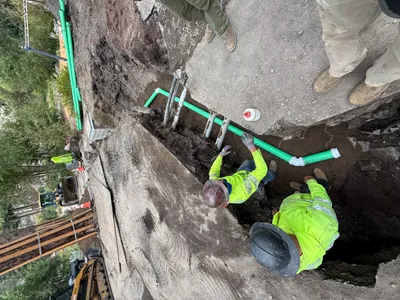
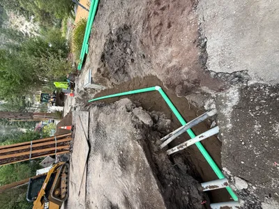
AI Analysis
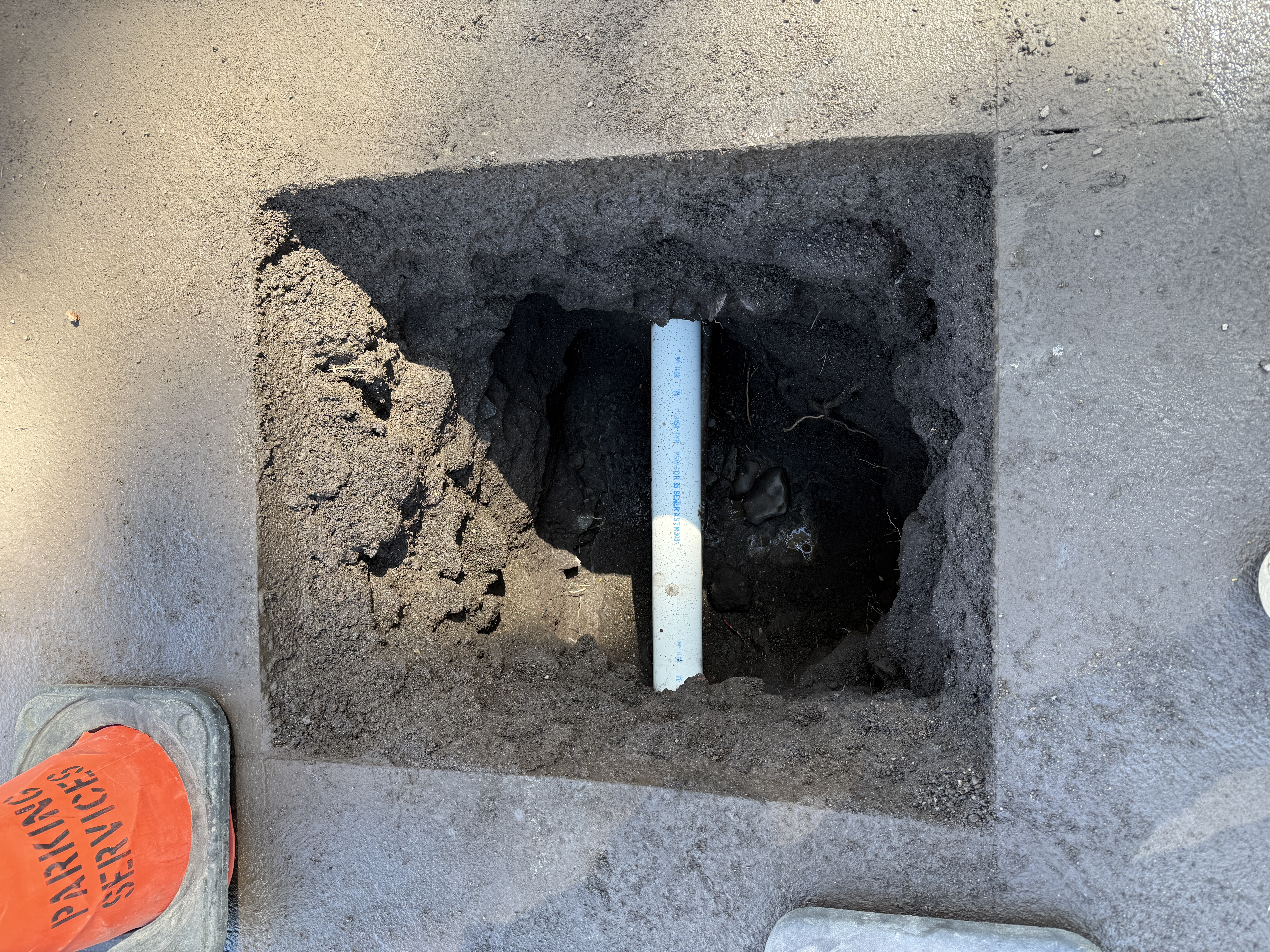
The image shows a rectangular excavation with a cross-section of a pipe visible beneath the ground. A traffic cone marked 'Parking Services' is positioned near the pothole. The work appears to involve locating and exposing a utility line, possibly for inspection or further work. The ground is asphalt with a cutout for the excavation.
excavation
asphalt with an excavation clear sunlight open access with caution cone present
A traffic cone is used to mark the location of the excavation.
Equipment & Materials
Analyzed Apr 21, 2026
Nearby Photos
1m
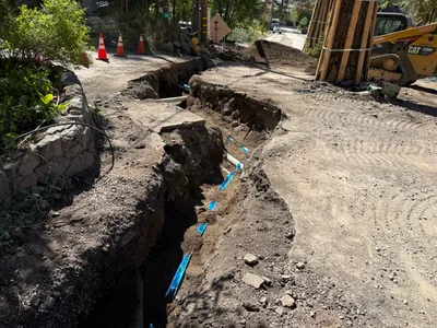
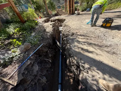
trenching
trenchingexcavation
tracked loader
1m
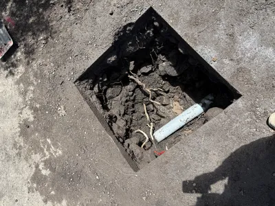
excavation
utility-locatingexcavation
pipe
1m
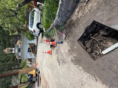
excavation
pothole-utility-locatingexcavation
excavator
1m
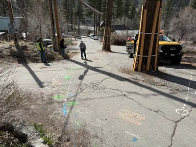
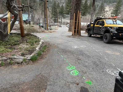
survey layout
utility-markingroad-assessment
truck
2m
survey layout
utility-markingsroad-marking
pickup-truck
2m
pipeline installation
pipeline-installationpipe-fitting
excavator

2m
site grading
gradingsite-preparation
dirt
2m
trenching
trenchingpipeline-installation
portable-generator
2m
other
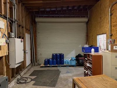
storage-setupchemical-barrels
chemical-barrels
2m
trenching
pipe-layingtrenching
excavator