No caption
IMG_7039.JPG
Tags
Details
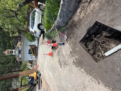
Monday, April 7, 2025 · 4:07 PM
39.39470, -120.02093· 1656m
Location Context
1 / 5
USGS Topo
No elevation data
FEMA Flood
No flood data
OSM Infra
No address data
USDA Soil
No soil data
USGS Hydro
No hydro data
Apple iPhone 16 Pro
iPhone 16 Pro back triple camera 6.765mm f/1.78
6.764999865652793mmf/1.7799999713880651/3584sISO 80
Flash did not fire, compulsory flash mode
Show all EXIF (43 fields)
ApertureValue1.6638
BrightnessValue9.6067
ColorSpace65535
CompositeImageGeneral Composite Image
ExifImageHeight4284
ExifVersion2.3.2
ExposureCompensation0
ExposureModeAuto
ExposureProgramNormal program
FlashpixVersion1.0
FocalLengthIn35mmFormat24
GPSDateStamp2025:04:07
GPSDestBearing285.5485
GPSDestBearingRefTrue North
GPSHPositioningError5.4808
GPSImgDirection285.5485
GPSImgDirectionRefT
GPSSpeed0.1195
GPSSpeedRefK
GPSTimeStamp23:7:25
HostComputeriPhone 16 Pro
latitude39.3947
LensInfo2.2200, 15.6600, 1.7800, 2.8000
LensMakeApple
longitude-120.0209
MeteringModePattern
ModifyDate2025-04-07T16:07:26.000Z
OffsetTime-07:00
OffsetTimeDigitized-07:00
OffsetTimeOriginal-07:00
ResolutionUnitinches
SceneCaptureTypeStandard
SceneTypeDirectly photographed
SensingMethodOne-chip color area sensor
ShutterSpeedValue11.8074
Software18.4
SubjectArea{"0":2851,"1":2137,"2":3141,"3":1884}
SubSecTimeDigitized987
SubSecTimeOriginal987
WhiteBalanceAuto
XResolution72
YCbCrPositioning1
YResolution72
AI Analysis
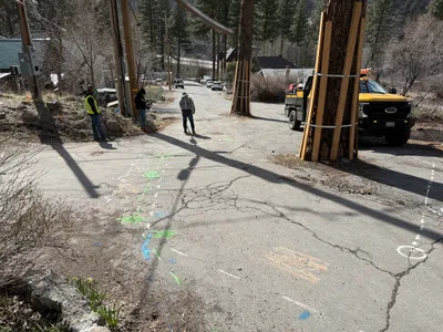
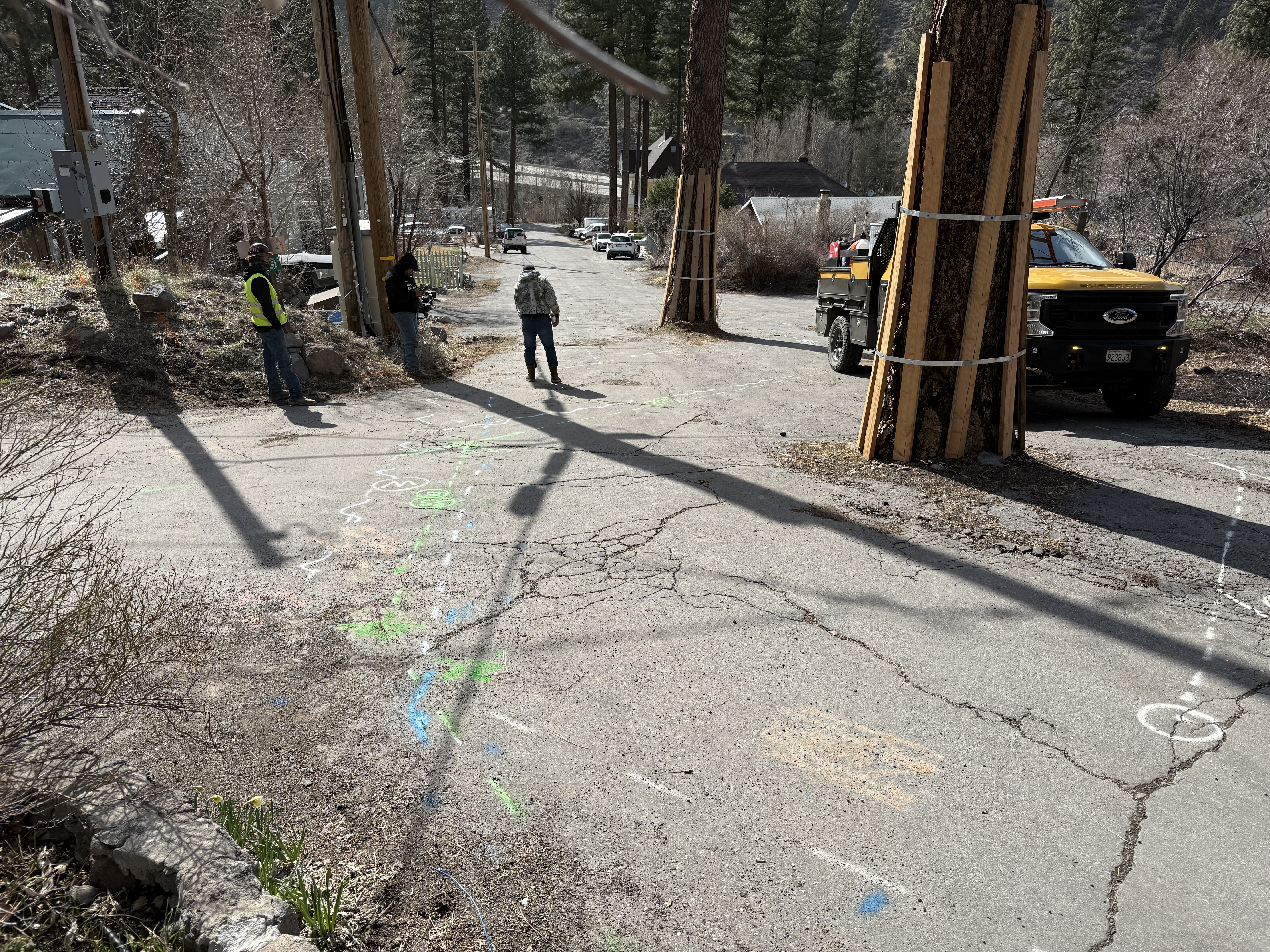
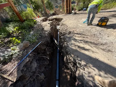
The image shows utility markings on a cracked asphalt road, with three individuals beside utility poles. A truck is on the road, near trees with protective wooden planks. Brightly colored markings indicate underground utilities across the pavement.
survey-layout
cracked asphalt clear daylight road access is partially obstructed
Safety PPE is visible, but no physical safety controls are seen.
Equipment & Materials
AI Tags
Analyzed Apr 21, 2026
Nearby Photos
1m
trenching
trenchingexcavation
tracked loader
1m
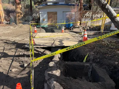
excavation
utility-locatingpotholing
pipe
2m
other
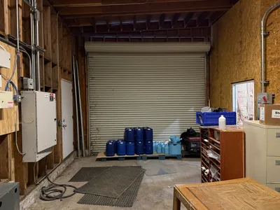
storage-setupchemical-barrels
chemical-barrels
2m
trenching
trenchingutility-trenching
plywood

2m
site grading
gradingsite-preparation
dirt
2m
trenching
trenchingpipeline-installation
portable-generator
2m
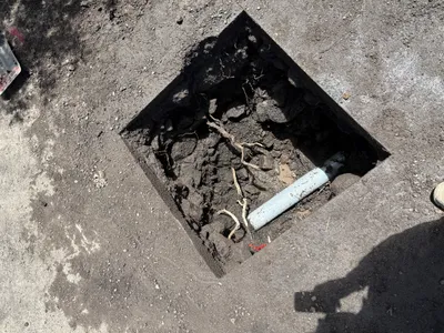
excavation
utility-locatingexcavation
pipe
2m
excavation
pothole-utility-locatingexcavation
excavator
2m
trenching
trench-measurementtrench
excavator
3m
site grading
site-gradingsoil-compaction
compacting-machine