
No caption
IMG_1640.JPG
Details
Tuesday, November 18, 2025 · 11:10 AM
39.39474, -120.02077· 1663m
Location Context
1 / 5
USGS Topo
No elevation data
FEMA Flood
No flood data
OSM Infra
No address data
USDA Soil
No soil data
USGS Hydro
No hydro data
Apple iPhone 16 Pro
iPhone 16 Pro back triple camera 2.22mm f/2.2
2.220000028611935mmf/2.21/99sISO 200
Flash did not fire, compulsory flash mode
Show all EXIF (43 fields)
ApertureValue2.2750
BrightnessValue4.1536
ColorSpace65535
CompositeImageGeneral Composite Image
ExifImageHeight3024
ExifVersion2.3.2
ExposureCompensation0
ExposureModeAuto
ExposureProgramNormal program
FlashpixVersion1.0
FocalLengthIn35mmFormat14
GPSDateStamp2025:11:18
GPSDestBearing107.4531
GPSDestBearingRefTrue North
GPSHPositioningError14.0461
GPSImgDirection107.4531
GPSImgDirectionRefT
GPSSpeed0.3256
GPSSpeedRefK
GPSTimeStamp19:10:23
HostComputeriPhone 16 Pro
latitude39.3947
LensInfo2.2200, 15.6600, 1.7800, 2.8000
LensMakeApple
longitude-120.0208
MeteringModePattern
ModifyDate2025-11-18T11:10:24.000Z
OffsetTime-08:00
OffsetTimeDigitized-08:00
OffsetTimeOriginal-08:00
ResolutionUnitinches
SceneCaptureTypeStandard
SceneTypeDirectly photographed
SensingMethodOne-chip color area sensor
ShutterSpeedValue6.6325
Software26.1
SubjectArea{"0":2002,"1":1511,"2":2218,"3":1328}
SubSecTimeDigitized214
SubSecTimeOriginal214
WhiteBalanceAuto
XResolution72
YCbCrPositioning1
YResolution72
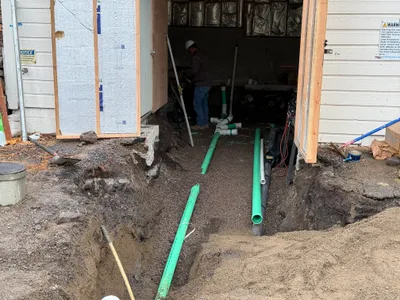
AI Analysis
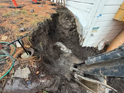
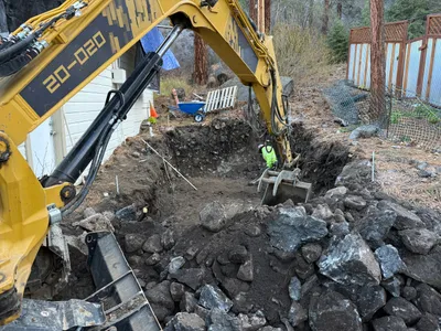
The image shows an excavation next to a building with exposed soil and roots. An excavator is visible on the right side of the image actively digging. A pipe with a partially open top is near the left edge, possibly indicating utility work. Cones are seen further back indicating some controlled area.
excavation
soil with pine needles overcast daylight limited space next to structure
Cones are visible indicating controlled access areas, open trench presents a hazard.
Analyzed Apr 21, 2026
Nearby Photos
1m
other
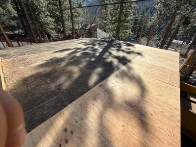
roof-sheathingplywood-installation
plywood
1m
other
roadwaypropane-tank
white car
1m
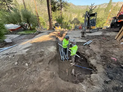
trenching
conduit-installationpipe-laying
excavator
1m
trenching
trenchingpipeline-installation
shovel
1m
excavation
excavationdigging
shovel
3m
trenching
trenchingconcrete-removal
excavator
3m
excavation
excavationasphalt
asphalt
3m
excavation
excavationdigging
backhoe
3m
trenching
trenchingdigging
shovel
3m
pipeline installation
pipe-fittingpipeline-installation
shovel