IMG_2768.JPG

No caption

IMG_2768.JPG

Tags

Details

Friday, January 30, 2026 · 12:17 PM

39.39086, -120.02130· 1686m

Location Context

1 / 5

USGS Topo

No elevation data

FEMA Flood

No flood data

OSM Infra

No address data

USDA Soil

No soil data

USGS Hydro

No hydro data

Apple iPhone 16 Pro
iPhone 16 Pro back triple camera 6.765mm f/1.78
6.764999865652793mmf/1.7799999713880651/5319sISO 80
Flash did not fire, compulsory flash mode
Show all EXIF (43 fields)
ApertureValue1.6638
BrightnessValue9.9146
ColorSpace65535
CompositeImageGeneral Composite Image
ExifImageHeight4284
ExifVersion2.3.2
ExposureCompensation0
ExposureModeAuto
ExposureProgramNormal program
FlashpixVersion1.0
FocalLengthIn35mmFormat24
GPSDateStamp2026:01:30
GPSDestBearing202.3643
GPSDestBearingRefTrue North
GPSHPositioningError13.9572
GPSImgDirection202.3643
GPSImgDirectionRefT
GPSSpeed0
GPSSpeedRefK
GPSTimeStamp20:17:20
HostComputeriPhone 16 Pro
latitude39.3909
LensInfo2.2200, 15.6600, 1.7800, 2.8000
LensMakeApple
longitude-120.0213
MeteringModePattern
ModifyDate2026-01-30T12:17:21.000Z
OffsetTime-08:00
OffsetTimeDigitized-08:00
OffsetTimeOriginal-08:00
ResolutionUnitinches
SceneCaptureTypeStandard
SceneTypeDirectly photographed
SensingMethodOne-chip color area sensor
ShutterSpeedValue12.3770
Software26.2.1
SubjectArea{"0":2853,"1":2140,"2":3142,"3":1881}
SubSecTimeDigitized443
SubSecTimeOriginal443
WhiteBalanceAuto
XResolution72
YCbCrPositioning1
YResolution72

AI Analysis

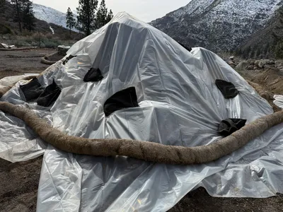
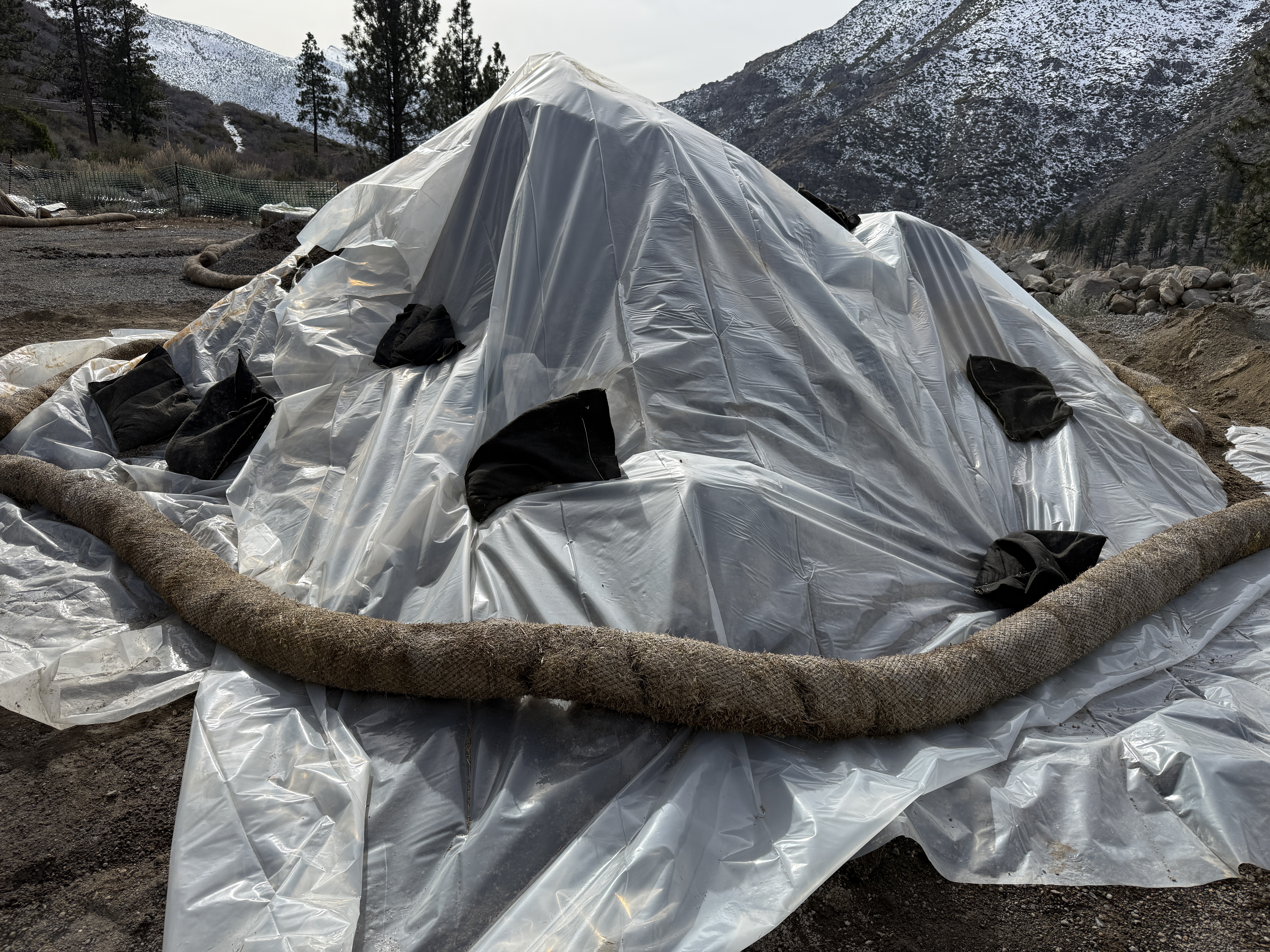
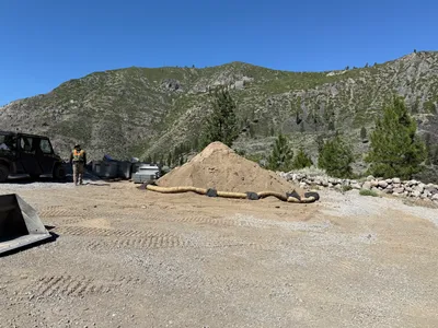
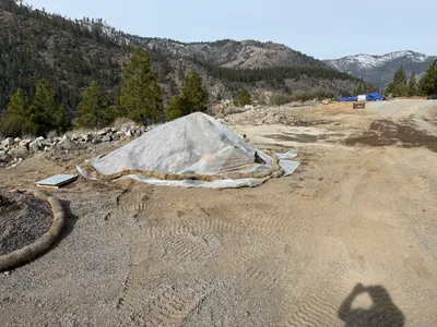
The image shows an erosion control setup at the Floriston Filtration Project site. The setup is covered with plastic sheeting and secured with weighted bags and erosion control barriers. The area is surrounded by natural terrain with visible snow on higher ground. This setup suggests measures for sediment control in a construction area.

swppp-erosion-control
natural terrain with some snow overcast with snow on higher terrain accessible setup in outdoor terrain
No specific safety features are visible in the frame.

Analyzed Apr 21, 2026