No caption
IMG_0513.JPG
Details
Friday, September 26, 2025 · 2:38 PM
39.39139, -120.02121· 1682m
Location Context
1 / 5
USGS Topo
No elevation data
FEMA Flood
No flood data
OSM Infra
No address data
USDA Soil
No soil data
USGS Hydro
No hydro data
Apple iPhone 16 Pro
iPhone 16 Pro back triple camera 2.22mm f/2.2
2.220000028611935mmf/2.21/4425sISO 50
Flash did not fire, compulsory flash mode
Show all EXIF (43 fields)
ApertureValue2.2750
BrightnessValue10.6854
ColorSpace65535
CompositeImageGeneral Composite Image
ExifImageHeight3024
ExifVersion2.3.2
ExposureCompensation0
ExposureModeAuto
ExposureProgramNormal program
FlashpixVersion1.0
FocalLengthIn35mmFormat14
GPSDateStamp2025:09:26
GPSDestBearing63.1200
GPSDestBearingRefTrue North
GPSHPositioningError15.0442
GPSImgDirection63.1200
GPSImgDirectionRefT
GPSSpeed0.0418
GPSSpeedRefK
GPSTimeStamp21:38:48
HostComputeriPhone 16 Pro
latitude39.3914
LensInfo2.2200, 15.6600, 1.7800, 2.8000
LensMakeApple
longitude-120.0212
MeteringModePattern
ModifyDate2025-09-26T14:38:49.000Z
OffsetTime-07:00
OffsetTimeDigitized-07:00
OffsetTimeOriginal-07:00
ResolutionUnitinches
SceneCaptureTypeStandard
SceneTypeDirectly photographed
SensingMethodOne-chip color area sensor
ShutterSpeedValue12.1114
Software26.0
SubjectArea{"0":2002,"1":1508,"2":2218,"3":1328}
SubSecTimeDigitized952
SubSecTimeOriginal952
WhiteBalanceAuto
XResolution72
YCbCrPositioning1
YResolution72
AI Analysis
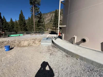
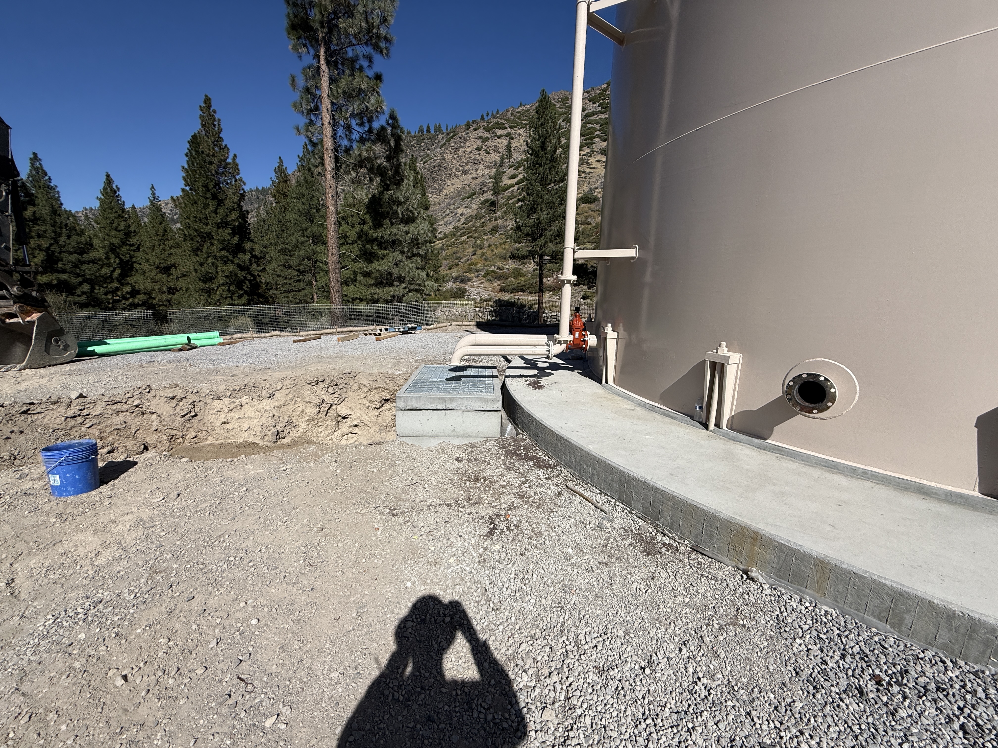
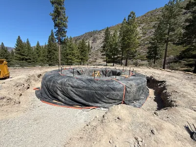
A large finished water tank is prominently featured on the right side of the image, with connected piping leading to an overflow pipe. The area surrounding the tank consists of gravel and concrete. A blue bucket is visible on the ground to the left, indicating active site work. Trees and hills serve as the backdrop.
other
gravel and concrete area clear weather with good lighting sufficient space for access
No specific PPE or safety controls are visible in the frame.
AI Tags
Analyzed Apr 21, 2026
Nearby Photos
0m
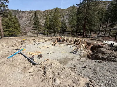
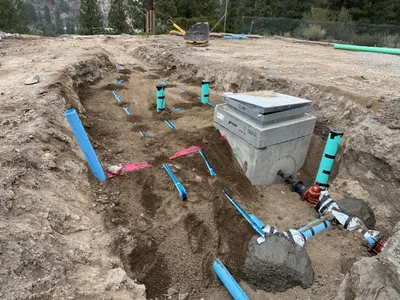
excavation
excavationformwork-setup
leveling-tripod
0m
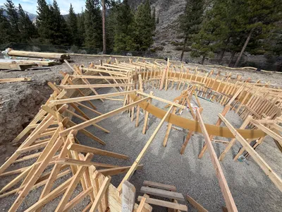
rebar formwork
formwork-constructiontank-foundation-preparation
wood
1m
excavation
tank-foundation-preparationexcavation-work
excavator
1m
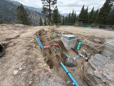
trenching
trenchingpipe-installation
gravel
1m
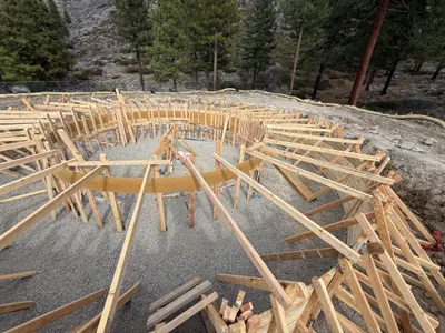
rebar formwork
formwork-installationfoundation-preparation
wooden-planks
1m
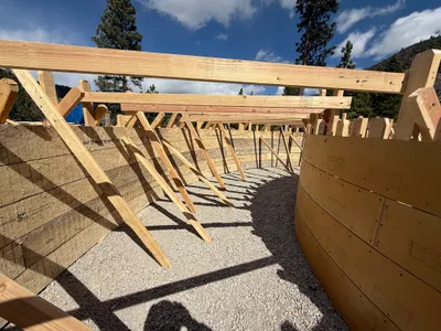
rebar formwork
formwork-constructionwall-preparation
wood
1m
pipeline installation
pipe-installationtrenching
concrete
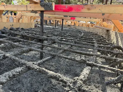
1m
concrete work
concrete-pouringrebar-installation
concrete

1m
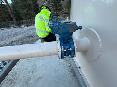
mechanical installation
valve-installationmechanical-work
valve
1m
mechanical installation
valve-installationpipeline-connection
valve