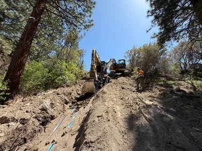
No caption
IMG_7710.JPG
Details
Friday, May 9, 2025 · 3:42 PM
39.39168, -120.02190· 1646m
Location Context
1 / 5
USGS Topo
No elevation data
FEMA Flood
No flood data
OSM Infra
No address data
USDA Soil
No soil data
USGS Hydro
No hydro data
Apple iPhone 16 Pro
iPhone 16 Pro back triple camera 6.765mm f/1.78
6.764999865652793mmf/1.7799999713880651/1689sISO 80
Flash did not fire, compulsory flash mode
Show all EXIF (43 fields)
ApertureValue1.6638
BrightnessValue8.2792
ColorSpace65535
CompositeImageGeneral Composite Image
ExifImageHeight4284
ExifVersion2.3.2
ExposureCompensation0
ExposureModeAuto
ExposureProgramNormal program
FlashpixVersion1.0
FocalLengthIn35mmFormat24
GPSDateStamp2025:05:09
GPSDestBearing50.4008
GPSDestBearingRefTrue North
GPSHPositioningError543.0222
GPSImgDirection50.4008
GPSImgDirectionRefT
GPSSpeed0
GPSSpeedRefK
GPSTimeStamp22:42:45
HostComputeriPhone 16 Pro
latitude39.3917
LensInfo2.2200, 15.6600, 1.7800, 2.8000
LensMakeApple
longitude-120.0219
MeteringModePattern
ModifyDate2025-05-09T15:42:48.000Z
OffsetTime-07:00
OffsetTimeDigitized-07:00
OffsetTimeOriginal-07:00
ResolutionUnitinches
SceneCaptureTypeStandard
SceneTypeDirectly photographed
SensingMethodOne-chip color area sensor
ShutterSpeedValue10.7221
Software18.5
SubjectArea{"0":2851,"1":2137,"2":3141,"3":1884}
SubSecTimeDigitized959
SubSecTimeOriginal959
WhiteBalanceAuto
XResolution72
YCbCrPositioning1
YResolution72
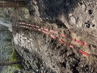
AI Analysis
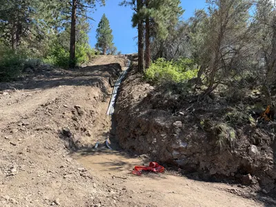
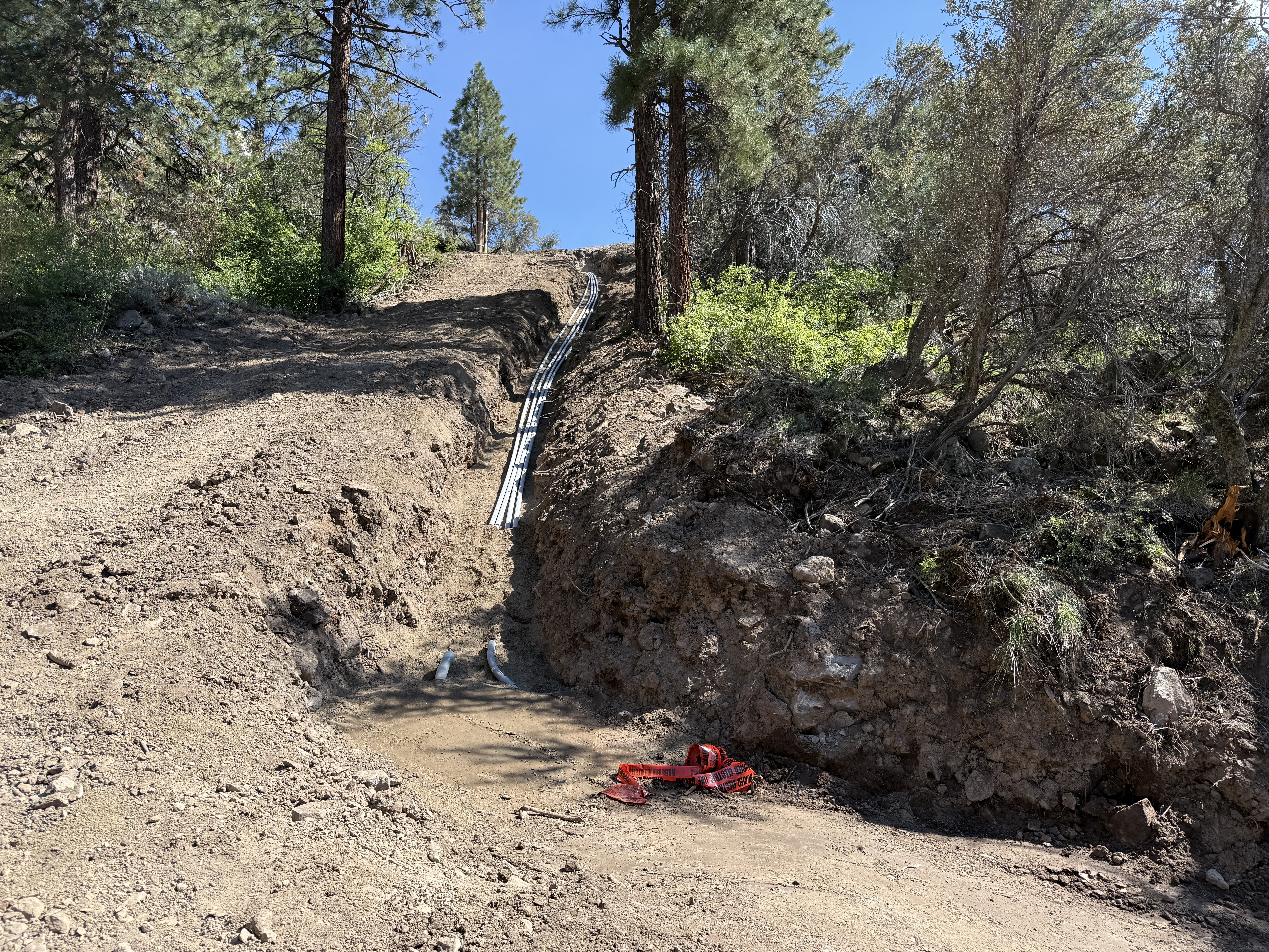
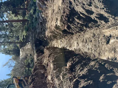
The image shows a trench running up a slope in a wooded environment with multiple conduits installed. The trench is partially filled with water and is lined with trees on both sides. There is caution tape nearby, indicating some form of safety control, while the area seems to have been recently excavated.
trenching
dirt slope with tree surroundings clear weather with daylight open access with no visible congestion
Safety controls such as caution tape are visible; open trench and uneven ground represent potential hazards.
Equipment & Materials
AI Tags
Analyzed Apr 21, 2026
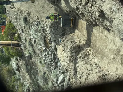
Nearby Photos
13m
trenching
trenchingpipeline
excavator
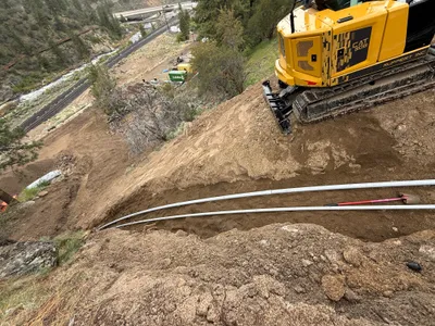
13m
trenching
trenchingpipe-repair
broken blue pipes
17m
trenching
trenchingduct-bank-excavation
skid-steer loader
17m
trenching
trenchingexcavation
excavator
18m
trenching
trenchingcompacting
excavator
18m
trenching
trenchingexcavation
excavator
18m
swppp erosion control
erosion-controlswppp
excavator
18m
site grading
site-gradingland-clearing
tracked-excavator
18m
trenching
trenchingutility-installation
soil
18m
trenching
trenchingutility-warning
excavator or similar equipment