No caption
IMG_8120.JPG
Details
Thursday, May 29, 2025 · 11:08 AM
39.39289, -120.02264· 1629m
Location Context
1 / 5
USGS Topo
No elevation data
FEMA Flood
No flood data
OSM Infra
No address data
USDA Soil
No soil data
USGS Hydro
No hydro data
Apple iPhone 16 Pro
iPhone 16 Pro back triple camera 6.765mm f/1.78
6.764999865652793mmf/1.7799999713880651/4098sISO 64
Flash did not fire, compulsory flash mode
Show all EXIF (43 fields)
ApertureValue1.6638
BrightnessValue9.7813
ColorSpace65535
CompositeImageGeneral Composite Image
ExifImageHeight3024
ExifVersion2.3.2
ExposureCompensation0
ExposureModeAuto
ExposureProgramNormal program
FlashpixVersion1.0
FocalLengthIn35mmFormat48
GPSDateStamp2025:05:29
GPSDestBearing171.7274
GPSDestBearingRefTrue North
GPSHPositioningError10.1748
GPSImgDirection171.7274
GPSImgDirectionRefT
GPSSpeed0.1000
GPSSpeedRefK
GPSTimeStamp18:8:14
HostComputeriPhone 16 Pro
latitude39.3929
LensInfo2.2200, 15.6600, 1.7800, 2.8000
LensMakeApple
longitude-120.0226
MeteringModePattern
ModifyDate2025-05-29T11:08:14.000Z
OffsetTime-07:00
OffsetTimeDigitized-07:00
OffsetTimeOriginal-07:00
ResolutionUnitinches
SceneCaptureTypeStandard
SceneTypeDirectly photographed
SensingMethodOne-chip color area sensor
ShutterSpeedValue12.0008
Software18.5
SubjectArea{"0":2011,"1":1508,"2":1106,"3":665}
SubSecTimeDigitized596
SubSecTimeOriginal596
WhiteBalanceAuto
XResolution72
YCbCrPositioning1
YResolution72
AI Analysis
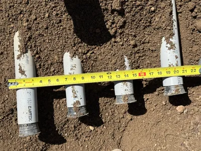
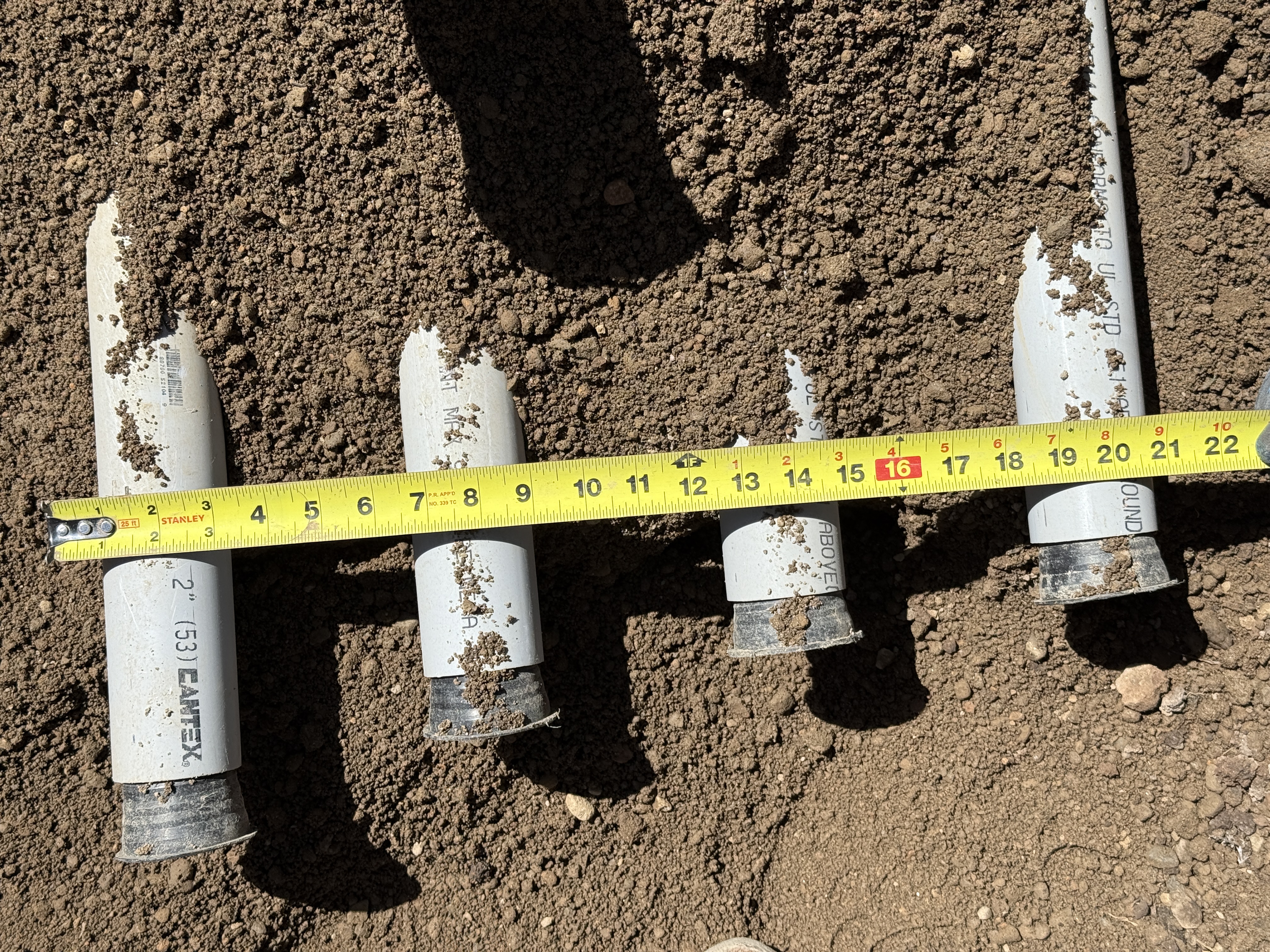
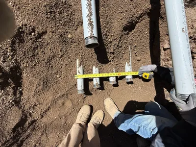
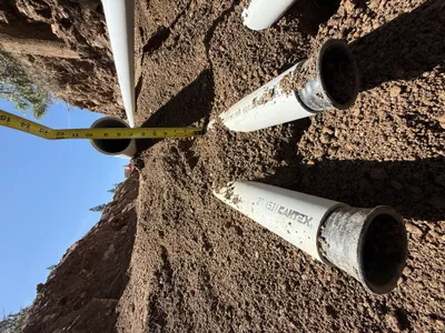
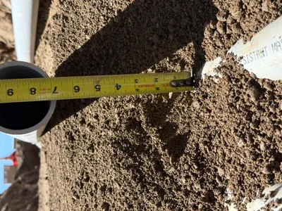
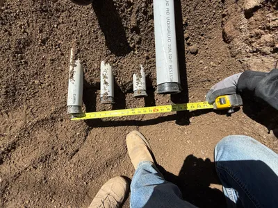
The image shows several pieces of capped PVC pipes partially embedded in sandy soil. A measuring tape is laid across the pipes, indicating their spacing and length. The pipes have dirt on them, suggesting recent excavation or preparation activity. No definitive reference to their diameter or intended use is visible.
other
sandy soil bright sunlight, clear shadows clear access for measurement
Safety features are not visible in frame.
Equipment & Materials
Analyzed Apr 21, 2026
Nearby Photos
0m
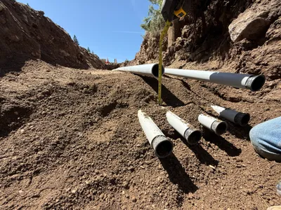
pipeline installation
measurementpipe-assessment
measuring tape
1m
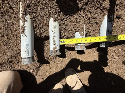
excavation
conduit-inspectiondamage-assessment
tape-measure
2m
pipeline installation
measuringpipe-measurement
tape measure
2m
pipeline installation
pipe-installationmeasurement
measuring-tape
2m
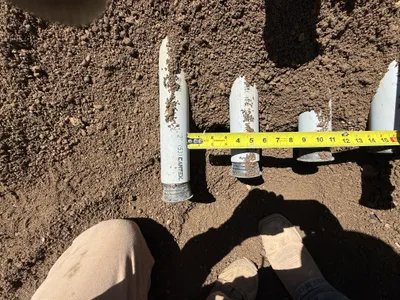
electrical
conduit-measurementconduit-assessment
measuring tape
2m
other
measurementconduit-inspection
measuring-tape
2m
pipeline installation
conduit-installationtrenching
measuring tape
2m
pipeline installation
depth-measurementpipeline-depth-check
tape measure
3m
pipeline installation
pipeline-installationpipe-laying
tracked-loader
4m
trenching
measurementconduit-measurement
measuring-tape