No caption
IMG_8118.JPG
Details
Thursday, May 29, 2025 · 11:08 AM
39.39288, -120.02265· 1630m
Location Context
1 / 5
USGS Topo
No elevation data
FEMA Flood
No flood data
OSM Infra
No address data
USDA Soil
No soil data
USGS Hydro
No hydro data
Apple iPhone 16 Pro
iPhone 16 Pro back triple camera 2.22mm f/2.2
2.220000028611935mmf/2.21/2165sISO 50
Flash did not fire, compulsory flash mode
Show all EXIF (43 fields)
ApertureValue2.2750
BrightnessValue9.1781
ColorSpace65535
CompositeImageGeneral Composite Image
ExifImageHeight3024
ExifVersion2.3.2
ExposureCompensation0
ExposureModeAuto
ExposureProgramNormal program
FlashpixVersion1.0
FocalLengthIn35mmFormat14
GPSDateStamp2025:05:29
GPSDestBearing175.2788
GPSDestBearingRefTrue North
GPSHPositioningError10.0684
GPSImgDirection175.2788
GPSImgDirectionRefT
GPSSpeed0.0720
GPSSpeedRefK
GPSTimeStamp18:8:1
HostComputeriPhone 16 Pro
latitude39.3929
LensInfo2.2200, 15.6600, 1.7800, 2.8000
LensMakeApple
longitude-120.0227
MeteringModePattern
ModifyDate2025-05-29T11:08:02.000Z
OffsetTime-07:00
OffsetTimeDigitized-07:00
OffsetTimeOriginal-07:00
ResolutionUnitinches
SceneCaptureTypeStandard
SceneTypeDirectly photographed
SensingMethodOne-chip color area sensor
ShutterSpeedValue11.0798
Software18.5
SubjectArea{"0":2000,"1":1511,"2":2217,"3":1330}
SubSecTimeDigitized159
SubSecTimeOriginal159
WhiteBalanceAuto
XResolution72
YCbCrPositioning1
YResolution72
AI Analysis
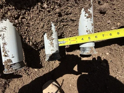
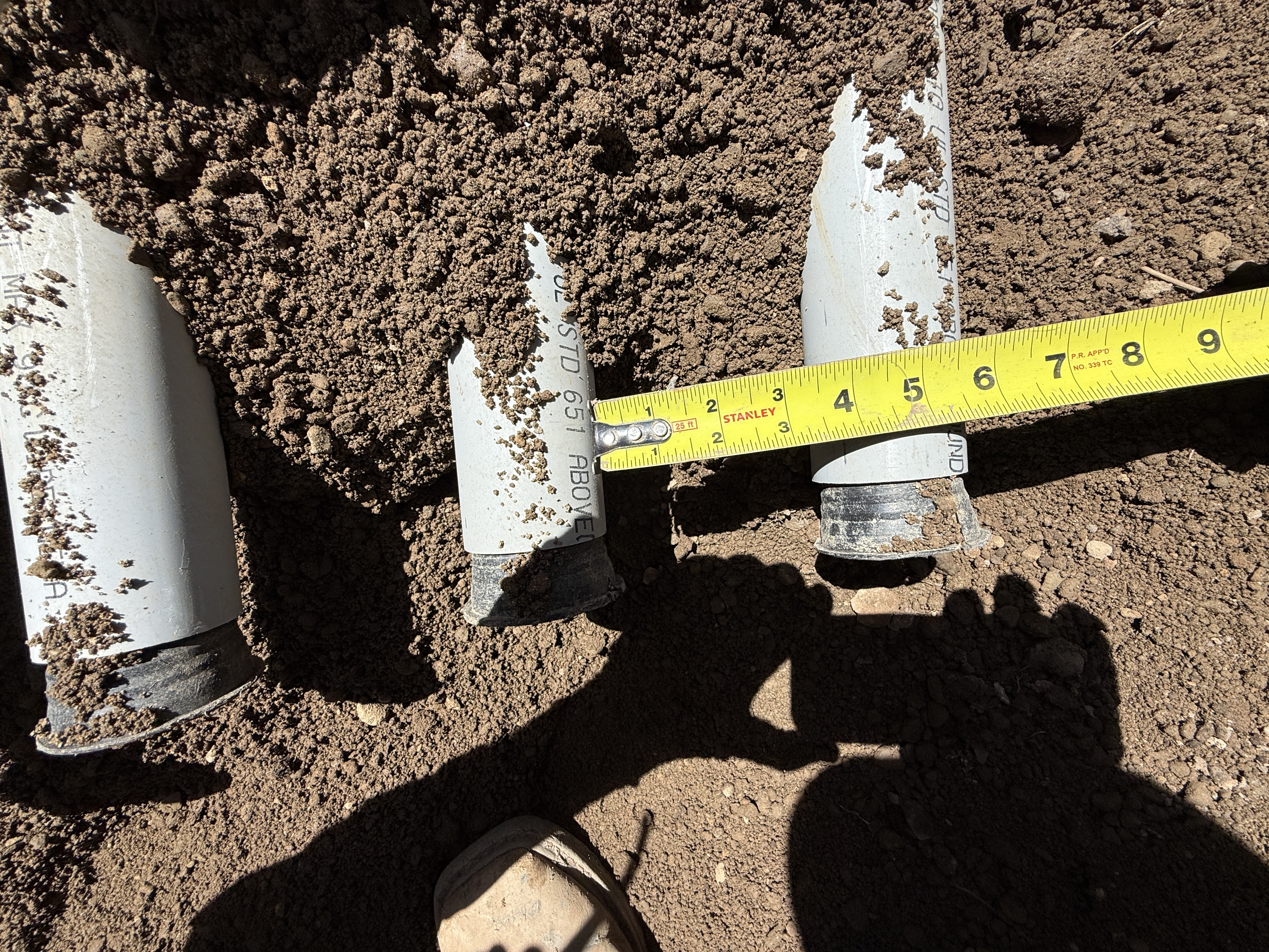
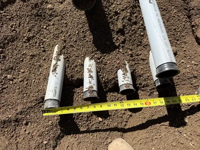
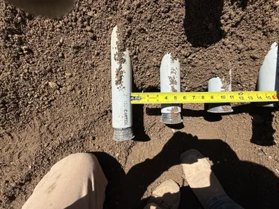
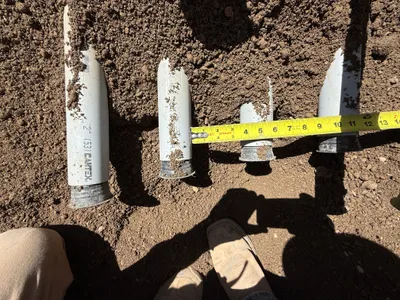
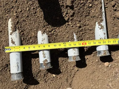
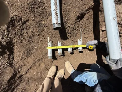
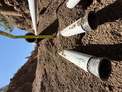
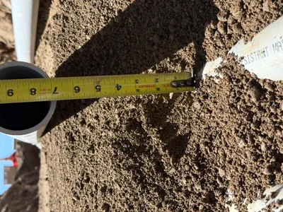
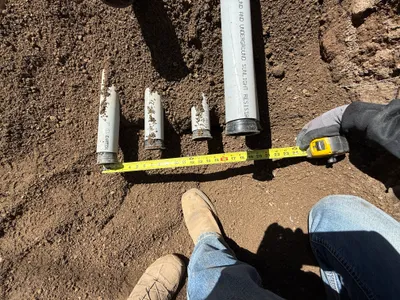
The image shows several damaged sections of electrical conduit, each partially buried in soil. A tape measure, marked in inches, spans across the conduits to measure their exposure or diameter. The conduits are arranged horizontally in an excavated area.
excavation
soil bright, natural lighting open excavation area
No specific safety controls are visible in frame.
Equipment & Materials
AI Tags
Analyzed Apr 21, 2026
Nearby Photos
1m
pipeline installation
measurementpipe-assessment
measuring tape
1m
other
measurementconduit-inspection
measuring-tape
1m
electrical
conduit-measurementconduit-assessment
measuring tape
1m
other
measurementpvc-pipe
measuring-tape
2m
pipeline installation
measuringpipe-measurement
tape measure
2m
pipeline installation
pipe-installationmeasurement
measuring-tape
3m
pipeline installation
conduit-installationtrenching
measuring tape
3m
pipeline installation
depth-measurementpipeline-depth-check
tape measure
3m
trenching
measurementconduit-measurement
measuring-tape
3m
pipeline installation
pipeline-installationpipe-laying
tracked-loader