
No caption
IMG_8688.JPG
Details
Wednesday, July 9, 2025 · 1:41 PM
39.39471, -120.02115· 1653m
Location Context
1 / 5
USGS Topo
No elevation data
FEMA Flood
No flood data
OSM Infra
No address data
USDA Soil
No soil data
USGS Hydro
No hydro data
Apple iPhone 16 Pro
iPhone 16 Pro back triple camera 2.22mm f/2.2
2.220000028611935mmf/2.21/220sISO 64
Flash did not fire, compulsory flash mode
Show all EXIF (43 fields)
ApertureValue2.2750
BrightnessValue6.5563
ColorSpace65535
CompositeImageGeneral Composite Image
ExifImageHeight3024
ExifVersion2.3.2
ExposureCompensation0
ExposureModeAuto
ExposureProgramNormal program
FlashpixVersion1.0
FocalLengthIn35mmFormat14
GPSDateStamp2025:07:09
GPSDestBearing153.7670
GPSDestBearingRefTrue North
GPSHPositioningError14
GPSImgDirection153.7670
GPSImgDirectionRefT
GPSSpeed0.2481
GPSSpeedRefK
GPSTimeStamp20:41:58
HostComputeriPhone 16 Pro
latitude39.3947
LensInfo2.2200, 15.6600, 1.7800, 2.8000
LensMakeApple
longitude-120.0212
MeteringModePattern
ModifyDate2025-07-09T13:41:58.000Z
OffsetTime-07:00
OffsetTimeDigitized-07:00
OffsetTimeOriginal-07:00
ResolutionUnitinches
SceneCaptureTypeStandard
SceneTypeDirectly photographed
SensingMethodOne-chip color area sensor
ShutterSpeedValue7.7793
Software18.5
SubjectArea{"0":2000,"1":1511,"2":2217,"3":1330}
SubSecTimeDigitized639
SubSecTimeOriginal639
WhiteBalanceAuto
XResolution72
YCbCrPositioning1
YResolution72
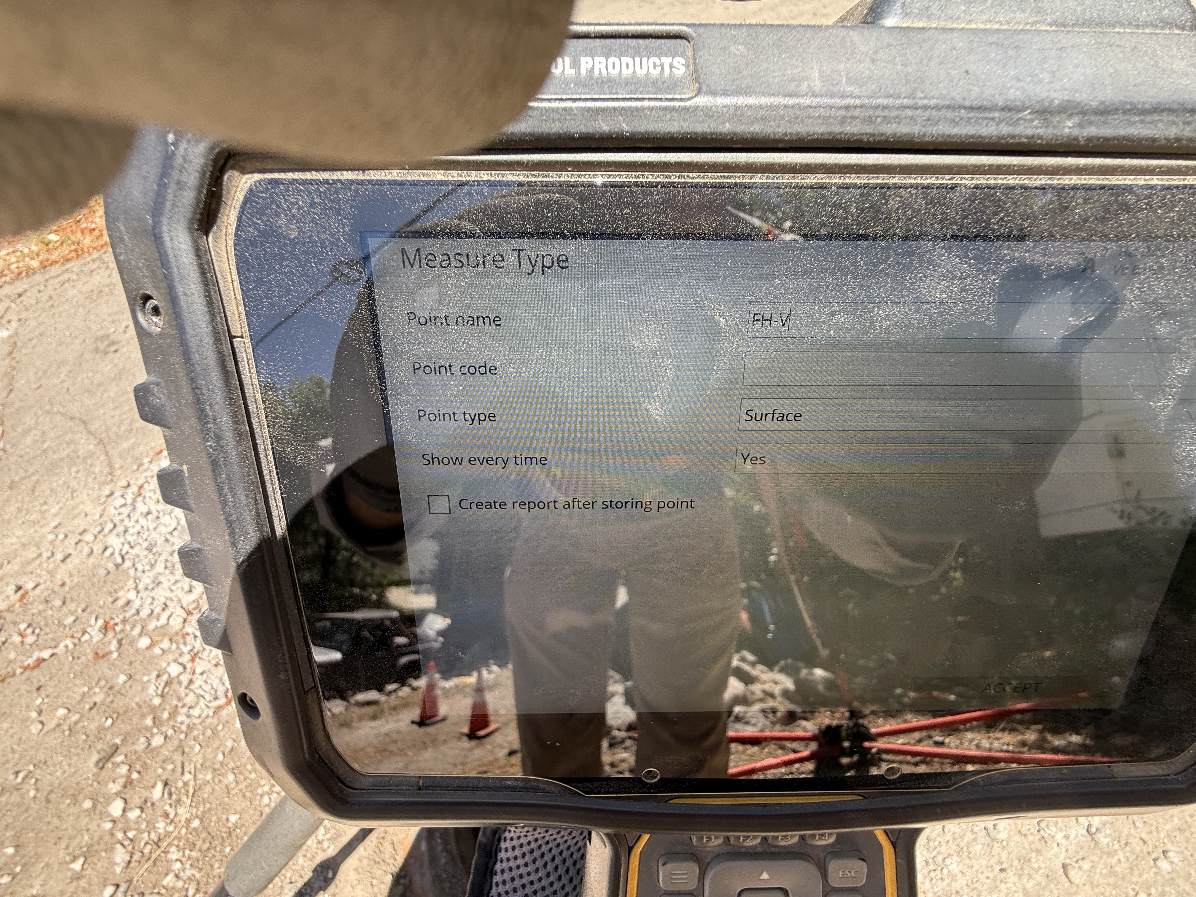
AI Analysis
A device screen is shown with a measure type form containing fields such as point name, point code, and point type. In the reflection, two individuals can be seen standing near traffic cones, suggesting ongoing site work. The form on the screen indicates data input, likely pertaining to surveying or documentation tasks on site.
survey-layout
pavement visible with cones bright and clear lighting conditions no congestion visible near workers
Cones are visible, indicating site safety controls.
Equipment & Materials
Analyzed Apr 21, 2026
Nearby Photos
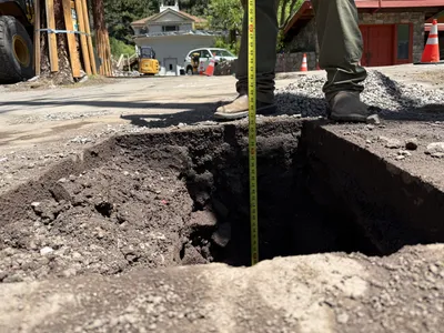
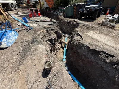
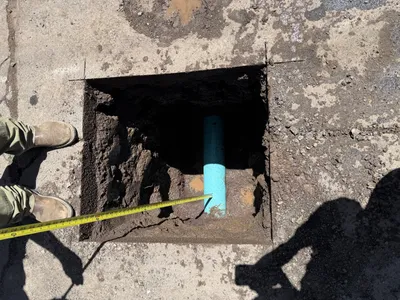
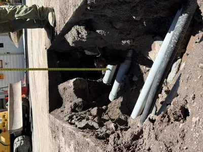
excavation
pothole-utility-locatingdepth-measurement
measuring-tape
1m
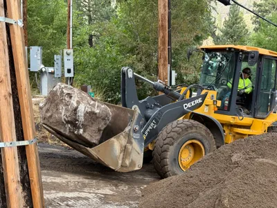
other
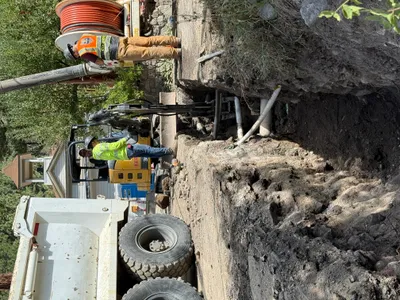
rock-movingloader-operation
front-loader
1m
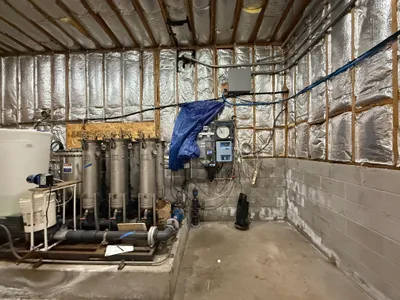
instrumentation controls
equipment-installationmaintenance
filtration-tanks
2m
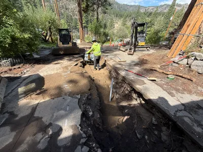
trenching
trenchingpipe-installation
excavator
2m
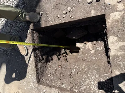
excavation
pothole-utility-locatingpotholing
measuring tape
2m
trenching
trenchingexcavation-work
mini excavator
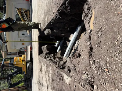
2m
trenching
utility-locatingtrench-measuring
small-excavator
3m
trenching
trench-measurementutility-locating
excavator
3m
excavation
utility-locatingpothole-excavation
tape-measure
3m
trenching
trenchingcompaction
excavator