No caption
IMG_8687.JPG
Details
Wednesday, July 9, 2025 · 1:41 PM
39.39468, -120.02184· 1652m
Location Context
1 / 5
USGS Topo
No elevation data
FEMA Flood
No flood data
OSM Infra
No address data
USDA Soil
No soil data
USGS Hydro
No hydro data
Apple iPhone 16 Pro
iPhone 16 Pro back triple camera 2.22mm f/2.2
2.220000028611935mmf/2.21/2024sISO 50
Flash did not fire, compulsory flash mode
Show all EXIF (43 fields)
ApertureValue2.2750
BrightnessValue9.7181
ColorSpace65535
CompositeImageGeneral Composite Image
ExifImageHeight3024
ExifVersion2.3.2
ExposureCompensation0
ExposureModeAuto
ExposureProgramNormal program
FlashpixVersion1.0
FocalLengthIn35mmFormat14
GPSDateStamp2025:07:09
GPSDestBearing131.2295
GPSDestBearingRefTrue North
GPSHPositioningError43.3473
GPSImgDirection131.2295
GPSImgDirectionRefT
GPSSpeed0
GPSSpeedRefK
GPSTimeStamp20:41:53
HostComputeriPhone 16 Pro
latitude39.3947
LensInfo2.2200, 15.6600, 1.7800, 2.8000
LensMakeApple
longitude-120.0218
MeteringModePattern
ModifyDate2025-07-09T13:41:54.000Z
OffsetTime-07:00
OffsetTimeDigitized-07:00
OffsetTimeOriginal-07:00
ResolutionUnitinches
SceneCaptureTypeStandard
SceneTypeDirectly photographed
SensingMethodOne-chip color area sensor
ShutterSpeedValue10.9832
Software18.5
SubjectArea{"0":2000,"1":1511,"2":2217,"3":1330}
SubSecTimeDigitized155
SubSecTimeOriginal155
WhiteBalanceAuto
XResolution72
YCbCrPositioning1
YResolution72
AI Analysis
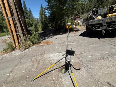
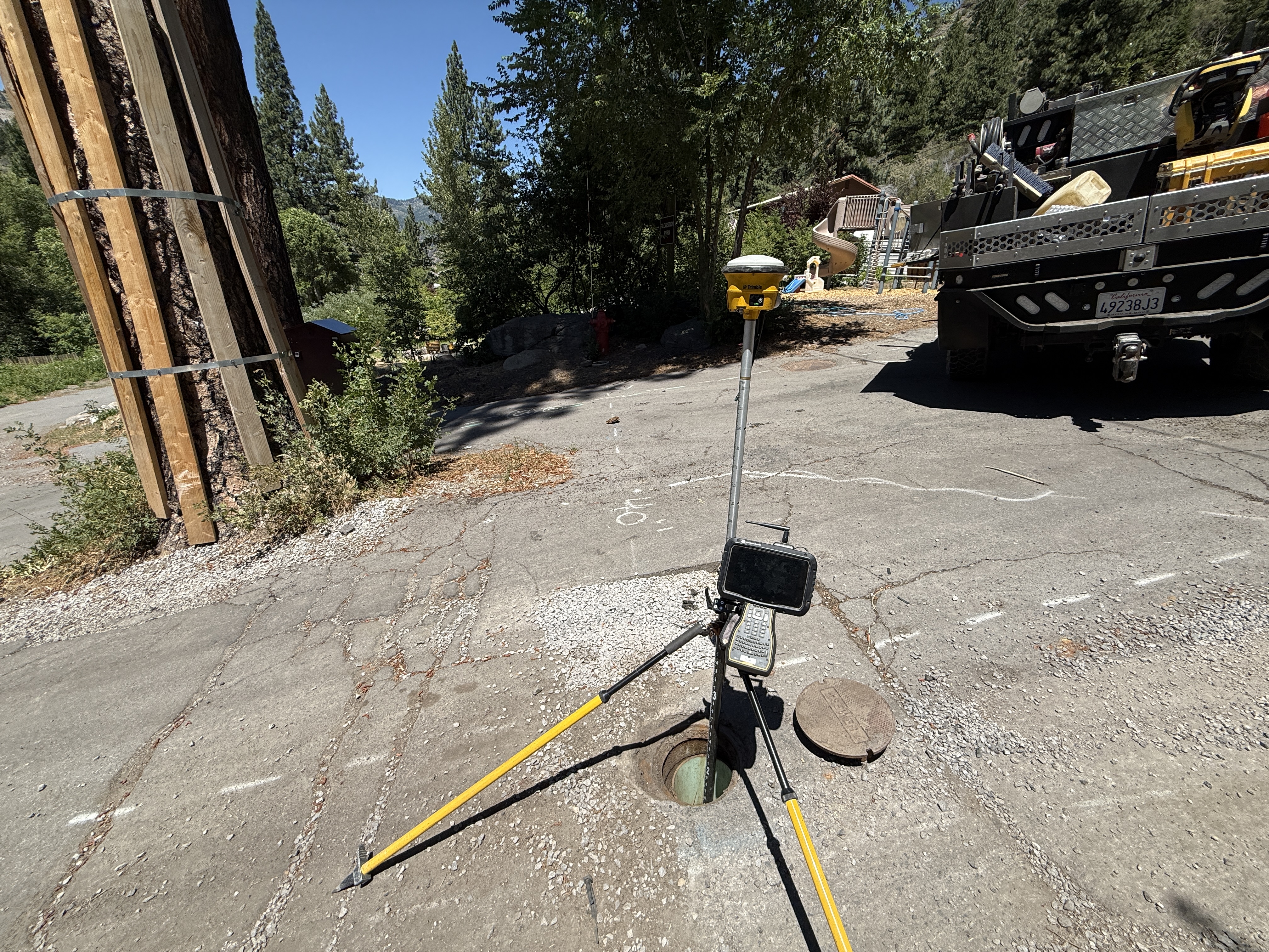
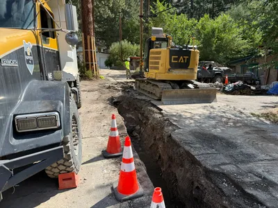
The image shows a survey setup with a tripod-mounted device positioned over an open manhole on a paved surface. To the left, a large tree is supported with wooden braces. A utility truck is parked nearby, partially visible. There is no visible activity of workers in the frame.
survey-layout
paved surface with visible cracks sunny clear day apparently clear access with no visible congestion
Safety features are not visible in frame.
Equipment & Materials
AI Tags
Analyzed Apr 21, 2026
Nearby Photos
3m
excavation
utility-potholingvacuum-excavation
vacuum truck
3m
survey layout
street-surveyingroad-measurement
white-SUV
4m
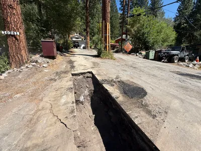
trenching
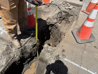
trenchingroadwork
excavator
4m
trenching
trench-measurementmeasuring-tape
measuring-tape
4m
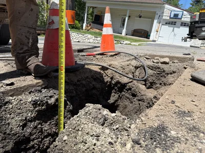
excavation
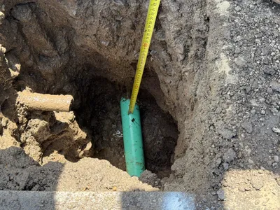
utility-locatingdepth-measurement
measuring-tape
4m
excavation
utility-locatingdepth-measurement
measuring-tape
4m
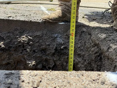
excavation
potholingutility-locating
tape-measure
4m
trenching
trenchingroadwork
jeep-type-vehicle
4m
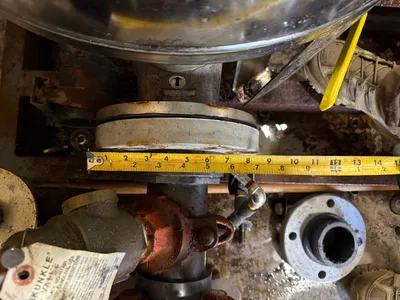
mechanical installation
measurementflange-inspection
measuring-tape
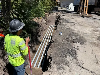
5m
trenching
trenchingconduit-installation
conduit