No caption
IMG_7035.JPG
Details
Monday, April 7, 2025 · 4:05 PM
39.39478, -120.02136· 1648m
Location Context
1 / 5
USGS Topo
No elevation data
FEMA Flood
No flood data
OSM Infra
No address data
USDA Soil
No soil data
USGS Hydro
No hydro data
Apple iPhone 16 Pro
iPhone 16 Pro back triple camera 6.765mm f/1.78
6.764999865652793mmf/1.7799999713880651/5714sISO 80
Flash did not fire, compulsory flash mode
Show all EXIF (43 fields)
ApertureValue1.6638
BrightnessValue10.3175
ColorSpace65535
CompositeImageGeneral Composite Image
ExifImageHeight4284
ExifVersion2.3.2
ExposureCompensation0
ExposureModeAuto
ExposureProgramNormal program
FlashpixVersion1.0
FocalLengthIn35mmFormat24
GPSDateStamp2025:04:07
GPSDestBearing94.7738
GPSDestBearingRefTrue North
GPSHPositioningError3.1889
GPSImgDirection94.7738
GPSImgDirectionRefT
GPSSpeed0.6471
GPSSpeedRefK
GPSTimeStamp23:5:11
HostComputeriPhone 16 Pro
latitude39.3948
LensInfo2.2200, 15.6600, 1.7800, 2.8000
LensMakeApple
longitude-120.0214
MeteringModePattern
ModifyDate2025-04-07T16:05:13.000Z
OffsetTime-07:00
OffsetTimeDigitized-07:00
OffsetTimeOriginal-07:00
ResolutionUnitinches
SceneCaptureTypeStandard
SceneTypeDirectly photographed
SensingMethodOne-chip color area sensor
ShutterSpeedValue12.4804
Software18.4
SubjectArea{"0":2849,"1":2137,"2":3291,"3":1884}
SubSecTimeDigitized393
SubSecTimeOriginal393
WhiteBalanceAuto
XResolution72
YCbCrPositioning1
YResolution72
AI Analysis
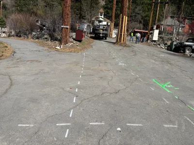
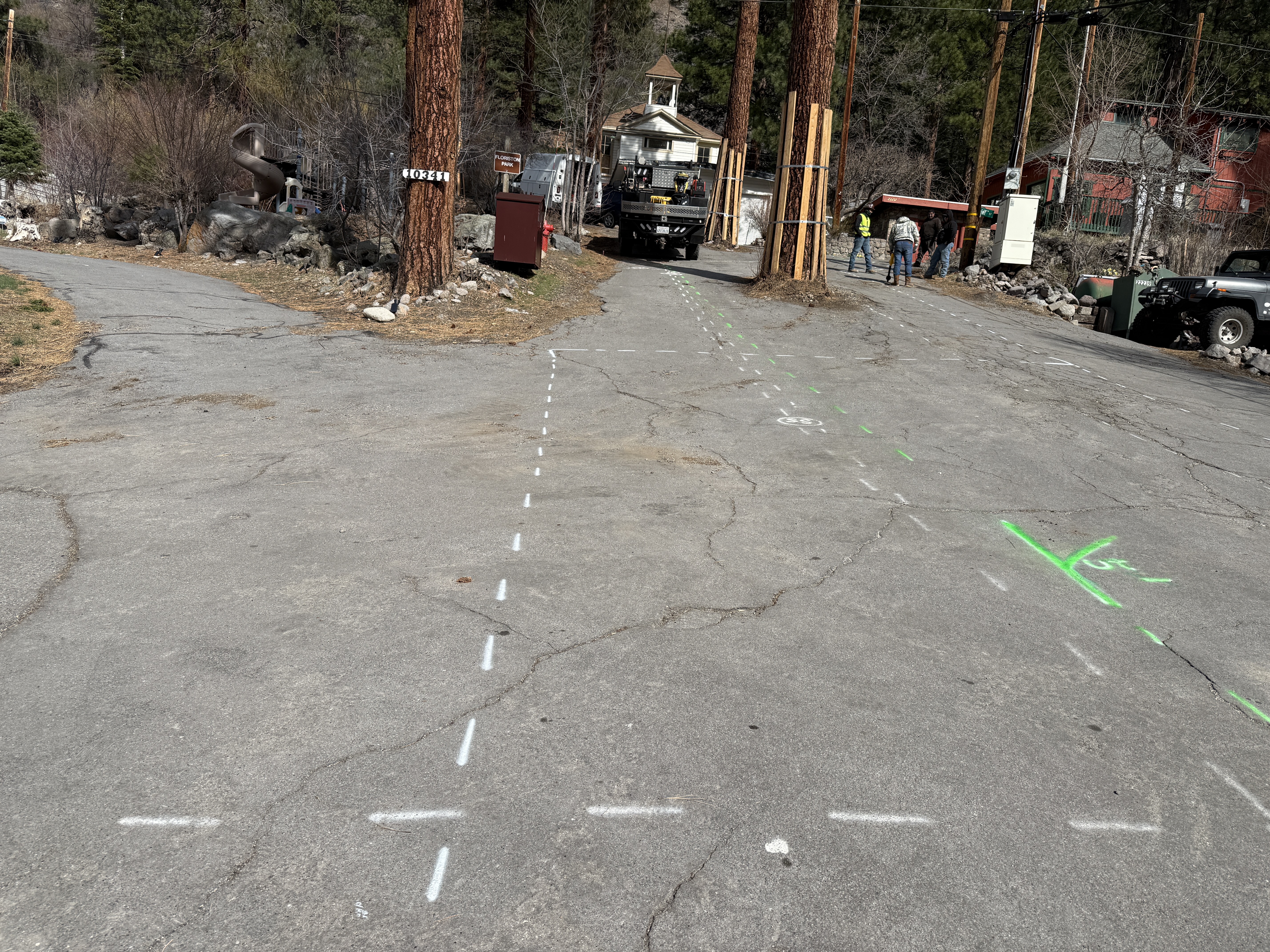
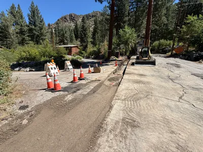
The image shows a section of paved road with white and green painted survey lines and markings. In the background, utility poles and trees are visible, along with a vehicle and three people. The markings suggest potential future excavation or installation activity in the area.
survey-layout
paved roadway daylight with clear conditions open roadway with vehicles present
Hi-vis vests are visible on individuals, but no physical safety controls are visible in the frame.
Equipment & Materials
Analyzed Apr 21, 2026
Nearby Photos
1m
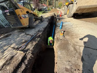
trenching
road-trenchingutility-excavation
excavator
2m
trenching
trenchingsoil-compaction
compactor
2m
trenching
trenchingroadwork
excavator
2m
pipeline installation
pipeline-installationtrenching
skid steer
2m
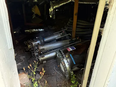
mechanical installation
component-storagecylindrical-components
cylindrical-components
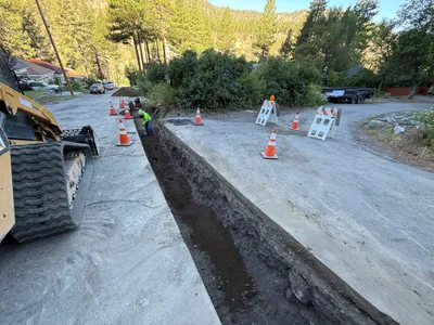
3m
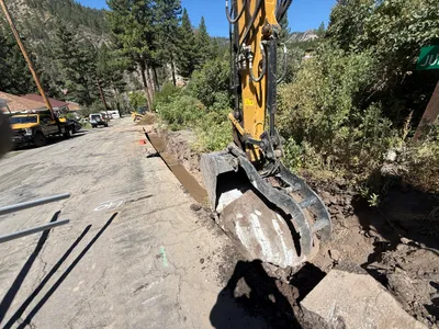
trenching
trenchingexcavation-work
excavator
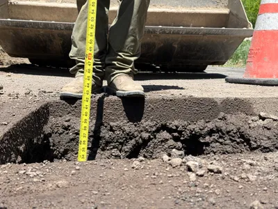
3m
excavation
excavation-depth-measurementutility-locating
measuring-tape
3m
trenching
trenchingtrench
excavator
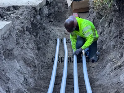
4m
pipeline installation
conduit-installationduct-bank-work
conduit
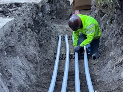
4m
pipeline installation
conduit-installationtrenching
conduits