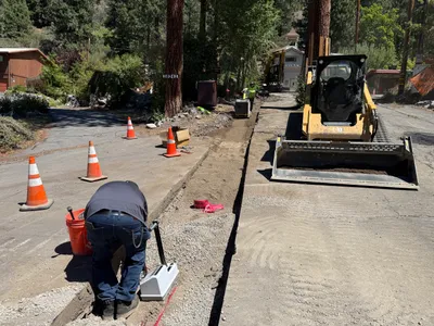
No caption
IMG_7025.JPG
Details
Monday, April 7, 2025 · 3:46 PM
39.39473, -120.02153· 1636m
Location Context
1 / 5
USGS Topo
No elevation data
FEMA Flood
No flood data
OSM Infra
No address data
USDA Soil
No soil data
USGS Hydro
No hydro data
Apple iPhone 16 Pro
iPhone 16 Pro back triple camera 6.765mm f/1.78
6.764999865652793mmf/1.7799999713880651/5319sISO 80
Flash did not fire, compulsory flash mode
Show all EXIF (43 fields)
ApertureValue1.6638
BrightnessValue10.0982
ColorSpace65535
CompositeImageGeneral Composite Image
ExifImageHeight4284
ExifVersion2.3.2
ExposureCompensation0
ExposureModeAuto
ExposureProgramNormal program
FlashpixVersion1.0
FocalLengthIn35mmFormat24
GPSDateStamp2025:04:07
GPSDestBearing91.8579
GPSDestBearingRefTrue North
GPSHPositioningError23.9854
GPSImgDirection91.8579
GPSImgDirectionRefT
GPSSpeed2.0530
GPSSpeedRefK
GPSTimeStamp22:46:57
HostComputeriPhone 16 Pro
latitude39.3947
LensInfo2.2200, 15.6600, 1.7800, 2.8000
LensMakeApple
longitude-120.0215
MeteringModePattern
ModifyDate2025-04-07T15:46:59.000Z
OffsetTime-07:00
OffsetTimeDigitized-07:00
OffsetTimeOriginal-07:00
ResolutionUnitinches
SceneCaptureTypeStandard
SceneTypeDirectly photographed
SensingMethodOne-chip color area sensor
ShutterSpeedValue12.3770
Software18.4
SubjectArea{"0":2851,"1":2137,"2":3141,"3":1884}
SubSecTimeDigitized365
SubSecTimeOriginal365
WhiteBalanceAuto
XResolution72
YCbCrPositioning1
YResolution72
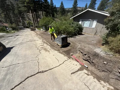
AI Analysis
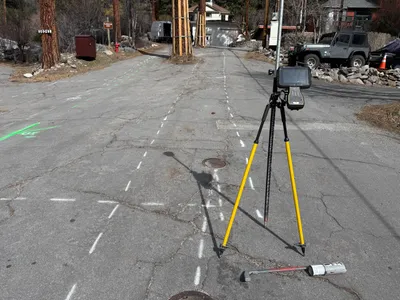
A surveying instrument is mounted on a tripod in the foreground on a paved road. The pavement is marked with white and green spray paint lines and symbols, indicating layout or alignment work. There are no visible active construction activities or personnel nearby. The background includes parked vehicles and some residential structures.
survey-layout
paved road with spray paint markings clear daylight road is unobstructed with survey equipment in place
No safety features are visible in frame.
Equipment & Materials
Analyzed Apr 21, 2026
Nearby Photos
1m
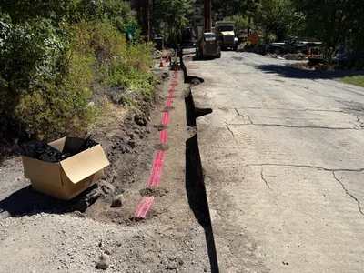
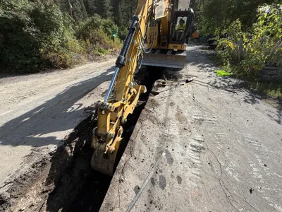
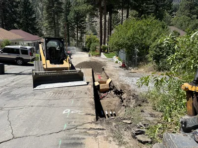
trenching
trenchingroadwork
skid-steer
2m
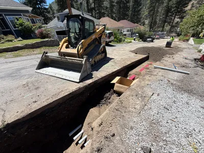
survey layout
waterline-alignmentsurvey-markings
manhole
2m
trenching
trenchingutility-work
excavator
2m
trenching
trenchingroadwork
skid-steer-loader

3m
other
preconstruction-photoschoolhouse
wooden siding
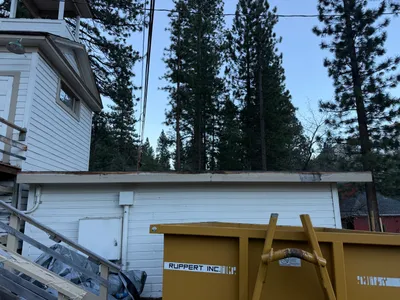
3m
other
white-buildingflat-roof
ladder
3m
trenching
trenchingutility-installation
skid-steer
5m
backfill
compactiontrenching
compactor
5m
trenching
trenchingexcavation
excavator
5m
trenching
trenchingduct-bank-installation
excavator