No caption
IMG_6608.JPG
Details
Friday, March 14, 2025 · 6:33 PM
39.39473, -120.02151· 1492m
Location Context
1 / 5
USGS Topo
No elevation data
FEMA Flood
No flood data
OSM Infra
No address data
USDA Soil
No soil data
USGS Hydro
No hydro data
Apple iPhone 16 Pro
iPhone 16 Pro back triple camera 6.765mm f/1.78
6.764999865652793mmf/1.7799999713880651/654sISO 80
Flash did not fire, compulsory flash mode
Show all EXIF (43 fields)
ApertureValue1.6638
BrightnessValue6.9240
ColorSpace65535
CompositeImageGeneral Composite Image
ExifImageHeight4284
ExifVersion2.3.2
ExposureCompensation0
ExposureModeAuto
ExposureProgramNormal program
FlashpixVersion1.0
FocalLengthIn35mmFormat24
GPSDateStamp2025:03:15
GPSDestBearing268.7636
GPSDestBearingRefTrue North
GPSHPositioningError19.8635
GPSImgDirection268.7636
GPSImgDirectionRefT
GPSSpeed0
GPSSpeedRefK
GPSTimeStamp1:33:25
HostComputeriPhone 16 Pro
latitude39.3947
LensInfo2.2200, 15.6600, 1.7800, 2.8000
LensMakeApple
longitude-120.0215
MeteringModePattern
ModifyDate2025-03-14T18:33:26.000Z
OffsetTime-07:00
OffsetTimeDigitized-07:00
OffsetTimeOriginal-07:00
ResolutionUnitinches
SceneCaptureTypeStandard
SceneTypeDirectly photographed
SensingMethodOne-chip color area sensor
ShutterSpeedValue9.3532
Software18.4
SubjectArea{"0":2851,"1":2137,"2":3141,"3":1884}
SubSecTimeDigitized542
SubSecTimeOriginal542
WhiteBalanceAuto
XResolution72
YCbCrPositioning1
YResolution72
AI Analysis
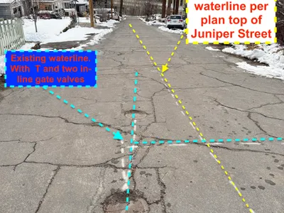
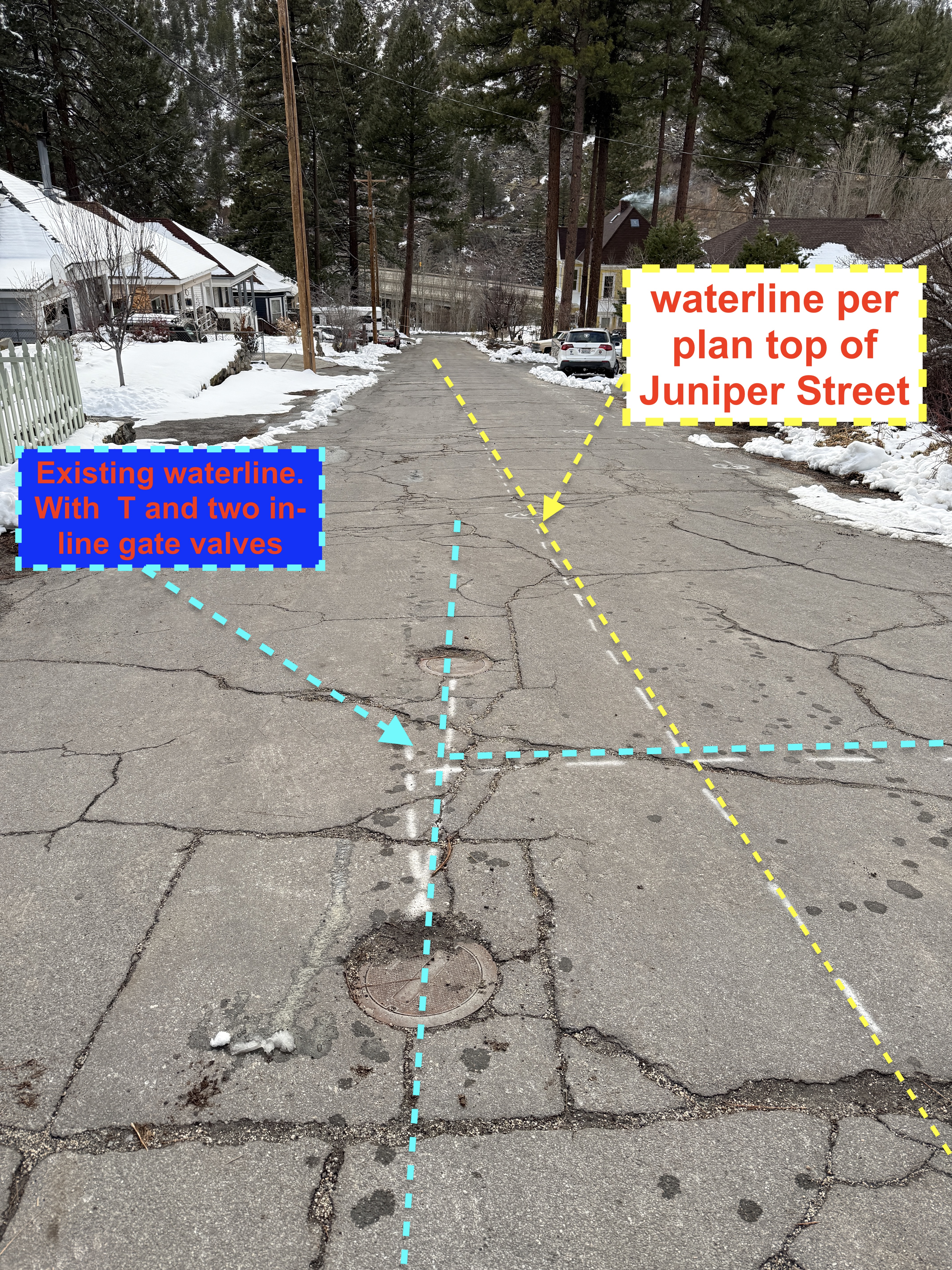
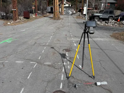
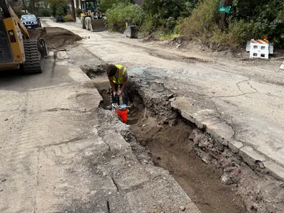
The image displays a section of Juniper Street with markings indicating an existing waterline and a planned waterline. Blue dashed lines mark the existing waterline alignment with a 'T' and gate valves indicated. Yellow dashed lines suggest the planned waterline per plan. The street surface is covered with snow indicating cold weather conditions.
survey-layout
asphalt street with snow patches overcast with snow on the ground open street with residential access
No specific safety features visible in frame.
Equipment & Materials
AI Tags
Analyzed Apr 21, 2026
Nearby Photos
1m
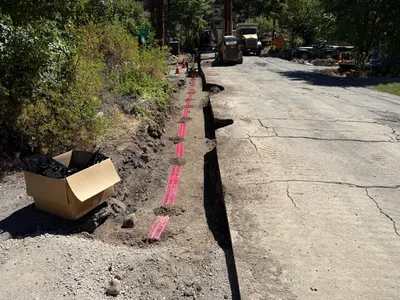
trenching
trenchingutility-installation
skid-steer
1m
other
white-buildingflat-roof
ladder

1m
other
preconstruction-photoschoolhouse
wooden siding
2m
trenching
trenchingutility-work
excavator
2m
survey layout
survey-layoutsurvey-instrument
jeep
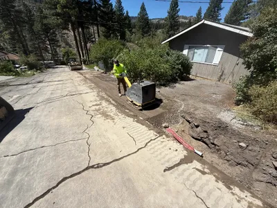
3m
backfill
compactiontrenching
compactor
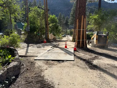
3m
paving surface restoration
road-maintenancesurface-stabilization
construction vehicle
3m
trenching
trenchingroadwork
skid-steer
4m
trenching
trenchingroadwork
skid-steer-loader
4m
trenching
trenchingpipeline-installation
excavator