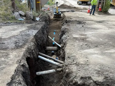
No caption
IMG_7011.JPG
Tags
Details
Monday, April 7, 2025 · 2:08 PM
39.39460, -120.02133· 1644m
Location Context
1 / 5
USGS Topo
No elevation data
FEMA Flood
No flood data
OSM Infra
No address data
USDA Soil
No soil data
USGS Hydro
No hydro data
Apple iPhone 16 Pro
iPhone 16 Pro back triple camera 6.765mm f/1.78
6.764999865652793mmf/1.7799999713880651/1122sISO 80
Flash did not fire, compulsory flash mode
Show all EXIF (43 fields)
ApertureValue1.6638
BrightnessValue8.0012
ColorSpace65535
CompositeImageGeneral Composite Image
ExifImageHeight4284
ExifVersion2.3.2
ExposureCompensation0
ExposureModeAuto
ExposureProgramNormal program
FlashpixVersion1.0
FocalLengthIn35mmFormat24
GPSDateStamp2025:04:07
GPSDestBearing93.8767
GPSDestBearingRefTrue North
GPSHPositioningError37.1346
GPSImgDirection93.8767
GPSImgDirectionRefT
GPSSpeed0
GPSSpeedRefK
GPSTimeStamp21:8:52
HostComputeriPhone 16 Pro
latitude39.3946
LensInfo2.2200, 15.6600, 1.7800, 2.8000
LensMakeApple
longitude-120.0213
MeteringModePattern
ModifyDate2025-04-07T14:08:53.000Z
OffsetTime-07:00
OffsetTimeDigitized-07:00
OffsetTimeOriginal-07:00
ResolutionUnitinches
SceneCaptureTypeStandard
SceneTypeDirectly photographed
SensingMethodOne-chip color area sensor
ShutterSpeedValue10.1323
Software18.4
SubjectArea{"0":2851,"1":2137,"2":3141,"3":1884}
SubSecTimeDigitized130
SubSecTimeOriginal130
WhiteBalanceAuto
XResolution72
YCbCrPositioning1
YResolution72
AI Analysis
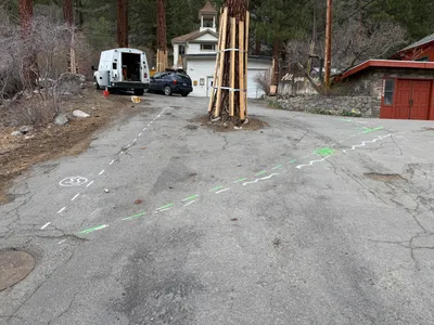
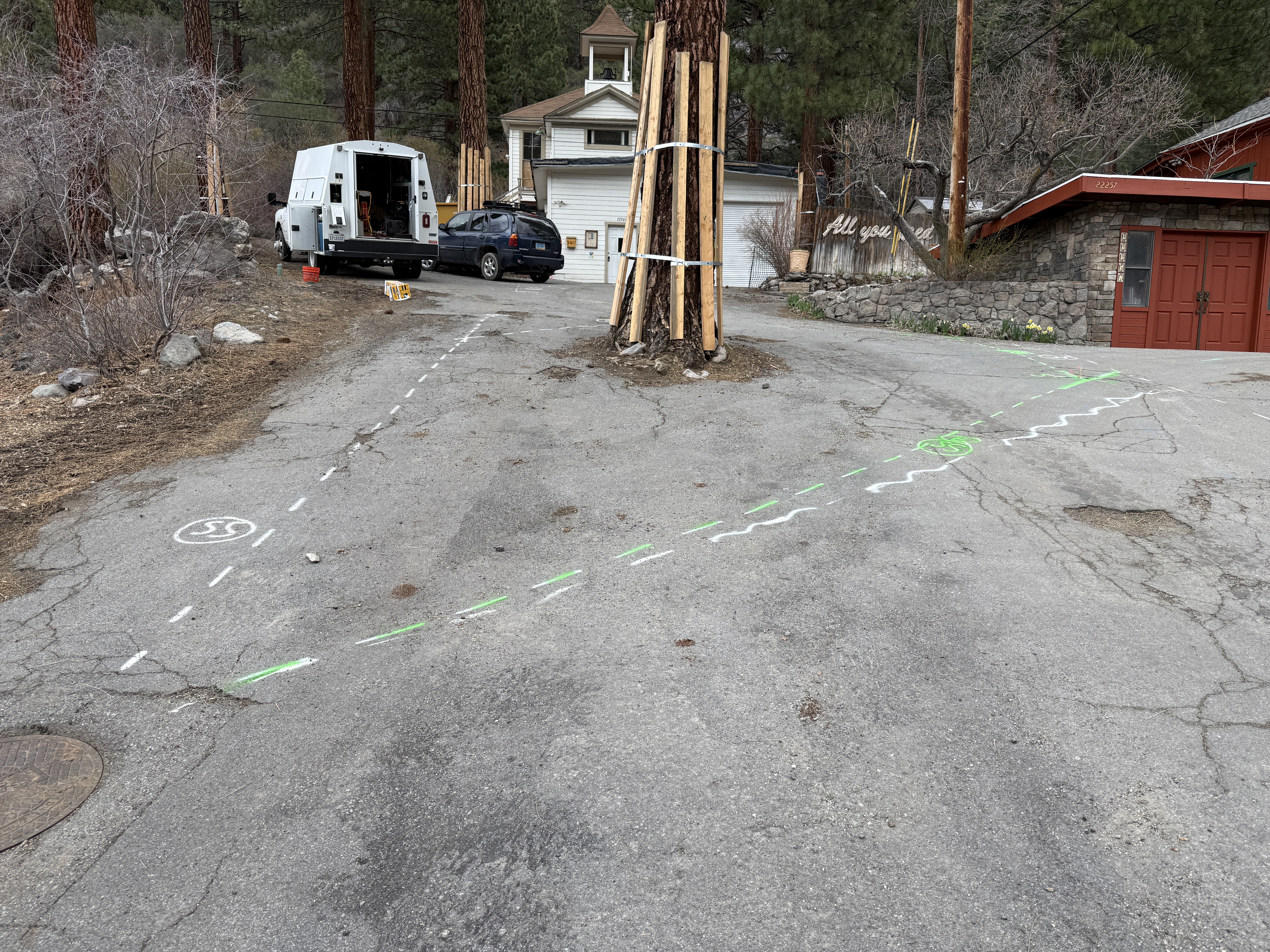
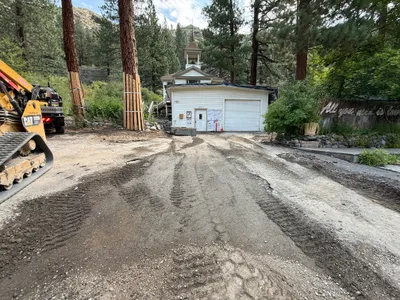
The photo captures pavement with painted markings possibly indicating waterline alignment work. A white van, a parked car, and tree protection structures can be seen. There are no visible signs of active construction work such as trenching or digging. The ground appears to have markings that might relate to a waterline project.
survey-layout
pavement with cracks and markings overcast lighting good access for vehicles; no active laydown
No specific safety features are visible in frame.
Analyzed Apr 21, 2026
Nearby Photos
2m
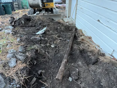
trenching
trenchingpipe
pipe
3m
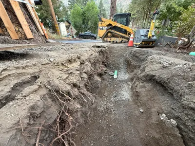
excavation
excavationearth-moving
excavator
3m
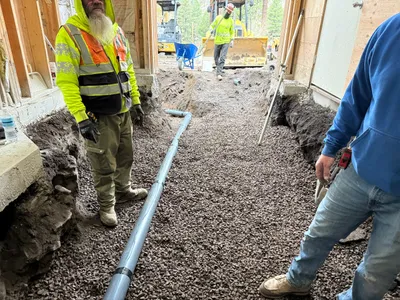
trenching
trenchingutility-work
trencher
4m
trenching
trenchinginspection
hand tools
5m
trenching
trenchingmanual-labor
excavator
5m
trenching
trenchingexcavation
excavator
5m
excavation
excavationsoil-excavation
excavator
6m
pipeline installation
pipeline-installationtrench-work
construction machinery
6m
trenching
trenchingexcavation-work
excavator
6m
site grading
site-preparationearthworks
tracked-loader