No caption
IMG_7001.JPG
Tags
Details
Monday, April 7, 2025 · 12:25 PM
39.39471, -120.02097· 1658m
Location Context
1 / 5
USGS Topo
No elevation data
FEMA Flood
No flood data
OSM Infra
No address data
USDA Soil
No soil data
USGS Hydro
No hydro data
Apple iPhone 16 Pro
iPhone 16 Pro back triple camera 6.765mm f/1.78
6.764999865652793mmf/1.7799999713880651/1091sISO 80
Flash did not fire, compulsory flash mode
Show all EXIF (43 fields)
ApertureValue1.6638
BrightnessValue7.9359
ColorSpace65535
CompositeImageGeneral Composite Image
ExifImageHeight4284
ExifVersion2.3.2
ExposureCompensation0
ExposureModeAuto
ExposureProgramNormal program
FlashpixVersion1.0
FocalLengthIn35mmFormat24
GPSDateStamp2025:04:07
GPSDestBearing291.1758
GPSDestBearingRefTrue North
GPSHPositioningError8.1053
GPSImgDirection291.1758
GPSImgDirectionRefT
GPSSpeed0
GPSSpeedRefK
GPSTimeStamp19:25:17
HostComputeriPhone 16 Pro
latitude39.3947
LensInfo2.2200, 15.6600, 1.7800, 2.8000
LensMakeApple
longitude-120.0210
MeteringModePattern
ModifyDate2025-04-07T12:25:18.000Z
OffsetTime-07:00
OffsetTimeDigitized-07:00
OffsetTimeOriginal-07:00
ResolutionUnitinches
SceneCaptureTypeStandard
SceneTypeDirectly photographed
SensingMethodOne-chip color area sensor
ShutterSpeedValue10.0908
Software18.4
SubjectArea{"0":2849,"1":2137,"2":3291,"3":1884}
SubSecTimeDigitized959
SubSecTimeOriginal959
WhiteBalanceAuto
XResolution72
YCbCrPositioning1
YResolution72
AI Analysis
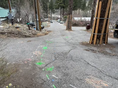
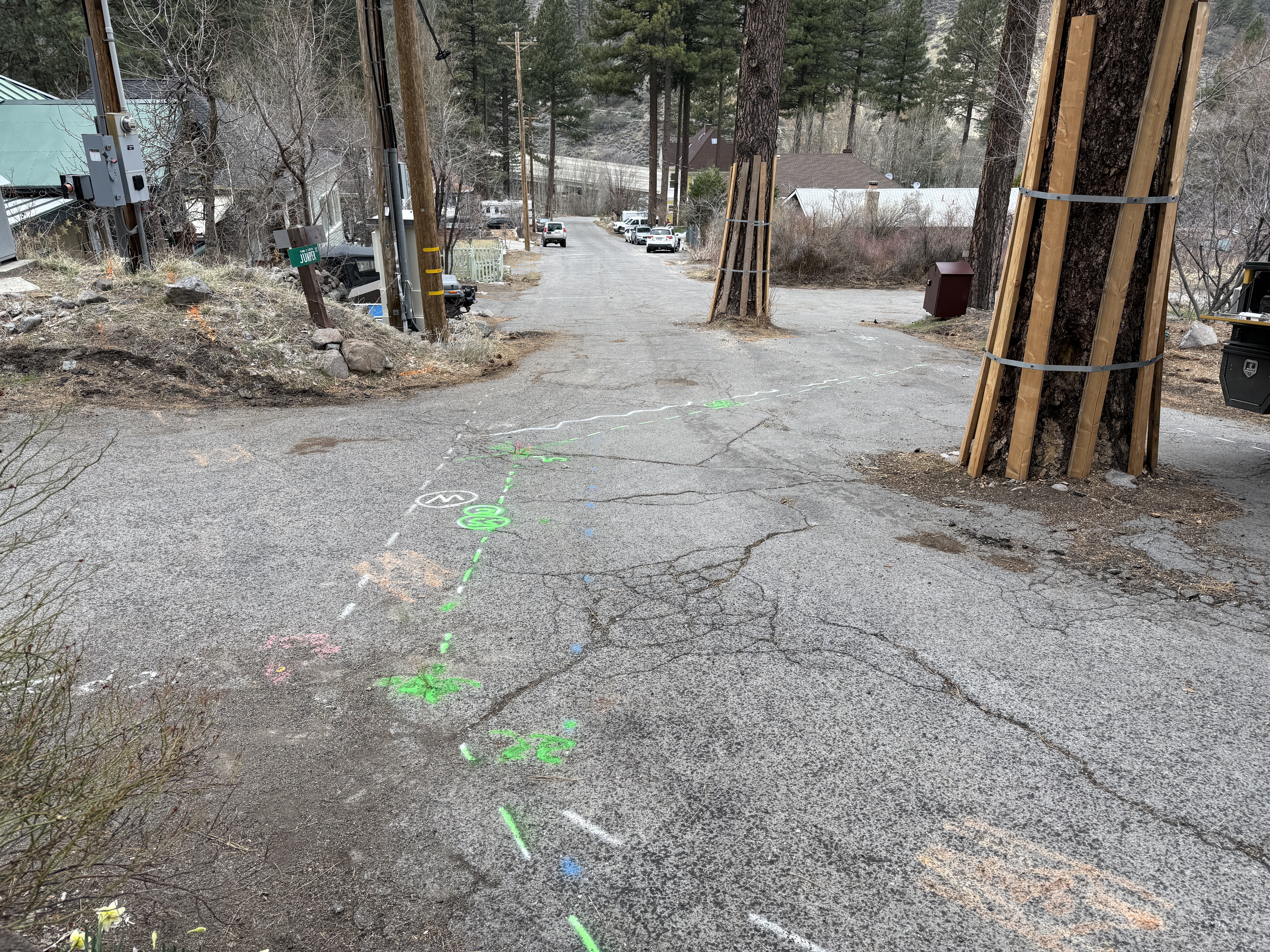
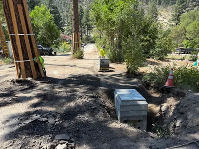
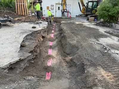
The image shows a narrow street with several trees protected by wooden slats. Bright green and orange paint markings are present on the pavement, suggesting locations for future utility work. The street is cracked and appears worn. No active construction work is visible in progress.
survey-layout
cracked pavement overcast daylight no visible access or congestion issues
No active safety features or personnel protective equipment are visible in frame.
Analyzed Apr 21, 2026
Nearby Photos
1m
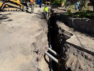
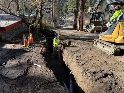
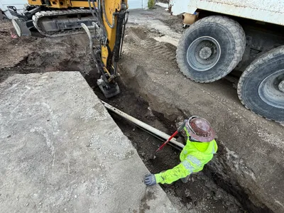
pipeline installation
trenchingpipeline-installation
excavator
2m
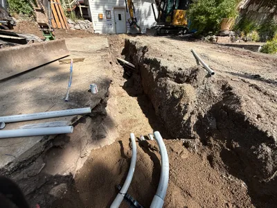
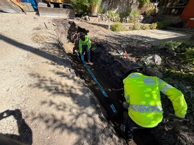
trenching
trenchingconduit-laying
excavator
2m
trenching
trenchingduct-bank-installation
compactor
2m
trenching
trenchingexcavation-work
mini excavator
2m
trenching
trench-measurementtrench
excavator
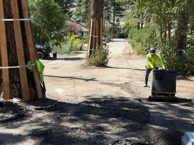
2m
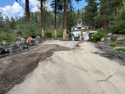
site grading
site-gradingland-preparation
excavators
3m
trenching
trenchingexcavation-work
excavator
3m
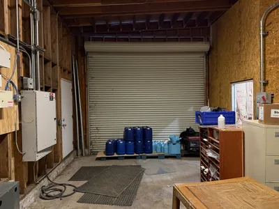
other
storage-setupchemical-barrels
chemical-barrels
3m
paving surface restoration
surface-compactionroad-restoration
walk-behind-compactor
3m
trenching
trenchingexcavation
excavator