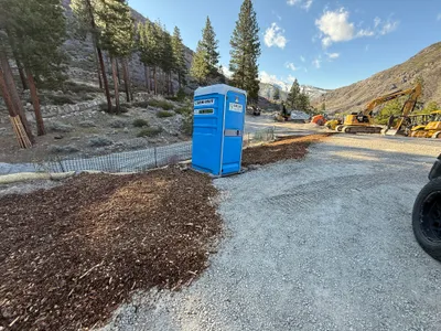
IMG_8231.JPG

No caption

IMG_8231.JPG

Tags

Details

Wednesday, March 12, 2025 · 9:24 AM

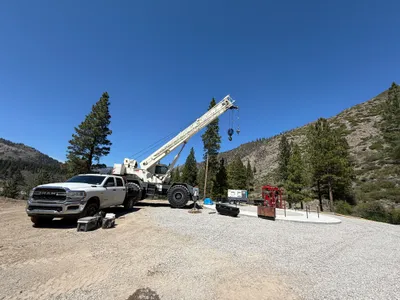
39.39127, -120.02130· 1681m

Location Context

1 / 5

USGS Topo

No elevation data

FEMA Flood

No flood data

OSM Infra

No address data

USDA Soil

No soil data

USGS Hydro

No hydro data

Apple iPhone 13
iPhone 13 back dual wide camera 1.54mm f/2.4
1.54mmf/2.41/167sISO 32
Flash did not fire, auto mode
Show all EXIF (43 fields)
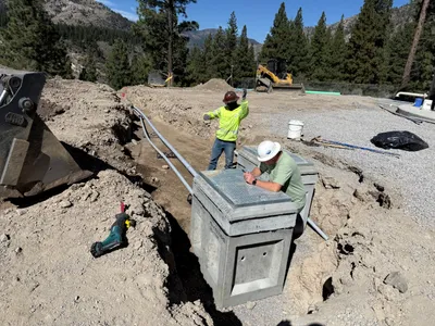
ApertureValue2.5261
BrightnessValue7.0261
ColorSpace1
CompositeImageGeneral Composite Image
DigitalZoomRatio1.0328
ExifImageHeight3024
ExifVersion2.2.1
ExposureCompensation0
ExposureModeAuto
ExposureProgramNormal program
FlashpixVersion1.0
FocalLengthIn35mmFormat13
GPSDateStamp1916:01:00
GPSDestBearing98.5606
GPSDestBearingRefTrue North
GPSDOP80.0666
GPSHPositioningError80.0666
GPSImgDirection98.5606
GPSImgDirectionRefT
GPSTimeStamp16:20:4
HostComputeriPhone 13
latitude39.3913
LensInfo1.5400, 5.1000, 1.6000, 2.4000
LensMakeApple
longitude-120.0213
MeteringModePattern
ModifyDate2025-03-12T09:24:58.000Z
OffsetTime-07:00
OffsetTimeDigitized-07:00
OffsetTimeOriginal-07:00
ResolutionUnitinches
SceneCaptureTypeStandard
SceneTypeDirectly photographed
SensingMethodOne-chip color area sensor
ShutterSpeedValue7.3847
SoftwareTimestamp Camera
SubjectArea{"0":2017,"1":1511,"2":2325,"3":1330}
SubSecTimeDigitized211
SubSecTimeOriginal211
WhiteBalanceAuto
XResolution72
YCbCrPositioning1
YResolution72

AI Analysis

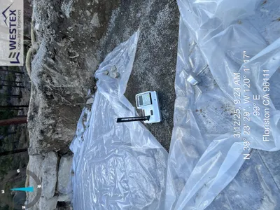
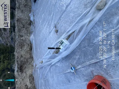
The image depicts a construction site with a rocky, excavated area partially covered by a plastic sheet. A nuclear density gauge is positioned on the plastic, likely for soil compaction testing. The surrounding area consists of exposed earth and some large rocks. There is a compass overlay on the image, and the site appears to be in a forested area with trees in the background.

survey-layout
rocky soil with plastic covering shaded natural light clear access on plastic-covered area
No visible safety controls or PPE are shown in the frame.

Equipment & Materials

Analyzed Apr 21, 2026