
No caption
IMG_9548.JPG
Details
Tuesday, August 19, 2025 · 1:47 PM
39.39464, -120.02237· 1659m
Location Context
1 / 5
USGS Topo
No elevation data
FEMA Flood
No flood data
OSM Infra
No address data
USDA Soil
No soil data
USGS Hydro
No hydro data
Apple iPhone 16 Pro
iPhone 16 Pro back triple camera 6.765mm f/1.78
6.764999865652793mmf/1.7799999713880651/868sISO 80
Flash did not fire, compulsory flash mode
Show all EXIF (43 fields)
ApertureValue1.6638
BrightnessValue7.4886
ColorSpace65535
CompositeImageGeneral Composite Image
ExifImageHeight4284
ExifVersion2.3.2
ExposureCompensation0
ExposureModeAuto
ExposureProgramNormal program
FlashpixVersion1.0
FocalLengthIn35mmFormat24
GPSDateStamp2025:08:19
GPSDestBearing254.3489
GPSDestBearingRefTrue North
GPSHPositioningError16.8836
GPSImgDirection254.3489
GPSImgDirectionRefT
GPSSpeed0
GPSSpeedRefK
GPSTimeStamp20:47:10
HostComputeriPhone 16 Pro
latitude39.3946
LensInfo2.2200, 15.6600, 1.7800, 2.8000
LensMakeApple
longitude-120.0224
MeteringModePattern
ModifyDate2025-08-19T13:47:11.000Z
OffsetTime-07:00
OffsetTimeDigitized-07:00
OffsetTimeOriginal-07:00
ResolutionUnitinches
SceneCaptureTypeStandard
SceneTypeDirectly photographed
SensingMethodOne-chip color area sensor
ShutterSpeedValue9.7616
Software18.6.1
SubjectArea{"0":2851,"1":2137,"2":3141,"3":1884}
SubSecTimeDigitized357
SubSecTimeOriginal357
WhiteBalanceAuto
XResolution72
YCbCrPositioning1
YResolution72
AI Analysis
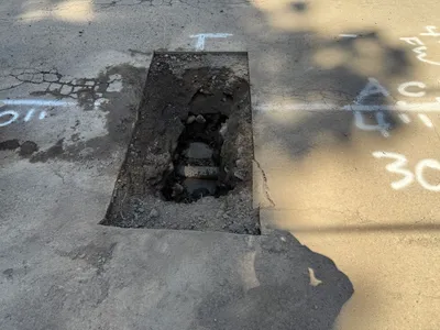
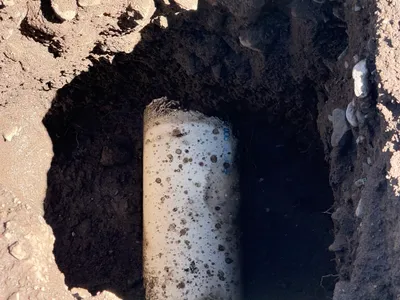
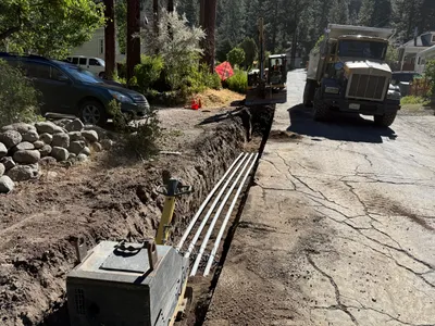
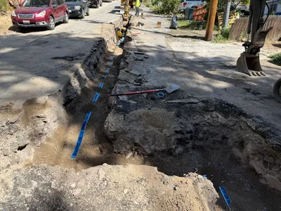
The image displays a rectangular section of pavement removed to expose a trench below. The trench shows disturbed soil and a section of pipe. There is white spray paint marking on the pavement around the hole, possibly indicating utility lines or cut lines for the excavation. The pothole appears to be used for utility locating purposes.
excavation
pavement with open pothole clear lighting, no adverse weather visible open area with visible pit
Safety features are not visible in frame, open trench is a potential hazard.
Equipment & Materials
Analyzed Apr 21, 2026
Nearby Photos
1m
excavation
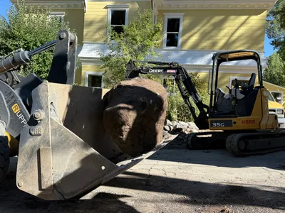
material-handlingexcavation
front-loader
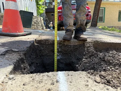
2m
excavation
utility-potholingunderground-location
measuring-tape
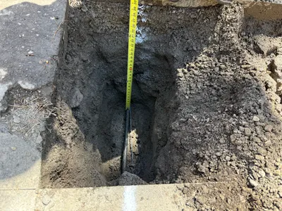
2m
excavation
pothole-utility-locatingmeasuring-depth
measuring-tape
2m
excavation
pothole-utility-locatingexposed-pipe
pipe
3m
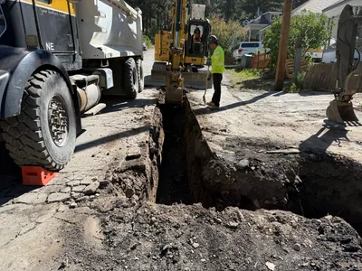
trenching
trenchingexcavation
excavator
4m
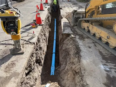
pipeline installation
pipeline-installationtrenching
tracked loader
4m
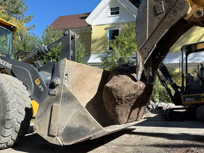
excavation
rock-movingequipment-operation
excavator
4m
trenching
trenchingduct-bank-installation
excavator
4m
trenching
trenchingutility-marking
excavator
4m
paving surface restoration
roadworksurface-maintenance
compaction-machine