No caption
IMG_9534.JPG
Details
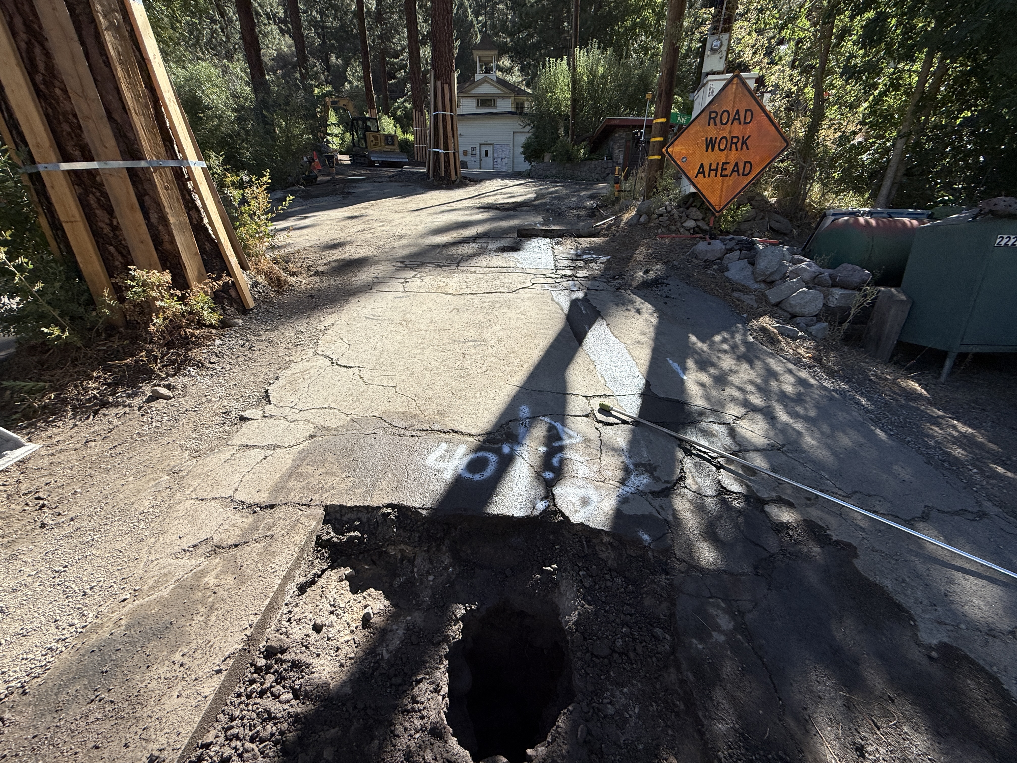
Tuesday, August 19, 2025 · 10:06 AM
39.39469, -120.02124· 1652m
Location Context
1 / 5
USGS Topo
No elevation data
FEMA Flood
No flood data
OSM Infra
No address data
USDA Soil
No soil data
USGS Hydro
No hydro data
Apple iPhone 16 Pro
iPhone 16 Pro back triple camera 2.22mm f/2.2
2.220000028611935mmf/2.21/1235sISO 50
Flash did not fire, compulsory flash mode
Show all EXIF (43 fields)
ApertureValue2.2750
BrightnessValue8.1102
ColorSpace65535
CompositeImageGeneral Composite Image
ExifImageHeight3024
ExifVersion2.3.2
ExposureCompensation0
ExposureModeAuto
ExposureProgramNormal program
FlashpixVersion1.0
FocalLengthIn35mmFormat14
GPSDateStamp2025:08:19
GPSDestBearing95.4354
GPSDestBearingRefTrue North
GPSHPositioningError5.7951
GPSImgDirection95.4354
GPSImgDirectionRefT
GPSSpeed0.1945
GPSSpeedRefK
GPSTimeStamp17:6:17
HostComputeriPhone 16 Pro
latitude39.3947
LensInfo2.2200, 15.6600, 1.7800, 2.8000
LensMakeApple
longitude-120.0212
MeteringModePattern
ModifyDate2025-08-19T10:06:19.000Z
OffsetTime-07:00
OffsetTimeDigitized-07:00
OffsetTimeOriginal-07:00
ResolutionUnitinches
SceneCaptureTypeStandard
SceneTypeDirectly photographed
SensingMethodOne-chip color area sensor
ShutterSpeedValue10.2698
Software18.6.1
SubjectArea{"0":2000,"1":1511,"2":2217,"3":1330}
SubSecTimeDigitized255
SubSecTimeOriginal255
WhiteBalanceAuto
XResolution72
YCbCrPositioning1
YResolution72
AI Analysis
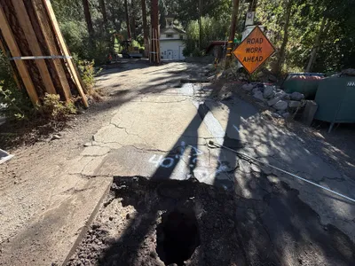
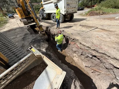
The image shows a pothole in a cracked asphalt road, indicating utility locating work. A 'road work ahead' sign is visible on the right side, suggesting ongoing construction. Wood structures are supporting nearby trees, and construction equipment is seen further down the road.
excavation
cracked asphalt pavement clear sunlight congested due to obstruction and equipment
No specific safety controls or PPE features are visible in frame.
Equipment & Materials
AI Tags
Analyzed Apr 21, 2026
Nearby Photos
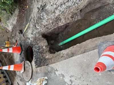
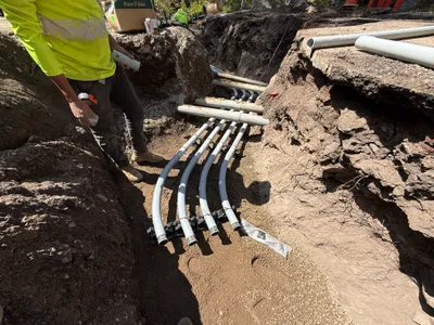
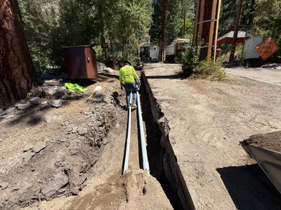
pipeline installation
pipeline-installationpipe
hand tool
0m
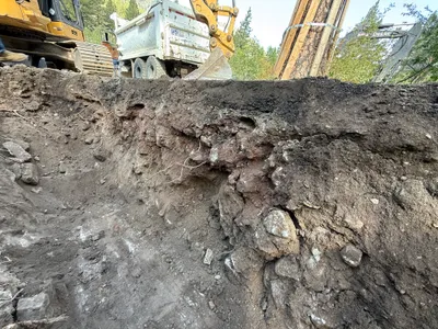
trenching
duct-bank-installationtrenching
excavators
1m
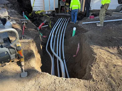
pipeline installation
conduit-installationtrenching
dirt
3m
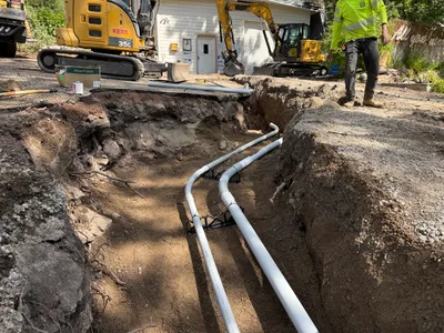
excavation
excavationearthmoving
backhoe excavator
3m
trenching
trenchingconduit-installation
shovel
3m
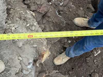
excavation
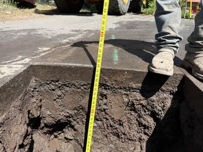
measurementsite-measurement
measuring tape
3m
trenching
trenchingexcavation
backhoe
3m
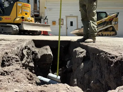
excavation
potholeutility-locating
measuring-tape
4m
trenching
trenchingpipe-laying
construction truck
4m
trenching
trench-creationutility-locating
John Deere excavator