No caption
IMG_8058.JPG
Details
Tuesday, May 27, 2025 · 10:47 AM
39.39448, -120.02264· 1639m
Location Context
1 / 5
USGS Topo
No elevation data
FEMA Flood
No flood data
OSM Infra
No address data
USDA Soil
No soil data
USGS Hydro
No hydro data
Apple iPhone 16 Pro
iPhone 16 Pro back triple camera 6.765mm f/1.78
6.764999865652793mmf/1.7799999713880651/127sISO 160
Flash did not fire, compulsory flash mode
Show all EXIF (43 fields)
ApertureValue1.6638
BrightnessValue3.4249
ColorSpace65535
CompositeImageGeneral Composite Image
ExifImageHeight3024
ExifVersion2.3.2
ExposureCompensation0
ExposureModeAuto
ExposureProgramNormal program
FlashpixVersion1.0
FocalLengthIn35mmFormat48
GPSDateStamp2025:05:27
GPSDestBearing111.5751
GPSDestBearingRefTrue North
GPSHPositioningError14
GPSImgDirection111.5751
GPSImgDirectionRefT
GPSSpeed2.1587
GPSSpeedRefK
GPSTimeStamp17:47:30
HostComputeriPhone 16 Pro
latitude39.3945
LensInfo2.2200, 15.6600, 1.7800, 2.8000
LensMakeApple
longitude-120.0226
MeteringModePattern
ModifyDate2025-05-27T10:47:31.000Z
OffsetTime-07:00
OffsetTimeDigitized-07:00
OffsetTimeOriginal-07:00
ResolutionUnitinches
SceneCaptureTypeStandard
SceneTypeDirectly photographed
SensingMethodOne-chip color area sensor
ShutterSpeedValue6.9880
Software18.5
SubjectArea{"0":2011,"1":1508,"2":1106,"3":665}
SubSecTimeDigitized213
SubSecTimeOriginal213
WhiteBalanceAuto
XResolution72
YCbCrPositioning1
YResolution72
AI Analysis
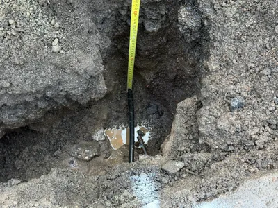
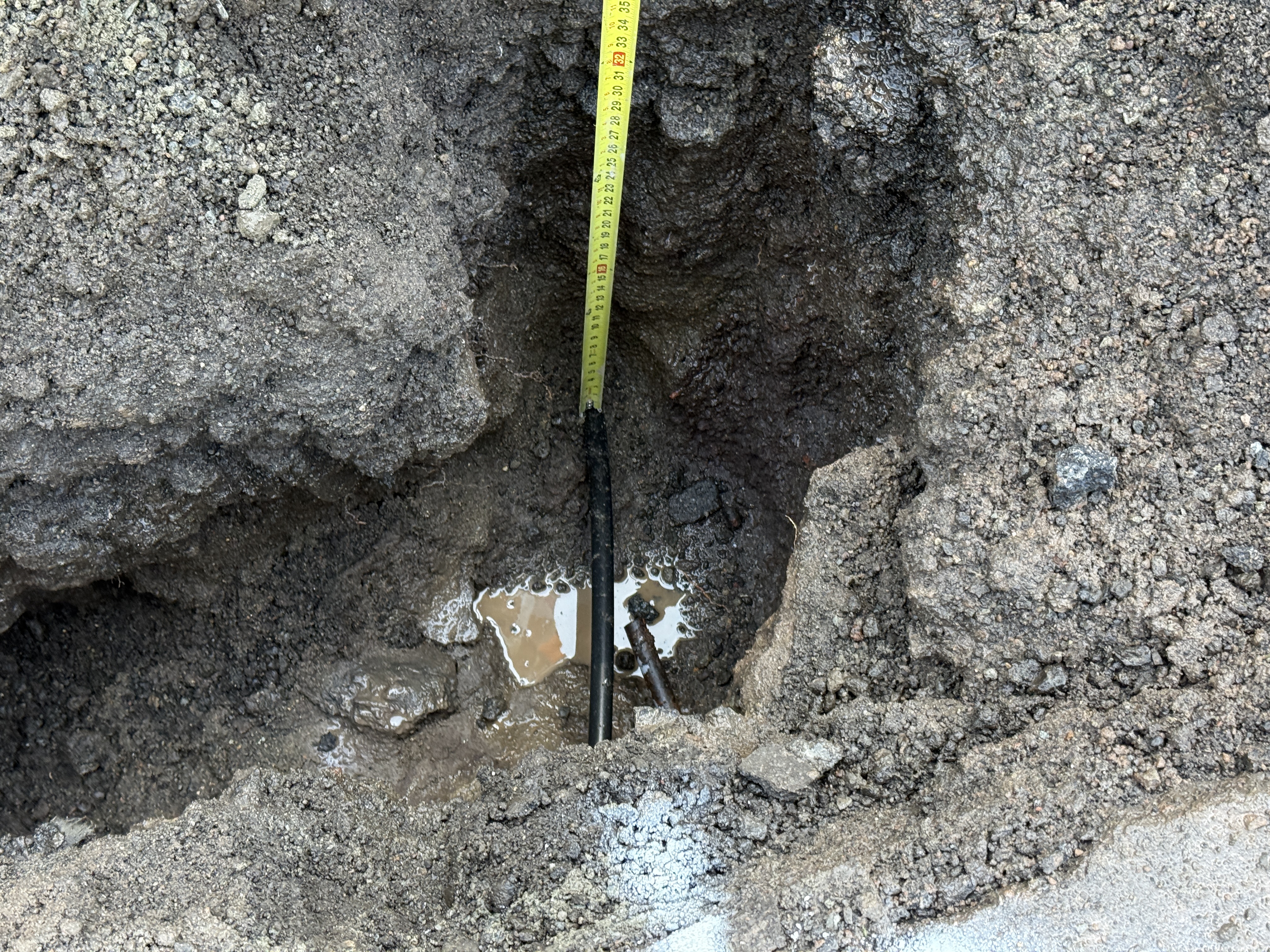
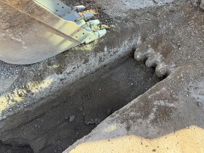
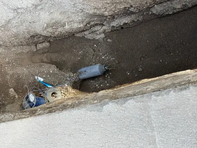
There is an open excavation with a partially exposed pipe visible in the bottom right of the frame. A measuring tape is positioned from the surface to the bottom of the excavation, likely for determining depth. The surrounding area is comprised of loose soil and some water accumulation. The activity involves utility locating through potholing.
excavation
loose soil with water accumulation lighting not determinable from image open access with potential for further excavation
Safety features are not visible in frame
Equipment & Materials
AI Tags
Analyzed Apr 21, 2026
Nearby Photos
1m
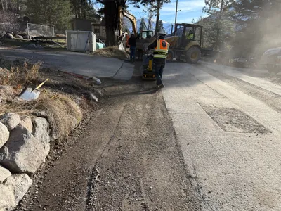
paving surface restoration
road-gradingsurface-preparation
compact-loader
2m
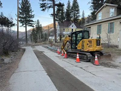
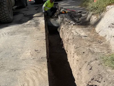
trenching
trenchingpipe-installation
soil
2m
paving surface restoration
pavement-restorationroadwork
compact-roller
2m
trenching
trenchingexcavation
excavator
2m
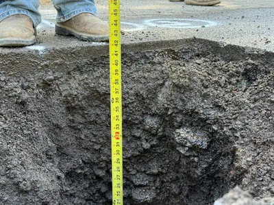
excavation
pothole-utility-locatingdepth-measurement
2m
excavation
excavationexcavator
excavator
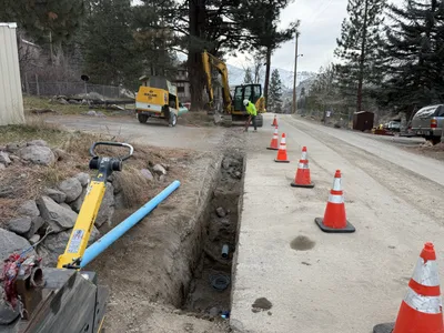
3m
trenching
trenchingcable-installation
cable
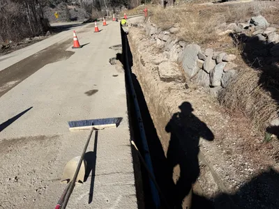
3m
trenching
trenchingmanual-labor
large vehicle (partially visible)
3m
trenching
trenchingsafety-cones
excavator
3m
trenching
trenchingroadside-work
broom